File:Abbey mill, Coggeshall - geograph.org.uk - 149630.jpg
Jump to navigation
Jump to search
No higher resolution available.
Abbey_mill,_Coggeshall_-_geograph.org.uk_-_149630.jpg (640 × 480 pixels, file size: 120 KB, MIME type: image/jpeg)
Captions
Captions
Add a one-line explanation of what this file represents
Summary
[edit]
This is a photo of listed building number 1168354. |
| Description |
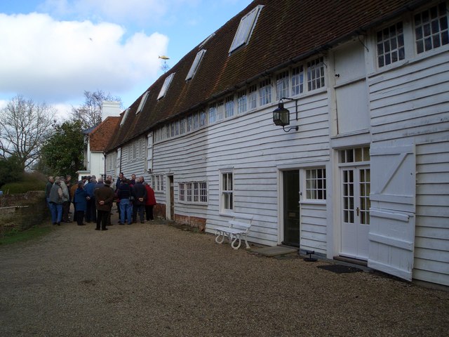
English: Abbey mill, Coggeshall. On the site of mediaeval corn and fulling mills, this was built about 1740 as a silk-throwing mill and converted to a corn mill 100 years later. A group of Flemish mill enthusiasts are standing in front of the mill on a tour of East Anglian mills. |
| Date | |
| Source | From geograph.org.uk |
| Author | Gareth Hughes |
| Attribution (required by the license) | Gareth Hughes / Abbey mill, Coggeshall / |
| Object location | | View this and other nearby images on: OpenStreetMap |
|---|
_heading:292.00&language=en)
Licensing
[edit]

|
This image was taken from the Geograph project collection. See this photograph's page on the Geograph website for the photographer's contact details. The copyright on this image is owned by Gareth Hughes and is licensed for reuse under the Creative Commons Attribution-ShareAlike 2.0 license.
|
This file is licensed under the Creative Commons Attribution-Share Alike 2.0 Generic license.
Attribution: Gareth Hughes
- You are free:
- to share – to copy, distribute and transmit the work
- to remix – to adapt the work
- Under the following conditions:
- attribution – You must give appropriate credit, provide a link to the license, and indicate if changes were made. You may do so in any reasonable manner, but not in any way that suggests the licensor endorses you or your use.
- share alike – If you remix, transform, or build upon the material, you must distribute your contributions under the same or compatible license as the original.
File history
Click on a date/time to view the file as it appeared at that time.
| Date/Time | Thumbnail | Dimensions | User | Comment | |
|---|---|---|---|---|---|
| current | 05:05, 31 January 2010 | | 640 × 480 (120 KB) | GeographBot (talk | contribs) | == {{int:filedesc}} == {{Information |description={{en|1=Abbey mill, Coggeshall. On the site of mediaeval corn and fulling mills, this was built about 1740 as a silk-throwing mill and converted to a corn mill 100 years later. A group of Flemish mill enthu |
You cannot overwrite this file.
File usage on Commons
The following page uses this file:
File usage on other wikis
The following other wikis use this file:
- Usage on dag.wikipedia.org
- Usage on en.wikipedia.org
- Usage on www.wikidata.org