File:A walk through Twyford Wood, No 1 - geograph.org.uk - 272030.jpg
Jump to navigation
Jump to search
No higher resolution available.
A_walk_through_Twyford_Wood,_No_1_-_geograph.org.uk_-_272030.jpg (640 × 427 pixels, file size: 90 KB, MIME type: image/jpeg)
Captions
Captions
Add a one-line explanation of what this file represents
Summary
[edit]
| Description |
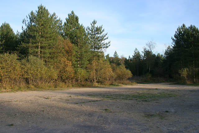
English: A walk through Twyford Wood: No 1 Twyford Wood (or "Forest" as mentioned on the 1940's map) was requisitioned by the RAF in the early 1940s and cleared for the construction of North Witham Airfield, see http://raf-lincolnshire.info/northwitham/northwitham.htm . After the site was sold back to the Forestry Commission twenty years later the wood was replanted with conifers and deciduous trees, mainly oak. The concrete runways and perimeter roads still run through the site making it a great place for walking and cycling in all weathers. There is a car park off the Bourne Road, just east of the Colsterworth turn on the A1. Take the main track into the woodland and follow the many routes through the trees and open areas.
To follow the walk pick up the images in order. Go to SK9522 next. |
| Date | |
| Source | From geograph.org.uk |
| Author | Kate Jewell |
| Attribution (required by the license) | Kate Jewell / A walk through Twyford Wood: No 1 / |
| Camera location | | View this and other nearby images on: OpenStreetMap |
|---|
_heading:135.00&language=en)
| Object location | | View this and other nearby images on: OpenStreetMap |
|---|
_heading:135.00&language=en)
Licensing
[edit]

|
This image was taken from the Geograph project collection. See this photograph's page on the Geograph website for the photographer's contact details. The copyright on this image is owned by Kate Jewell and is licensed for reuse under the Creative Commons Attribution-ShareAlike 2.0 license.
|
This file is licensed under the Creative Commons Attribution-Share Alike 2.0 Generic license.
Attribution: Kate Jewell
- You are free:
- to share – to copy, distribute and transmit the work
- to remix – to adapt the work
- Under the following conditions:
- attribution – You must give appropriate credit, provide a link to the license, and indicate if changes were made. You may do so in any reasonable manner, but not in any way that suggests the licensor endorses you or your use.
- share alike – If you remix, transform, or build upon the material, you must distribute your contributions under the same or compatible license as the original.
File history
Click on a date/time to view the file as it appeared at that time.
| Date/Time | Thumbnail | Dimensions | User | Comment | |
|---|---|---|---|---|---|
| current | 19:04, 12 December 2010 | | 640 × 427 (90 KB) | GeographBot (talk | contribs) | == {{int:filedesc}} == {{Information |description={{en|1=A walk through Twyford Wood: No 1 Twyford Wood (or "Forest" as mentioned on the 1940's map) was requisitioned by the RAF in the early 1940s and cleared for the construction of North Witham Airfield, |
You cannot overwrite this file.
File usage on Commons
There are no pages that use this file.