File:A possible Roman disc brooch (FindID 479333).jpg
Jump to navigation
Jump to search
Size of this preview: 622 × 599 pixels. Other resolutions: 249 × 240 pixels | 498 × 480 pixels | 797 × 768 pixels | 1,063 × 1,024 pixels | 2,424 × 2,336 pixels.
Original file (2,424 × 2,336 pixels, file size: 373 KB, MIME type: image/jpeg)
Captions
Captions
Add a one-line explanation of what this file represents
Summary
[edit].jpg&action=edit§ion=1)
| A possible Roman disc brooch | |||
|---|---|---|---|
| Photographer |
Lincolnshire County Council, Becky Sanderson, 2012-01-04 10:47:03 |
||
| Title |
A possible Roman disc brooch |
||
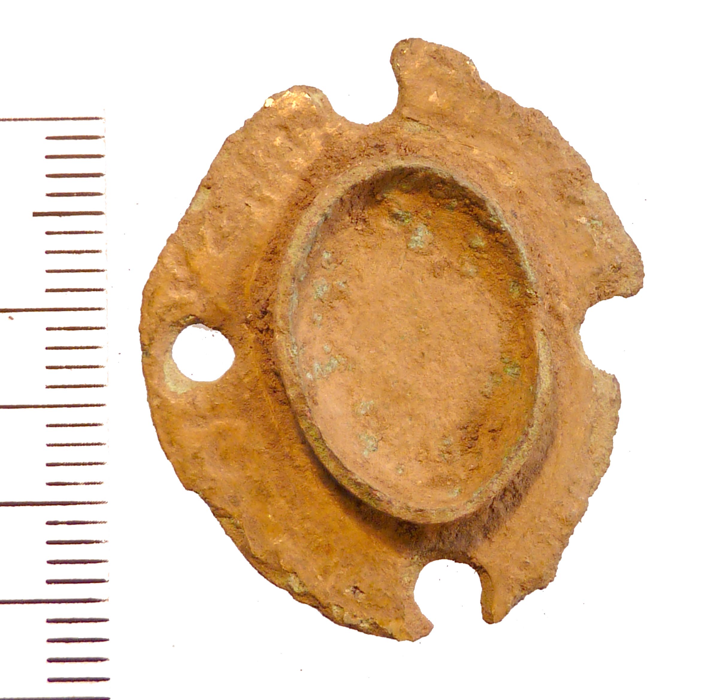
| Description |
English: An oval disc formed from cast copper alloy with a central setting, probably for a glass or semi-precious stone. There are traces of gilt on the surface and four circular holes piercing the outer edge. There is insufficient information on the rally record to determine if the object has evidence of an attachment pin on the reverse.
Disc or plate brooches were in use in Roman Britain predominantly in the 2nd Century (Bedoyere, 1991, 121). Similar examples may be seen on this database, for example YORYM-F6A164 and SWYOR-3D4F28, though these are without the pierced rim. These holes may be an unusual form of decoration, evidence of later reuse of the object or may point to an alternative function as a small mount of a later period. |
||
| Depicted place | (County of findspot) Lincolnshire | ||
| Date | between 100 and 200 | ||
| Accession number |
FindID: 479333 Old ref: LIN-42DE72 Filename: AL564.jpg |
||
| Credit line |
|
||
| Source |
https://finds.org.uk/database/ajax/download/id/362160 Catalog: https://finds.org.uk/database/images/image/id/362160/recordtype/artefacts archive copy at the Wayback Machine Artefact: https://finds.org.uk/database/artefacts/record/id/479333 |
||
| Permission (Reusing this file) |
Attribution-ShareAlike License version 4.0 (verified 2 December 2020) | ||
| Object location | | View this and other nearby images on: OpenStreetMap |
|---|
.jpg¶ms=053.261500_N_0000.174577_E_globe:Earth_class:object_type:object__&language=en)
Licensing
[edit].jpg&action=edit§ion=2)
This file is licensed under the Creative Commons Attribution-Share Alike 4.0 International license.
Attribution: The Portable Antiquities Scheme/ The Trustees of the British Museum
- You are free:
- to share – to copy, distribute and transmit the work
- to remix – to adapt the work
- Under the following conditions:
- attribution – You must give appropriate credit, provide a link to the license, and indicate if changes were made. You may do so in any reasonable manner, but not in any way that suggests the licensor endorses you or your use.
- share alike – If you remix, transform, or build upon the material, you must distribute your contributions under the same or compatible license as the original.
File history
Click on a date/time to view the file as it appeared at that time.
| Date/Time | Thumbnail | Dimensions | User | Comment | |
|---|---|---|---|---|---|
| current | 22:53, 30 January 2017 | | 2,424 × 2,336 (373 KB) | Fæ (talk | contribs) | Portable Antiquities Scheme, LIN, FindID: 479333, roman, page 259, batch count 3144 |
You cannot overwrite this file.
File usage on Commons
The following page uses this file:
.jpg)
.jpg&oldid=806814301)