File:A new map of the principal routes to the gold region of Colorado Territory - DPLA - 02dabb87729049c60463a9fdf4ff7491.jpg
Jump to navigation
Jump to search

Size of this preview: 800 × 472 pixels. Other resolutions: 320 × 189 pixels | 640 × 378 pixels | 1,024 × 604 pixels | 1,280 × 755 pixels | 2,560 × 1,510 pixels | 9,000 × 5,310 pixels.
Original file (9,000 × 5,310 pixels, file size: 5.39 MB, MIME type: image/jpeg)
Captions
Captions
Add a one-line explanation of what this file represents
Summary
[edit]This file was uploaded by the Digital Public Library of America, and the following item metadata was created by the contributing institution's staff.
Note: this data is being maintained by an automated bot, synced with the source data.
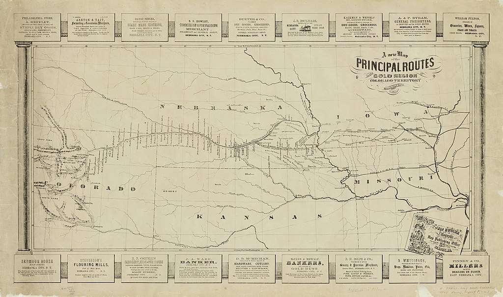
| Description | Gold rush map promoting Nebraska City as a supply center, showing railroads, rivers, territorial boundaries, and types of resources available along the route. Advertisers from Nebraska City surround map. | ||||||||||||||||||||
| Title | A new map of the principal routes to the gold region of Colorado Territory | ||||||||||||||||||||
| Institution |
|
||||||||||||||||||||
| Subject | |||||||||||||||||||||
| Source |
Plains to Peaks Collective |
||||||||||||||||||||
| Author |
Harvey, August F |
||||||||||||||||||||
| Permission (Reusing this file) |
Copyright determination made by Denver Public Library (Q69470198) using RightsStatements.org
|
||||||||||||||||||||
| Partnership |
|
||||||||||||||||||||


File history
Click on a date/time to view the file as it appeared at that time.
| Date/Time | Thumbnail | Dimensions | User | Comment | |
|---|---|---|---|---|---|
| current | 13:29, 18 December 2020 | | 9,000 × 5,310 (5.39 MB) | DPLA bot (talk | contribs) | Uploading DPLA ID 02dabb87729049c60463a9fdf4ff7491 |
You cannot overwrite this file.
File usage on Commons
There are no pages that use this file.