File:A geographically correct county map of the states traversed by the Atchison Topeka and the Santa Fé Railroad and its connections. LOC 98688578.jpg
Jump to navigation
Jump to search

Size of this preview: 800 × 390 pixels. Other resolutions: 320 × 156 pixels | 640 × 312 pixels | 1,024 × 499 pixels | 1,280 × 624 pixels | 2,560 × 1,248 pixels | 9,456 × 4,608 pixels.
Original file (9,456 × 4,608 pixels, file size: 9.66 MB, MIME type: image/jpeg)
Captions
Captions
Add a one-line explanation of what this file represents
Summary
[edit]| Description |
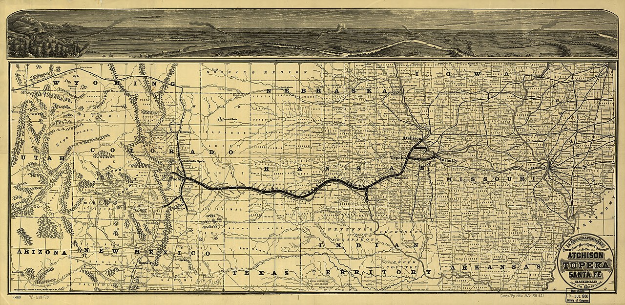
English: Detailed map of the central United States showing relief by hachures, drainage, counties, cities and towns, roads, wagon trails, and the railroad network. This line was chartered by the state of Kansas in 1859; the first 75 miles of line were not completed until 1871. See also entry 553. |
||
| Title | A geographically correct county map of the states traversed by the Atchison Topeka and the Santa Fé Railroad and its connections. | ||
| Shelf ID | G4051.P3 1880 .W6 | ||
| Date | |||
| Source | https://www.loc.gov/item/98688578/ | ||
| Author | Woodward, Tiernan, And Hale; Atchison, Topeka, And Santa Fe Railroad Company | ||
| Permission (Reusing this file) |
|
||
| Other versions |
|
||
| Location | United States · West | ||
| Part of | American Memory · Catalog · Railroad Maps, 1828-1900 · Geography And Map Division · Transportation And Communication | ||
| Subject | Railroads · West · Atchison, Topeka, And Santa Fe Railroad Company · West (U.S.) · United States · Maps |


Licensing
[edit]
|
This is a faithful photographic reproduction of a two-dimensional, public domain work of art. The work of art itself is in the public domain for the following reason:
The official position taken by the Wikimedia Foundation is that "faithful reproductions of two-dimensional public domain works of art are public domain".
This photographic reproduction is therefore also considered to be in the public domain in the United States. In other jurisdictions, re-use of this content may be restricted; see Reuse of PD-Art photographs for details. | ||||
File history
Click on a date/time to view the file as it appeared at that time.
| Date/Time | Thumbnail | Dimensions | User | Comment | |
|---|---|---|---|---|---|
| current | 08:56, 25 May 2018 | | 9,456 × 4,608 (9.66 MB) | Fæ (talk | contribs) | LOC Maps https://www.loc.gov/item/98688578/ #855 |
You cannot overwrite this file.
File usage on Commons
The following page uses this file: