File:A general map of North America drawn from the best surveys LOC 2017585877.jpg
Jump to navigation
Jump to search
Size of this preview: 702 × 600 pixels. Other resolutions: 281 × 240 pixels | 562 × 480 pixels | 899 × 768 pixels | 1,198 × 1,024 pixels | 2,397 × 2,048 pixels | 5,732 × 4,898 pixels.
Original file (5,732 × 4,898 pixels, file size: 4.04 MB, MIME type: image/jpeg)
Captions
Captions
Add a one-line explanation of what this file represents
Summary
[edit]| Description |
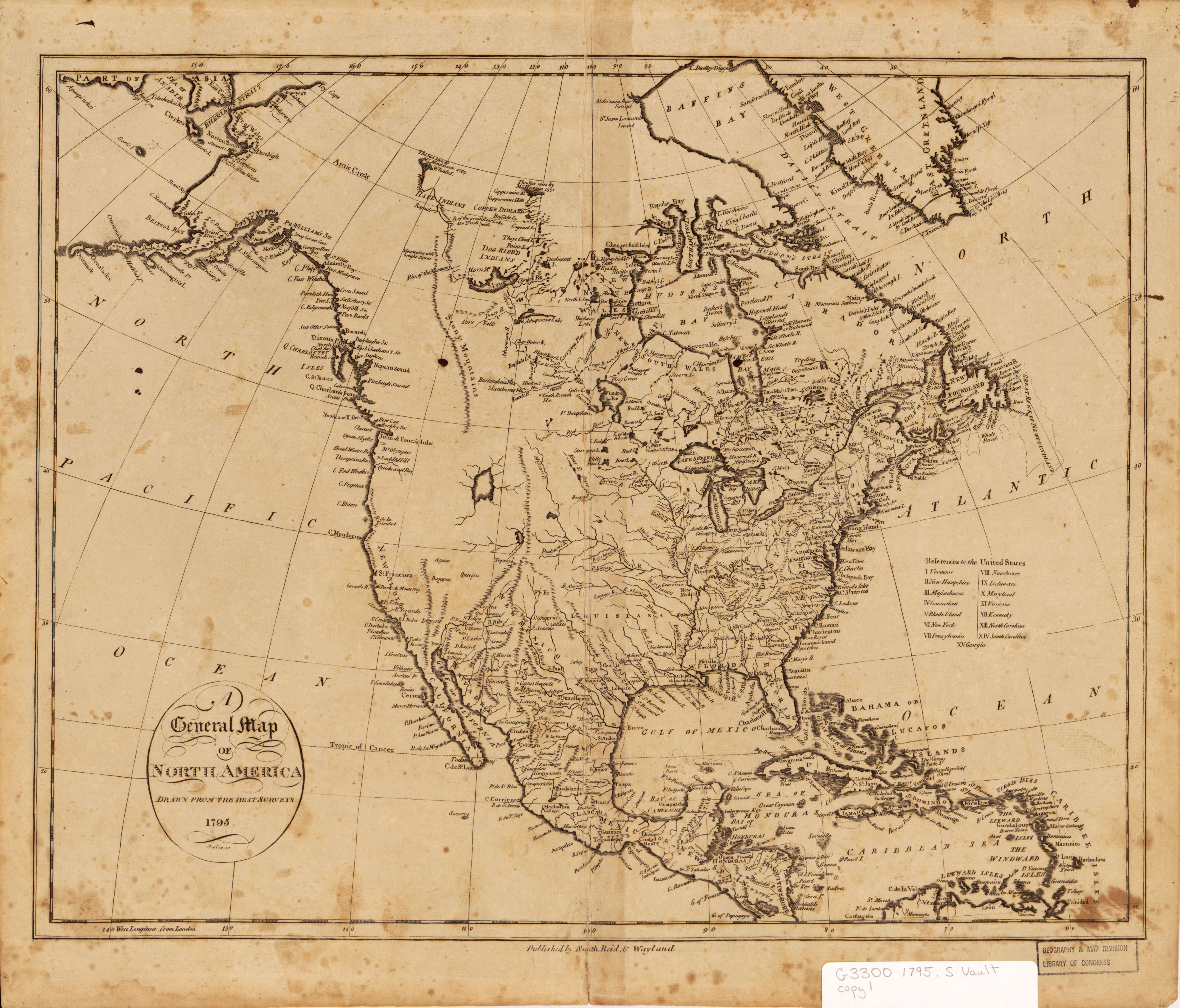
English: Relief shown pictorially. Includes index to states. LC copy has several small ink spots and some foxing. Wheat & Brun 1969, 56 Available also through the Library of Congress Web site as a raster image. |
||
| Title | A general map of North America drawn from the best surveys | ||
| Shelf ID | G3300 1795 .G4 | ||
| Date | |||
| Source | https://www.loc.gov/item/2017585877/ | ||
| Author | Scoles, John; Smith, Reid & Wayland; Winterbotham, William | ||
| Permission (Reusing this file) |
|
||
| Other versions |
|
||
| Location | North America · North America. | ||
| Part of | American Memory · General Maps · Catalog · Geography And Map Division | ||
| Subject | North America · Maps · Early Works To 1800 · Early Maps · Discovery And Exploration |


Licensing
[edit]
|
This is a faithful photographic reproduction of a two-dimensional, public domain work of art. The work of art itself is in the public domain for the following reason:
The official position taken by the Wikimedia Foundation is that "faithful reproductions of two-dimensional public domain works of art are public domain".
This photographic reproduction is therefore also considered to be in the public domain in the United States. In other jurisdictions, re-use of this content may be restricted; see Reuse of PD-Art photographs for details. | ||||
File history
Click on a date/time to view the file as it appeared at that time.
| Date/Time | Thumbnail | Dimensions | User | Comment | |
|---|---|---|---|---|---|
| current | 21:02, 25 June 2018 | | 5,732 × 4,898 (4.04 MB) | Fæ (talk | contribs) | LOC Maps https://www.loc.gov/item/2017585877/ #28459 |
You cannot overwrite this file.
File usage on Commons
The following page uses this file: