File:A first glimpse - geograph.org.uk - 1103381.jpg
Jump to navigation
Jump to search
No higher resolution available.
A_first_glimpse_-_geograph.org.uk_-_1103381.jpg (640 × 480 pixels, file size: 103 KB, MIME type: image/jpeg)
Captions
Captions
Add a one-line explanation of what this file represents
Summary
[edit]
| Description |
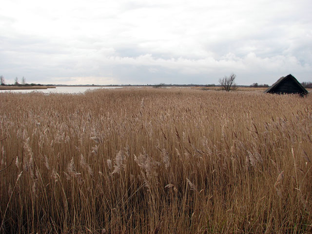
English: A first glimpse A first glimpse of the open water, taken from the public footpath which skirts the northeastern edge of the mere. It is difficult to spot the mere for the tall reeds surrounding it, with only the thatched roofs of boathouses (one seen at right) and the occasional tree rising above the extensive reed beds.
Horsey Mere is the only broad in Norfolk surrounded by a high level bank for which reason it is called a mere, rather than a broad. The term 'mere' originates from an old Dutch word meaning an artificial lake. The mere is part of the Broads national park area, and the Horsey Estate is part of the Norfolk Coast Area of Outstanding Natural Beauty (AONB). Horsey Estate was purchased by the National Trust from the Buxton family in 1948. The Buxton family still manage the estate in partnership with the National Trust and it is thanks to the fact that nature conservation has always been a priority for the Buxtons that Horsey remains an important place for wildlife. In winter Horsey Mere is an internationally important wildfowl refuge and home to thousands of ducks including teal, wigeon and pochard. |
| Date | |
| Source | From geograph.org.uk |
| Author | Evelyn Simak |
| Attribution (required by the license) | Evelyn Simak / A first glimpse / |
| Camera location | | View this and other nearby images on: OpenStreetMap |
|---|
_heading:247.00&language=en)
| Object location | | View this and other nearby images on: OpenStreetMap |
|---|
_heading:247.00&language=en)
Licensing
[edit]

|
This image was taken from the Geograph project collection. See this photograph's page on the Geograph website for the photographer's contact details. The copyright on this image is owned by Evelyn Simak and is licensed for reuse under the Creative Commons Attribution-ShareAlike 2.0 license.
|
This file is licensed under the Creative Commons Attribution-Share Alike 2.0 Generic license.
Attribution: Evelyn Simak
- You are free:
- to share – to copy, distribute and transmit the work
- to remix – to adapt the work
- Under the following conditions:
- attribution – You must give appropriate credit, provide a link to the license, and indicate if changes were made. You may do so in any reasonable manner, but not in any way that suggests the licensor endorses you or your use.
- share alike – If you remix, transform, or build upon the material, you must distribute your contributions under the same or compatible license as the original.
- Remove redundant categories and try to put this image in the most specific category/categories
- Remove this template
- The location categories are based on information from this geonames tool and this OpenStreetMap tool combined with a database. You can also have a look at this tool from mysociety.
- The topic category from Geograph was Mere (find similar images at Geograph)
File history
Click on a date/time to view the file as it appeared at that time.
| Date/Time | Thumbnail | Dimensions | User | Comment | |
|---|---|---|---|---|---|
| current | 16:52, 24 February 2011 | | 640 × 480 (103 KB) | GeographBot (talk | contribs) | == {{int:filedesc}} == {{Information |description={{en|1=A first glimpse A first glimpse of the open water, taken from the public footpath which skirts the northeastern edge of the mere. It is difficult to spot the mere for the tall reeds surrounding it, |
You cannot overwrite this file.
File usage on Commons
There are no pages that use this file.