File:A chart of the gulf of Florida or New Bahama channel... - from the journals... Chas. Roberts... ; compared with the surveys of Mr. George Gauld etc. - btv1b53103268b.jpg
Jump to navigation
Jump to search

Size of this preview: 761 × 599 pixels. Other resolutions: 305 × 240 pixels | 610 × 480 pixels | 975 × 768 pixels | 1,280 × 1,008 pixels | 2,560 × 2,016 pixels | 10,517 × 8,284 pixels.
Original file (10,517 × 8,284 pixels, file size: 12.51 MB, MIME type: image/jpeg)
Captions
Captions
Add a one-line explanation of what this file represents
Summary
[edit]| Warning | The original file is very high-resolution. It might not load properly or could cause your browser to freeze when opened at full size. |
|---|
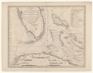
| A chart of the gulf of Florida or New Bahama channel,... / from the journals... Chas. Roberts,... ; compared with the surveys of Mr. George Gauld etc.
( |
|||||||||||||||||||||||||||
|---|---|---|---|---|---|---|---|---|---|---|---|---|---|---|---|---|---|---|---|---|---|---|---|---|---|---|---|
| Author |
Roberts, Charles (17..-18..). Cartographe du modèle Gauld, George (1732-1782). Cartographe du modèle |
||||||||||||||||||||||||||
| Title |
A chart of the gulf of Florida or New Bahama channel,... / from the journals... Chas. Roberts,... ; compared with the surveys of Mr. George Gauld etc. |
||||||||||||||||||||||||||
| Description |
Français : Sujet : Cuba, Colonie de -- Nord-Ouest -- Côtes
Bahamas, Colonie des Floride, Colonie de la Floride, Détroit de Couverture : Cuba Bahamas États-Unis – Floride Langue : anglais Éditeur : W. Faden (London) |
||||||||||||||||||||||||||
| Date | 1794 | ||||||||||||||||||||||||||
| Dimensions | height: 73.5 cm (28.9 in); width: 59 cm (23.2 in) | ||||||||||||||||||||||||||
| Collection |
|
||||||||||||||||||||||||||
| References |
Français : Notice de recueil : http://catalogue.bnf.fr/ark:/12148/cb438168097
Appartient à : [Division 1 du portefeuille 139 du Service hydrographique de la marine consacrée aux cartes générales du canal des Bahamas] ; 12 Notice du catalogue : http://catalogue.bnf.fr/ark:/12148/cb43819734w |
||||||||||||||||||||||||||
| Source/Photographer |
Français : Bibliothèque nationale de France, département Cartes et plans, GE SH 18 PF 139 DIV 1 P 12
Bibliothèque nationale de France |
||||||||||||||||||||||||||
| Permission (Reusing this file) |
|
||||||||||||||||||||||||||

File history
Click on a date/time to view the file as it appeared at that time.
| Date/Time | Thumbnail | Dimensions | User | Comment | |
|---|---|---|---|---|---|
| current | 09:49, 9 August 2022 | | 10,517 × 8,284 (12.51 MB) | Gzen92Bot (talk | contribs) | Gallica btv1b53103268b |
You cannot overwrite this file.
File usage on Commons
The following page uses this file: