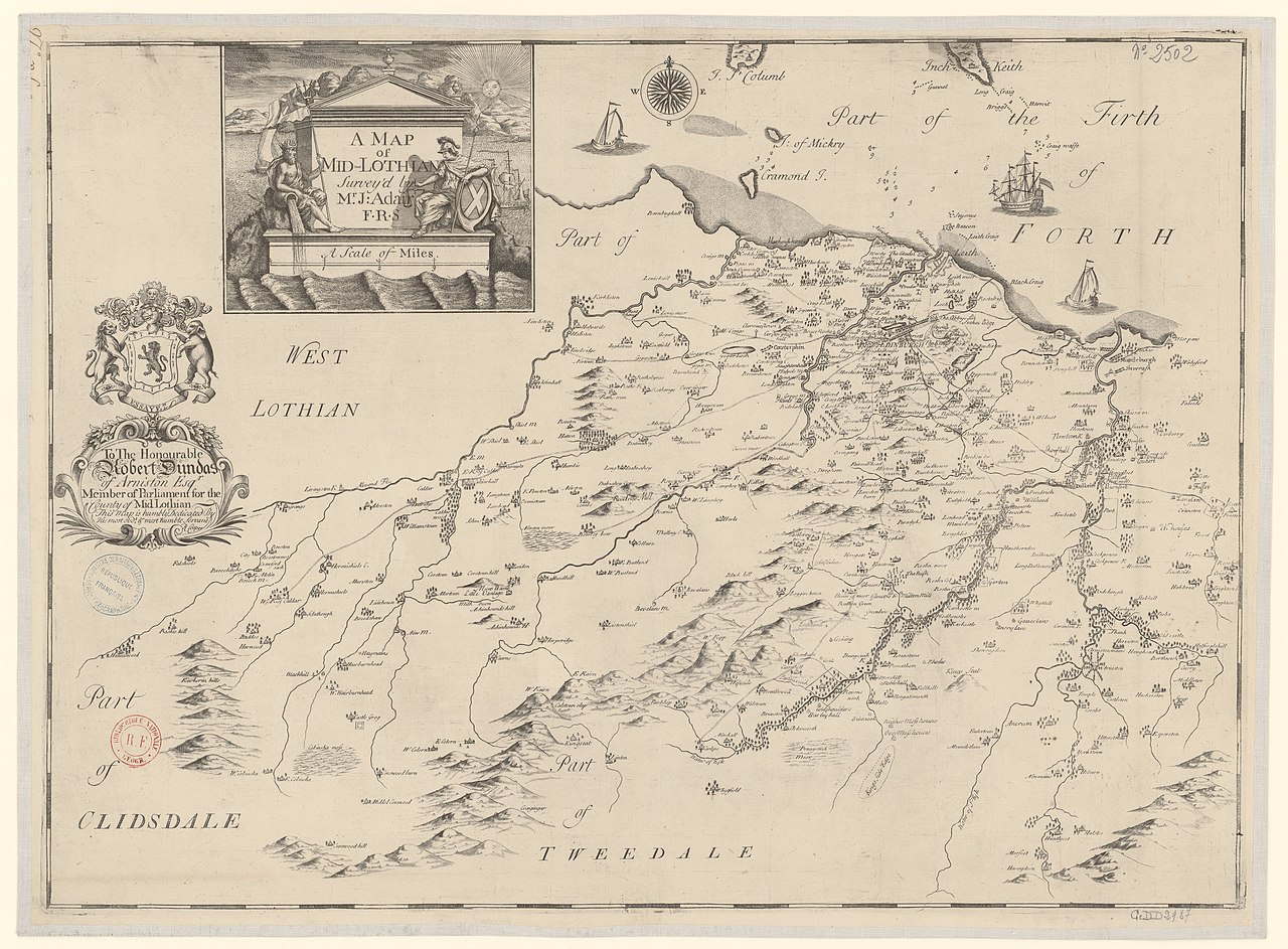
File:A Map of Mid-Lothian - To The Honourable Robert Dundas of Arniston This Map is humbly Dedicated By His most obed.t & most humble Servant R. Cooper - Survey'd by Mr. J. Adair - btv1b530572841.jpg
Jump to navigation
Jump to search

Size of this preview: 800 × 589 pixels. Other resolutions: 320 × 236 pixels | 640 × 472 pixels | 1,024 × 755 pixels | 1,280 × 943 pixels | 2,560 × 1,886 pixels | 8,804 × 6,487 pixels.
Original file (8,804 × 6,487 pixels, file size: 7.39 MB, MIME type: image/jpeg)
Captions
Captions
Add a one-line explanation of what this file represents
Summary
[edit]| Warning | The original file is very high-resolution. It might not load properly or could cause your browser to freeze when opened at full size. |
|---|
| A Map of Mid-Lothian : To The Honourable Robert Dundas of Arniston This Map is humbly Dedicated By His most obed.t & most humble Servant R. Cooper / Survey'd by Mr. J. Adair
( |
|||||||||||||||||||||||||||
|---|---|---|---|---|---|---|---|---|---|---|---|---|---|---|---|---|---|---|---|---|---|---|---|---|---|---|---|
| Author |
Adair, John (1655?-1719). Cartographe Cooper, Richard (1701-1764). Cartographe |
||||||||||||||||||||||||||
| Title |
A Map of Mid-Lothian : To The Honourable Robert Dundas of Arniston This Map is humbly Dedicated By His most obed.t & most humble Servant R. Cooper / Survey'd by Mr. J. Adair |
||||||||||||||||||||||||||
| Description |
Français : Sujet : Midlothian, District de
Échelle(s) : A Sacle of Miles 4 [= 12,6 cm] Appartient à l’ensemble documentaire : AnvilEur Appartient à l’ensemble documentaire : MAEDI008 Appartient à l’ensemble documentaire : MAEDIGen0 Couverture : Royaume-Uni – Écosse – Lothian Langue : anglais Éditeur : [s.n.] |
||||||||||||||||||||||||||
| Date | 1735 | ||||||||||||||||||||||||||
| Dimensions | height: 69.5 cm (27.3 in); width: 50.5 cm (19.8 in) | ||||||||||||||||||||||||||
| Collection |
|
||||||||||||||||||||||||||
| References |
Français : Notice de recueil : http://catalogue.bnf.fr/ark:/12148/cb40577015h
Appartient à : Collection d'Anville ; 02502 B Notice du catalogue : http://catalogue.bnf.fr/ark:/12148/cb40654299z |
||||||||||||||||||||||||||
| Source/Photographer |
Français : Bibliothèque nationale de France, département Cartes et plans, GE DD-2987 (2502 B)
Bibliothèque nationale de France |
||||||||||||||||||||||||||
| Permission (Reusing this file) |
|
||||||||||||||||||||||||||

File history
Click on a date/time to view the file as it appeared at that time.
| Date/Time | Thumbnail | Dimensions | User | Comment | |
|---|---|---|---|---|---|
| current | 09:01, 15 August 2022 | | 8,804 × 6,487 (7.39 MB) | Gzen92Bot (talk | contribs) | Gallica btv1b530572841 |
You cannot overwrite this file.
File usage on Commons
The following page uses this file: