File:AUT — Kärnten — Bezirk Spittal an der Drau — Stadtgemeinde Spittal an der Drau — Zur Seilbahn 10 (alte Goldeckbahn, Talstation, Eingang) 2021.jpg
From Wikimedia Commons, the free media repository
Jump to navigation
Jump to search
Size of this preview: 800 × 600 pixels. Other resolutions: 320 × 240 pixels | 640 × 480 pixels | 1,024 × 768 pixels | 1,280 × 960 pixels | 2,560 × 1,919 pixels | 3,353 × 2,514 pixels.
Original file (3,353 × 2,514 pixels, file size: 1.78 MB, MIME type: image/jpeg)
File information
Structured data
Captions
Summary
[edit]DescriptionAUT — Kärnten — Bezirk Spittal an der Drau — Stadtgemeinde Spittal an der Drau — Zur Seilbahn 10 (alte Goldeckbahn, Talstation, Eingang) 2021.jpg |
location of photographer Austria > Kärnten > Bezirk Spittal an der Drau > Spittal an der Drau > Zur Seilbahn 10 
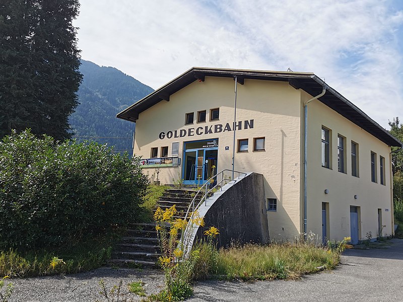
Deutsch: alte Goldeckbahn (Großkabinen-Pendelbahn, Talstation, erbaut 1960; Betrieb eingestellt; der Neubau befindet sich wenige km weiter) |
Date | Taken on 4 September 2021 |
Source | Self-photographed |
Author | User:Mateus2019 |
Camera location | 46° 47′ 26.53″ N, 13° 29′ 07.56″ E | View this and other nearby images on: OpenStreetMap | 46.790703; 13.485433 |
---|
Licensing
[edit]I, the copyright holder of this work, hereby publish it under the following license:
This file is licensed under the Creative Commons Attribution-Share Alike 4.0 International license.
- You are free:
- to share – to copy, distribute and transmit the work
- to remix – to adapt the work
- Under the following conditions:
- attribution – You must give appropriate credit, provide a link to the license, and indicate if changes were made. You may do so in any reasonable manner, but not in any way that suggests the licensor endorses you or your use.
- share alike – If you remix, transform, or build upon the material, you must distribute your contributions under the same or compatible license as the original.
File history
Click on a date/time to view the file as it appeared at that time.
Date/Time | Thumbnail | Dimensions | User | Comment | |
---|---|---|---|---|---|
current | 16:09, 12 September 2021 | 3,353 × 2,514 (1.78 MB) | Mateus2019 (talk | contribs) | == {{int:filedesc}} == {{Information |Description={{Loc desc}} {{AUT}} > Kärnten > Bezirk Spittal an der Drau > Spittal an der Drau {{de|1=Alte Goldeckbahn (Talstation)}} |Source={{own photograph}} |Date={{Taken on |1=2021-09-04 |cat= |location=Austria |source= }} |Author=User:Mateus2019 |Permission= |other_versions= }} =={{int:license-header}}== {{self|cc-by-sa-4.0}} Category:Goldeckbahn Category:Empty Category:lost places Category:Work by Mattes 2021 [[Category:File u... |
You cannot overwrite this file.
File usage on Commons
The following page uses this file:
Metadata
This file contains additional information such as Exif metadata which may have been added by the digital camera, scanner, or software program used to create or digitize it. If the file has been modified from its original state, some details such as the timestamp may not fully reflect those of the original file. The timestamp is only as accurate as the clock in the camera, and it may be completely wrong.
Camera manufacturer | HUAWEI |
---|---|
Camera model | VOG-L29 |
Exposure time | 301/1,000,000 sec (0.000301) |
F-number | f/1.6 |
ISO speed rating | 50 |
Date and time of data generation | 12:55, 4 September 2021 |
Lens focal length | 5.56 mm |
Latitude | 46° 47′ 26.53″ N |
Longitude | 13° 29′ 7.56″ E |
Altitude | 594.08 meters above sea level |
Width | 3,648 px |
Height | 2,736 px |
Bits per component |
|
Orientation | Normal |
Horizontal resolution | 72 dpi |
Vertical resolution | 72 dpi |
Software used | Windows Photo Editor 10.0.10011.16384 |
File change date and time | 21:07, 6 September 2021 |
Y and C positioning | Centered |
Exposure Program | Normal program |
Exif version | 2.1 |
Date and time of digitizing | 12:55, 4 September 2021 |
Meaning of each component |
|
Image compression mode | 0.95 |
APEX shutter speed | 29.8973 |
APEX aperture | 1.35 |
APEX brightness | 0 |
APEX exposure bias | 0 |
Maximum land aperture | 1.35 APEX (f/1.6) |
Metering mode | Pattern |
Light source | Daylight |
Flash | Flash did not fire |
DateTime subseconds | 734756 |
DateTimeOriginal subseconds | 734756 |
DateTimeDigitized subseconds | 734756 |
Supported Flashpix version | 1 |
Color space | sRGB |
Sensing method | One-chip color area sensor |
File source | Digital still camera |
Scene type | A directly photographed image |
Custom image processing | Custom process |
Exposure mode | Auto exposure |
White balance | Auto white balance |
Digital zoom ratio | 1 |
Focal length in 35 mm film | 27 mm |
Scene capture type | Standard |
Scene control | None |
Contrast | Normal |
Saturation | Normal |
Sharpness | Normal |
Subject distance range | Unknown |
GPS time (atomic clock) | 10:55 |
GPS date | 4 September 2021 |
GPS tag version | 2.2.0.0 |
Structured data
Items portrayed in this file
depicts
0.000301 second
1.6
5.56 millimetre
image/jpeg
5d6a9c9d198a12d38e6107f954507e4b846d3bbe
1,868,025 byte
2,514 pixel
3,353 pixel
46°47'26.531"N, 13°29'7.559"E
Hidden categories:
- Austria photographs taken on 2021-09-04
- Taken on missing SDC inception
- Files with coordinates missing SDC location of creation
- CC-BY-SA-4.0
- Self-published work
- Work by Mattes 2021
- File uploads by User:Mattes (flat)
- Taken with Huawei P30 Pro
- User:Mattes/Contributions/Topics/Austria/Kärnten
- User:Mattes/Contributions/Topics/Buildings and structures
- User:Mattes/Contributions/Geolocation/OK