File:ATM Catalunya 2016.svg
Jump to navigation
Jump to search

Size of this PNG preview of this SVG file: 617 × 600 pixels. Other resolutions: 247 × 240 pixels | 494 × 480 pixels | 790 × 768 pixels | 1,054 × 1,024 pixels | 2,108 × 2,048 pixels | 812 × 789 pixels.
Original file (SVG file, nominally 812 × 789 pixels, file size: 1.18 MB)
Captions
Captions
Add a one-line explanation of what this file represents
Summary
[edit]
| Description |
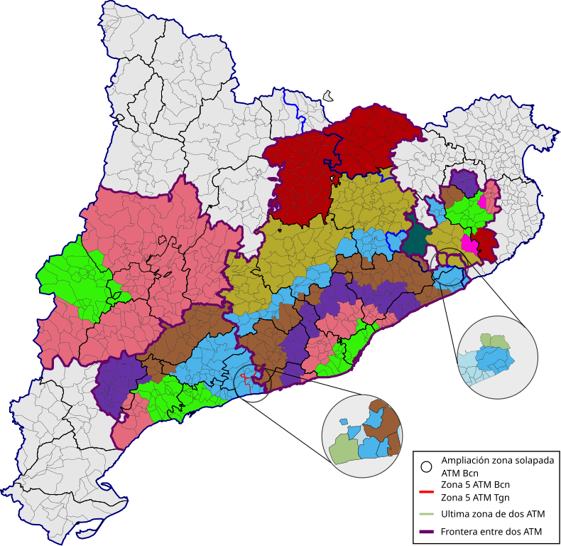
Español: Mapa d'Autoritats de Territorials de la Mobilitat de Catalunya. |
| Date | |
| Source | Own work |
| Author | Filiprino |
Licensing
[edit]
I, the copyright holder of this work, hereby publish it under the following license:
This file is licensed under the Creative Commons Attribution-Share Alike 4.0 International license.
- You are free:
- to share – to copy, distribute and transmit the work
- to remix – to adapt the work
- Under the following conditions:
- attribution – You must give appropriate credit, provide a link to the license, and indicate if changes were made. You may do so in any reasonable manner, but not in any way that suggests the licensor endorses you or your use.
- share alike – If you remix, transform, or build upon the material, you must distribute your contributions under the same or compatible license as the original.
File history
Click on a date/time to view the file as it appeared at that time.
| Date/Time | Thumbnail | Dimensions | User | Comment | |
|---|---|---|---|---|---|
| current | 23:47, 12 August 2017 | | 812 × 789 (1.18 MB) | Filiprino (talk | contribs) | Añadidas las comarcas de Cataluña. Las zonas de integración se rigen por las comarcas, no por las provincias. Provincias: azul de 2px de ancho. Comarcas: negro de 0.5px de ancho. Municipios: negro de 0.21px de ancho. ATMs: rosa de 3.2px de ancho. |
| 23:22, 12 August 2017 |  | 812 × 789 (1.18 MB) | Filiprino (talk | contribs) | User created page with UploadWizard |
You cannot overwrite this file.
File usage on Commons
There are no pages that use this file.
File usage on other wikis
The following other wikis use this file:
- Usage on es.wikipedia.org