File:ARRA Supai Camp- Rehab Existing 1815 (5861764220).jpg
Original file (2,272 × 1,704 pixels, file size: 559 KB, MIME type: image/jpeg)
Captions
Captions
Summary
[edit].jpg&action=edit§ion=1)
| Description |
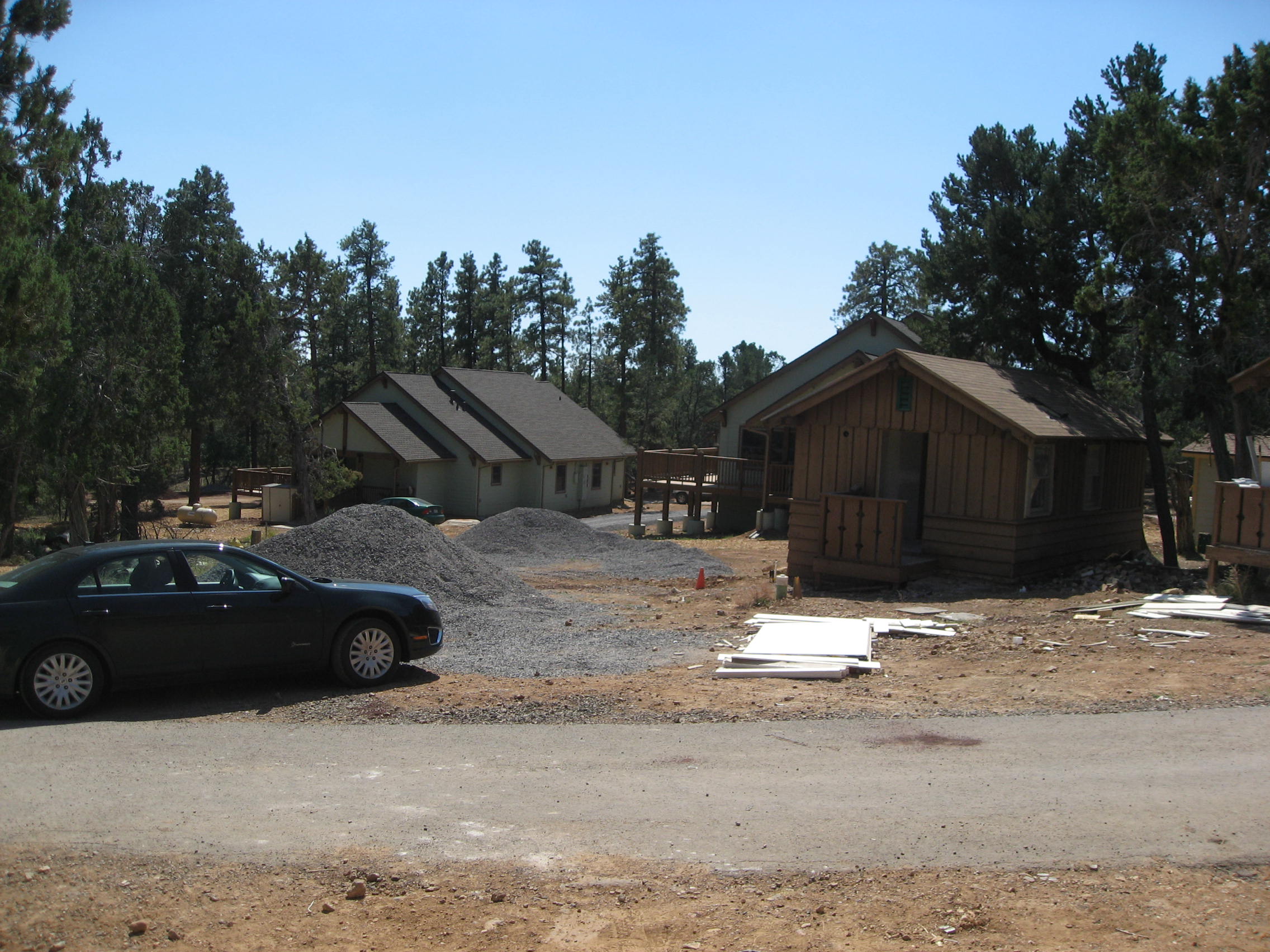
Project: Rehabilitate Four Historic and Two Non-Historic Structures at Supai Camp. . Project overview: This project involves repairing and rehabilitating five housing units and one outbuilding that already exist at Supai Camp. Repairs will include a complete renovation of the four historic structures. This renovation work will include installing plumbing (running water and sewer), replacing roofing and windows, repainting, and upgrading the interior walls for all units. Residential fire sprinkler systems will also be installed in each of the units. Minor rehab work on the non-historic residence and common bath/laundry facility will include fixture replacement, lighting retrofit, and installation of fire sprinkler systems. Incidental site work includes the replacement of the potable water main to meet fire flow requirements and the installation of a sewer line and lift station.These repairs will vastly improve housing units and living conditions for the members of the Havasupai Tribe that reside at Supai Camp.. . Project leader: Phil Fessler. . Park contact: Maureen Oltrogge, Public Affairs Officer, (928) 638-7779. . Project timing: This project will get under way following completion of the other ARRA project at Supai Camp, Repair and Rehabilitate Housing at Supai Camp. This will allow current residents a transition period to move from their existing, outdated housing units to the newly constructed housing units.. . ARRA funding: $468,000. . Partners: Havasupai Indian Tribe. . Accepting outside solicitations: This project was awarded to Nagaki Design Build Associates, Phoenix, Arizona |
| Date | |
| Source | ARRA Supai Camp- Rehab Existing 1815 |
| Author | Grand Canyon National Park |
| Camera location | | View this and other nearby images on: OpenStreetMap |
|---|
.jpg¶ms=036.044969_N_-112.159767_E_globe:Earth_type:camera_source:Flickr_&language=en)
Licensing
[edit].jpg&action=edit§ion=2)
- You are free:
- to share – to copy, distribute and transmit the work
- to remix – to adapt the work
- Under the following conditions:
- attribution – You must give appropriate credit, provide a link to the license, and indicate if changes were made. You may do so in any reasonable manner, but not in any way that suggests the licensor endorses you or your use.
| This image was originally posted to Flickr by Grand Canyon NPS at https://flickr.com/photos/50693818@N08/5861764220. It was reviewed on 20 April 2020 by FlickreviewR 2 and was confirmed to be licensed under the terms of the cc-by-2.0. |
File history
Click on a date/time to view the file as it appeared at that time.
| Date/Time | Thumbnail | Dimensions | User | Comment | |
|---|---|---|---|---|---|
| current | 18:04, 20 April 2020 | | 2,272 × 1,704 (559 KB) | Killarnee (talk | contribs) | Transferred from Flickr via #flickr2commons |
You cannot overwrite this file.
File usage on Commons
The following page uses this file:
.jpg&oldid=775820278)