File:AMH-8152-KB Map of the Angolan coast.jpg
Jump to navigation
Jump to search
Size of this preview: 496 × 599 pixels. Other resolutions: 199 × 240 pixels | 397 × 480 pixels | 636 × 768 pixels | 848 × 1,024 pixels | 1,987 × 2,400 pixels.
Original file (1,987 × 2,400 pixels, file size: 753 KB, MIME type: image/jpeg)
Captions
Captions
Add a one-line explanation of what this file represents
Summary
[edit]Nederlands: Kaart van de kust van Angola
English: Map of the Angolan coast( |
|||||||||||||||||||||||||||
|---|---|---|---|---|---|---|---|---|---|---|---|---|---|---|---|---|---|---|---|---|---|---|---|---|---|---|---|
| Author |
Nederlands: Anoniem / Anonymous (landmeter / kaartenmaker), Awnsham Churchill (uitgever), John Churchill (uitgever)
English: Anoniem / Anonymous (land surveyor / mapmaker), Awnsham Churchill (publisher), John Churchill (publisher) |
||||||||||||||||||||||||||
| Title |
Nederlands: Kaart van de kust van Angola
English: Map of the Angolan coast |
||||||||||||||||||||||||||
| Description |
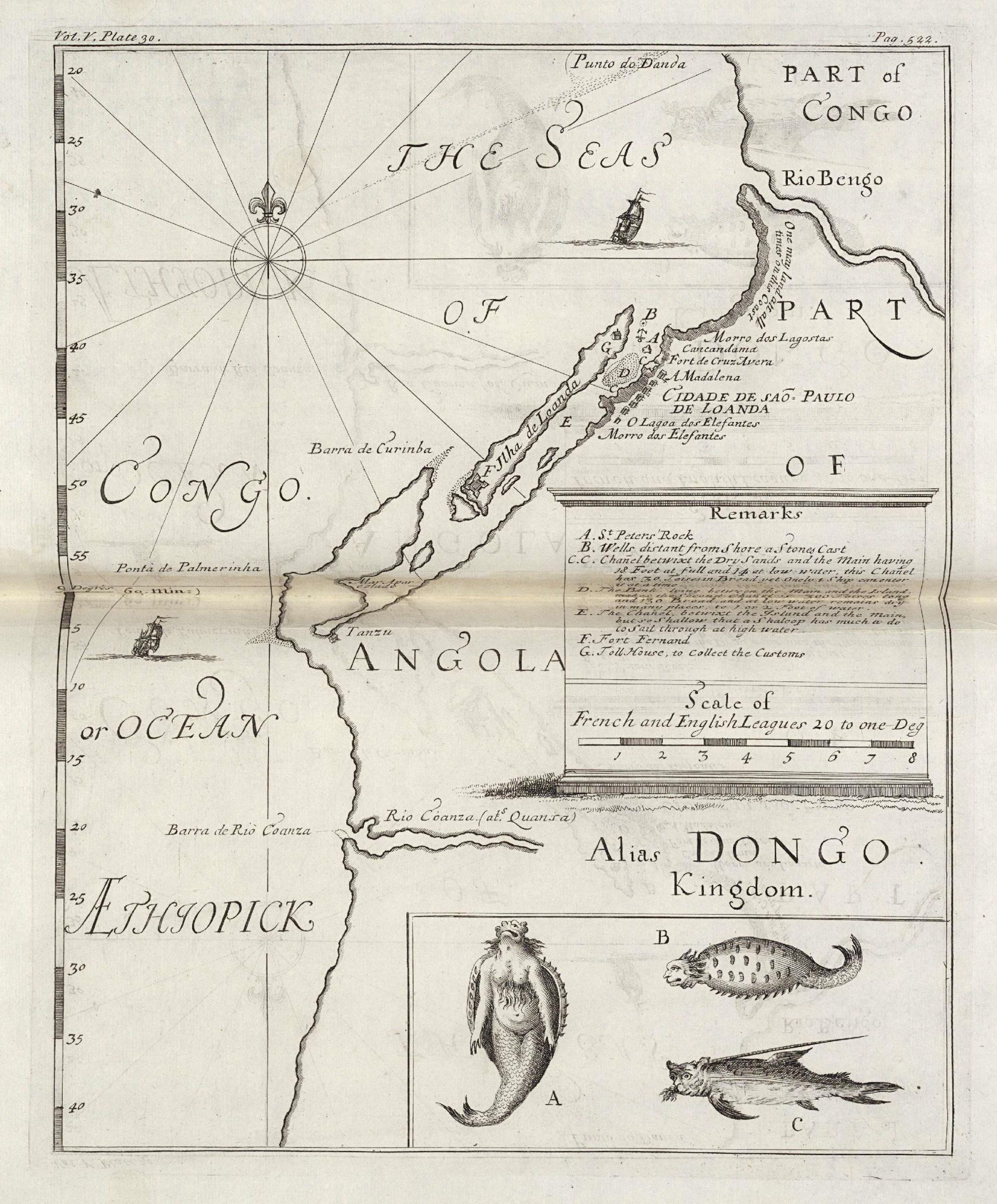
Nederlands: Kaart van de kust van Angola.
Linksboven: Vol. V. Plate 30. Rechtsboven: Pag. 522. Legenda: A-G. Op de inzet zijn vissen en fantasiewezens afgebeeld.English: Map of the Angolan coast.
Top left: Vol. V. Plate 30. Top right: Pag. 522. Key: A-G. Fishes and fantasy figures are shown in the inset. |
||||||||||||||||||||||||||
| Date | 1732 | ||||||||||||||||||||||||||
| Medium |
Nederlands: gravure op papier
English: engraving on paper |
||||||||||||||||||||||||||
| Dimensions | height: 20 cm (7.8 in); width: 24.5 cm (9.6 in) | ||||||||||||||||||||||||||
| Collection |
|
||||||||||||||||||||||||||
| Accession number |
61 B 25, na p. 522 |
||||||||||||||||||||||||||
| Notes |
English: Subjects: chart / map / plan, compass / dial, key, ship / vessel, guard house / tollbooth, fortification, fauna
Nederlands: Onderwerpen: plattegrond / kaart, kompas / windroos, legenda, schip / vaartuig, tolhuis / wachthuis, vesting, fauna |
||||||||||||||||||||||||||
| Source/Photographer |
|
||||||||||||||||||||||||||
| Permission (Reusing this file) |
|
||||||||||||||||||||||||||

| Object location | | View this and other nearby images on: OpenStreetMap |
|---|
File history
Click on a date/time to view the file as it appeared at that time.
| Date/Time | Thumbnail | Dimensions | User | Comment | |
|---|---|---|---|---|---|
| current | 15:35, 10 June 2014 | | 1,987 × 2,400 (753 KB) | HuskyBot (talk | contribs) | == {{int:filedesc}} == {{Artwork |title = {{nl|1=Kaart van de kust van Angola}} {{en|1=Map of the Angolan coast}} |description = {{nl|1=Kaart van de kust van Angola. Linksboven: ''Vol. V. Plate 30''. Rechtsbo... |
You cannot overwrite this file.
File usage on Commons
The following page uses this file:
File usage on other wikis
The following other wikis use this file:
- Usage on en.wikipedia.org