File:AMH-7933-KB Map of the mouth of the Sierra Leona.jpg
Jump to navigation
Jump to search
Size of this preview: 659 × 599 pixels. Other resolutions: 264 × 240 pixels | 528 × 480 pixels | 845 × 768 pixels | 1,126 × 1,024 pixels | 2,400 × 2,182 pixels.
Original file (2,400 × 2,182 pixels, file size: 522 KB, MIME type: image/jpeg)
Captions
Captions
Add a one-line explanation of what this file represents
Summary
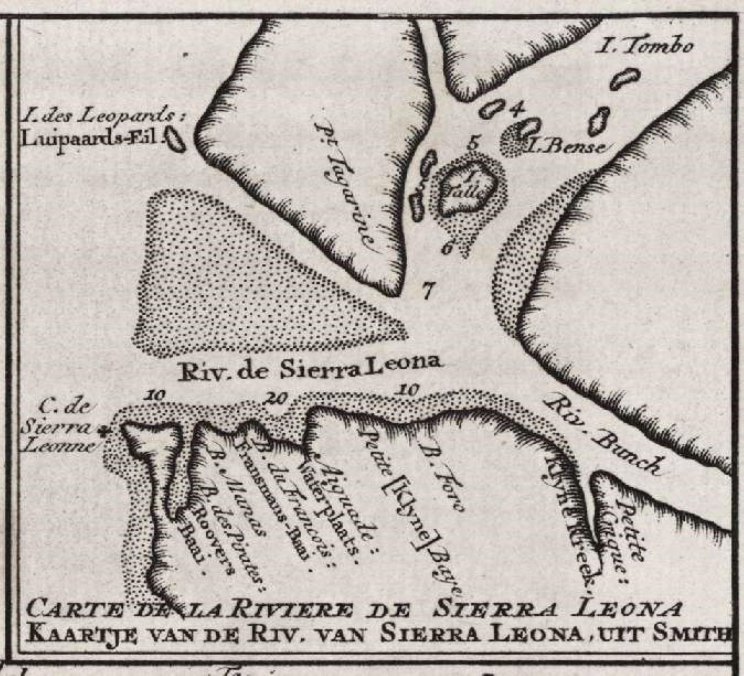
[edit]Nederlands: Kaart van de monding van de Sierra Leona
English: Map of the mouth of the Sierra Leona( |
|||||||||||||||||||||||
|---|---|---|---|---|---|---|---|---|---|---|---|---|---|---|---|---|---|---|---|---|---|---|---|
| Author |
Nederlands: Pierre d' Hondt (uitgever), Anoniem / Anonymous (landmeter / kaartenmaker)
English: Pierre d' Hondt (publisher), Anoniem / Anonymous (land surveyor / mapmaker) |
||||||||||||||||||||||
| Title |
Nederlands: Kaart van de monding van de Sierra Leona
English: Map of the mouth of the Sierra Leona |
||||||||||||||||||||||
| Description |
Nederlands: Kaart van de monding van de Sierra Leona.
Kaartje van de Riv. van Sierra Leona. Carte de la Riviere de Sierra Leona. Inzet bij: Koninklijke Bibliotheek, Den Haag, inv. nr. 693 C 6 dl IV, na p. 238.English: Map of the mouth of the Sierra Leona. .
Kaartje van de Riv. van Sierra Leona. Carte de la Riviere de Sierra Leona. Insert accompanying: Koninklijke Bibliotheek, The Hague, inv. nr. 693 C 6 dl IV, after p. 238. |
||||||||||||||||||||||
| Date | 1747 | ||||||||||||||||||||||
| Medium |
Nederlands: gravure op papier
English: engraving on paper |
||||||||||||||||||||||
| Dimensions | height: 5.5 cm (2.1 in); width: 5 cm (1.9 in) | ||||||||||||||||||||||
| Collection |
|
||||||||||||||||||||||
| Accession number |
693 C 6 dl IV, na p. 238, I |
||||||||||||||||||||||
| Inscriptions |
Kaartje van de Riv. van Sierra Leona
|
||||||||||||||||||||||
| Notes |
English: Subjects: chart / map / plan
Nederlands: Onderwerpen: plattegrond / kaart
English: Post: this image is related to a WIC trading post called Tasso Island |
||||||||||||||||||||||
| Source/Photographer |
|
||||||||||||||||||||||
| Permission (Reusing this file) |
|
||||||||||||||||||||||

| Object location | | View this and other nearby images on: OpenStreetMap |
|---|
File history
Click on a date/time to view the file as it appeared at that time.
| Date/Time | Thumbnail | Dimensions | User | Comment | |
|---|---|---|---|---|---|
| current | 14:47, 10 June 2014 | | 2,400 × 2,182 (522 KB) | HuskyBot (talk | contribs) | == {{int:filedesc}} == {{Artwork |title = {{nl|1=Kaart van de monding van de Sierra Leona}} {{en|1=Map of the mouth of the Sierra Leona}} |description = {{nl|1=Kaart van de monding van de Sierra Leona. ''Kaart... |
You cannot overwrite this file.
File usage on Commons
The following page uses this file: