File:AMH-6805-NA View of Serinhain.jpg
Jump to navigation
Jump to search

Size of this preview: 800 × 545 pixels. Other resolutions: 320 × 218 pixels | 640 × 436 pixels | 1,024 × 698 pixels | 1,280 × 873 pixels | 2,400 × 1,636 pixels.
Original file (2,400 × 1,636 pixels, file size: 410 KB, MIME type: image/jpeg)
Captions
Captions
Add a one-line explanation of what this file represents
Summary
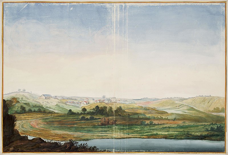
[edit]| Nederlands: Gezicht op Serinhain
English: View of Serinhain ( |
||||||||||||||||||||||||
|---|---|---|---|---|---|---|---|---|---|---|---|---|---|---|---|---|---|---|---|---|---|---|---|---|
| Author |
Nederlands: Johannes Vingboons (landmeter / kaartenmaker)
English: Johannes Vingboons (land surveyor / mapmaker) |
|||||||||||||||||||||||
| Title |
Nederlands: Gezicht op Serinhain
English: View of Serinhain |
|||||||||||||||||||||||
| Description |
Nederlands: Titel catalogus Leupe (NA): Gezicht op ?.
Gezicht op Serinhain. Bijzonderheden: de kaart hoort bij de Atlas Vingboons.English: Title in the Leupe catalogue (NA): Gezicht op ?.
View of Serinhain. Remarks: the plate is included in the Vingboons Atlas. |
|||||||||||||||||||||||
| Date | circa 1665 | |||||||||||||||||||||||
| Medium |
Nederlands: aquarel/waterverf op papier
English: watercolour on paper |
|||||||||||||||||||||||
| Dimensions | height: 60 cm (23.6 in); width: 41 cm (16.1 in) | |||||||||||||||||||||||
| Collection |
|
|||||||||||||||||||||||
| Accession number |
NL-HaNA_4.VELH_619.109 (old number: VELH0619.109) |
|||||||||||||||||||||||
| Notes |
English: Subjects: survey / view, flora, building, house, fence / kraal
Nederlands: Onderwerpen: overzicht / aanzicht, flora, gebouw, huis / woonhuis, omheining / kraal |
|||||||||||||||||||||||
| Source/Photographer |
|
|||||||||||||||||||||||
| Permission (Reusing this file) |
|
|||||||||||||||||||||||

| Object location | | View this and other nearby images on: OpenStreetMap |
|---|
File history
Click on a date/time to view the file as it appeared at that time.
| Date/Time | Thumbnail | Dimensions | User | Comment | |
|---|---|---|---|---|---|
| current | 09:54, 11 June 2014 | | 2,400 × 1,636 (410 KB) | HuskyBot (talk | contribs) | == {{int:filedesc}} == {{Artwork |title = {{nl|1=Gezicht op Serinhain}} {{en|1=View of Serinhain}} |description = {{nl|1=Titel catalogus Leupe (NA): ''Gezicht op ?''. Gezicht op Serinhain. Bijzonderheden: de... |
You cannot overwrite this file.
File usage on Commons
The following page uses this file: