File:AMH-6092-NA Map of Oubyse island and environs.jpg

Original file (2,400 × 1,624 pixels, file size: 553 KB, MIME type: image/jpeg)
Captions
Captions
Summary
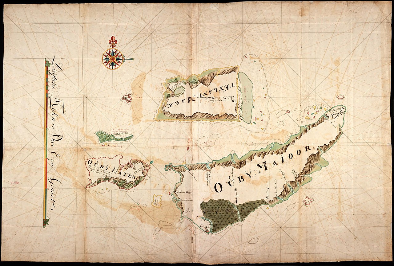
[edit]Nederlands: Kaart van Oubyse eiland en omgeving
English: Map of Oubyse island and environs( |
||||||||||||||||||||||||
|---|---|---|---|---|---|---|---|---|---|---|---|---|---|---|---|---|---|---|---|---|---|---|---|---|
| Author |
Nederlands: Anoniem / Anonymous
English: Anoniem / Anonymous |
|||||||||||||||||||||||
| Title |
Nederlands: Kaart van Oubyse eiland en omgeving
English: Map of Oubyse island and environs |
|||||||||||||||||||||||
| Description |
Nederlands: Titel catalogus Leupe (NA): Kaart van Oubyse Eylanden, Ouby Major, Ouby Laten, het Eyland Maga, met alle daeromleggende reven enz..
Notities verso: No. 27. De kaart toont de eilanden T Eylant Maga, Oubij Laten, Oubij Majoor en kleine omringende eilanden. Links de schaalverdeling Duijtsche Mijlen 15 Voor Een Graadt.English: Title in the Leupe catalogue (NA): Kaart van Oubyse Eylanden, Ouby Major, Ouby Laten, het Eyland Maga, met alle daeromleggende reven enz..
Notes on reverse: No. 27. The map shows the islands T Eylant Maga, Oubij Laten, Oubij Majoor and small surrounding islands. Left is the scale: Duijtsche Mijlen 15 Voor Een Graadt. |
|||||||||||||||||||||||
| Date | between 1700 and 1800 | |||||||||||||||||||||||
| Medium |
Nederlands: ingekleurde tekening op papier
English: coloured drawing on paper |
|||||||||||||||||||||||
| Dimensions | height: 140.5 cm (55.3 in); width: 94 cm (37 in) | |||||||||||||||||||||||
| Collection |
|
|||||||||||||||||||||||
| Accession number |
NL-HaNA_4.VEL_471 (old number: VEL0471) |
|||||||||||||||||||||||
| Inscriptions |
-
|
|||||||||||||||||||||||
| Notes |
English: Subjects: chart / map / plan, flora
Nederlands: Onderwerpen: plattegrond / kaart, flora
English: Post: this image is related to a VOC trading post called Loji |
|||||||||||||||||||||||
| Source/Photographer |
|
|||||||||||||||||||||||
| Permission (Reusing this file) |
|
|||||||||||||||||||||||

| Object location | | View this and other nearby images on: OpenStreetMap |
|---|
File history
Click on a date/time to view the file as it appeared at that time.
| Date/Time | Thumbnail | Dimensions | User | Comment | |
|---|---|---|---|---|---|
| current | 08:57, 11 June 2014 | | 2,400 × 1,624 (553 KB) | HuskyBot (talk | contribs) | == {{int:filedesc}} == {{Artwork |title = {{nl|1=Kaart van Oubyse eiland en omgeving}} {{en|1=Map of Oubyse island and environs}} |description = {{nl|1=Titel catalogus Leupe (NA): ''Kaart van Oubyse Eylanden, O... |
You cannot overwrite this file.
File usage on Commons
The following page uses this file: