File:AMH-5244-NA Map of the islands of Onrust and Cuyper.jpg
Jump to navigation
Jump to search
Size of this preview: 423 × 599 pixels. Other resolutions: 169 × 240 pixels | 339 × 480 pixels | 542 × 768 pixels | 723 × 1,024 pixels | 1,695 × 2,400 pixels.
Original file (1,695 × 2,400 pixels, file size: 452 KB, MIME type: image/jpeg)
Captions
Captions
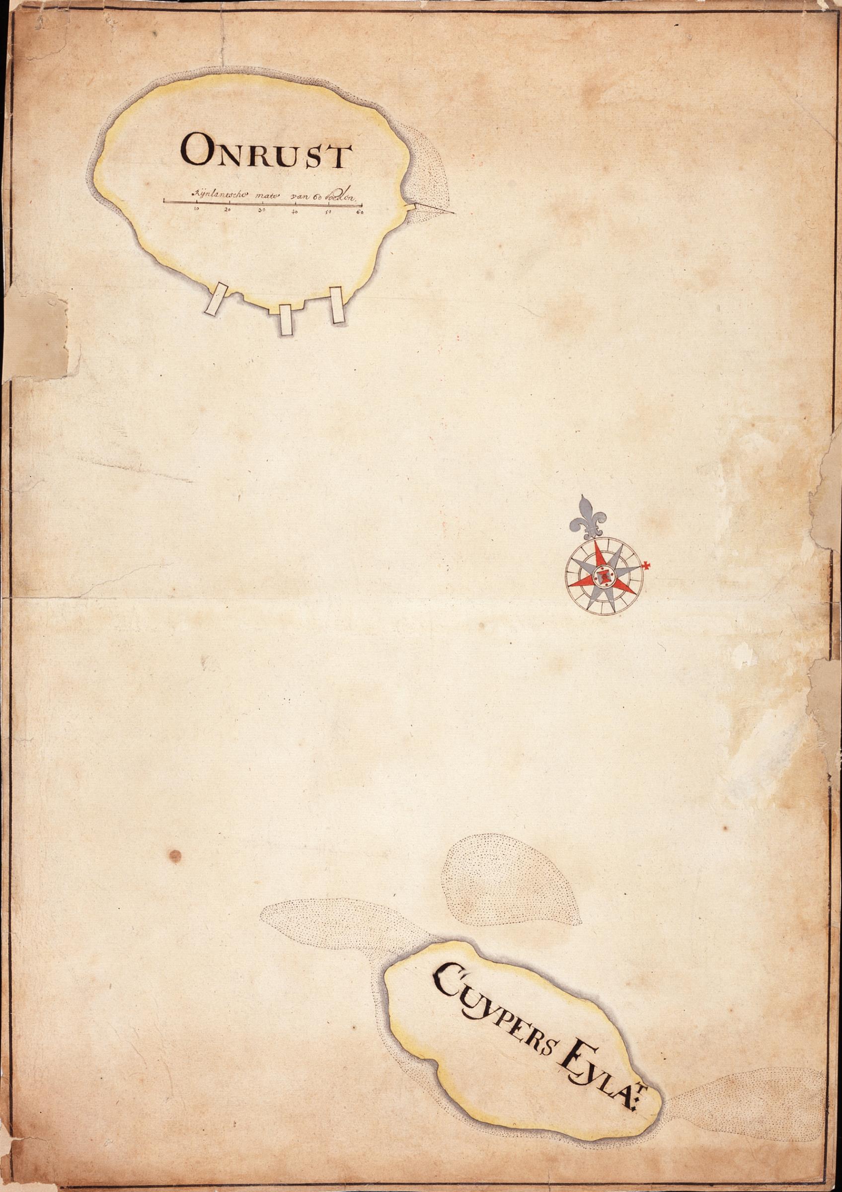
Map of the islands of Onrust and Cuyper
Summary
[edit]Nederlands: Kaart van de eilanden Onrust en Cuyper
                     English:  Map of the islands of Onrust and Cuyper
                     Bahasa Indonesia:  Peta pulau Onrust dan Cuyper
( |
||||||||||||||||||||||||
|---|---|---|---|---|---|---|---|---|---|---|---|---|---|---|---|---|---|---|---|---|---|---|---|---|
| Author |
Nederlands: Anoniem / Anonymous (landmeter / kaartenmaker)
English: Anoniem / Anonymous (land surveyor / mapmaker) |
|||||||||||||||||||||||
| Title |
Nederlands: Kaart van de eilanden Onrust en Cuyper
English: Map of the islands of Onrust and Cuyper
Bahasa Indonesia: Peta pulau Onrust dan Cuyper |
|||||||||||||||||||||||
| Description |
Nederlands: Titel in catalogus Leupe (NA): Kaart van de Eilanden Onrust en Cuyper.
English: Title in the Leupe catalogue (National Archives): Kaart van de Eilanden Onrust en Cuyper.
Bahasa Indonesia: Judul dalam katalog Leupe (Arsip Nasional): Kaart van de Eilanden Onrust en Cuyper. |
|||||||||||||||||||||||
| Date | between 1600 and 1700 | |||||||||||||||||||||||
| Medium |
Nederlands: ingekleurde tekening op papier
English: coloured drawing on paper
Bahasa Indonesia: gambar berwarna di atas kertas |
|||||||||||||||||||||||
| Dimensions | height: 35.5 cm (13.9 in); width: 50.5 cm (19.8 in) | |||||||||||||||||||||||
| Collection |
|
|||||||||||||||||||||||
| Accession number |
NL-HaNA_4.VEL_445 (old number: VEL0445) |
|||||||||||||||||||||||
| Inscriptions |
-
|
|||||||||||||||||||||||
| Notes |
English: Subjects: compass / dial, chart / map / plan
Nederlands: Onderwerpen: kompas / windroos, plattegrond / kaart |
|||||||||||||||||||||||
| Source/Photographer |
|
|||||||||||||||||||||||
| Permission (Reusing this file) |
|
|||||||||||||||||||||||

File history
Click on a date/time to view the file as it appeared at that time.
| Date/Time | Thumbnail | Dimensions | User | Comment | |
|---|---|---|---|---|---|
| current | 17:45, 10 June 2014 | | 1,695 × 2,400 (452 KB) | HuskyBot (talk | contribs) | == {{int:filedesc}} == {{Artwork |title = {{nl|1=Kaart van de eilanden Onrust en Cuyper}} {{en|1=Map of the islands of Onrust and Cuyper}} |description = {{nl|1=Titel in catalogus Leupe (NA): ''Kaart van de Eil... |
You cannot overwrite this file.
File usage on Commons
The following page uses this file:
File usage on other wikis
The following other wikis use this file:
- Usage on id.wikipedia.org