File:AMH-5241-NA Map of Java's north coast, from Poelo Mandelique to Petjarang.jpg
Jump to navigation
Jump to search

Size of this preview: 800 × 512 pixels. Other resolutions: 320 × 205 pixels | 640 × 409 pixels | 1,024 × 655 pixels | 1,280 × 819 pixels | 2,400 × 1,535 pixels.
Original file (2,400 × 1,535 pixels, file size: 612 KB, MIME type: image/jpeg)
Captions
Captions
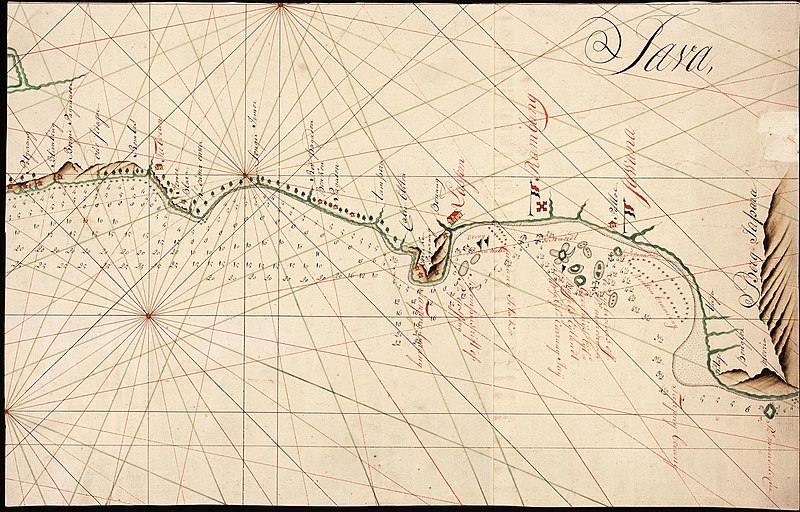
Map of Java's north coast, from Poelo Mandelique to Petjarang
Summary
[edit]| Author |
Nederlands: Anoniem / Anonymous (landmeter / kaartenmaker)
English: Anoniem / Anonymous (land surveyor / mapmaker) |
|||||||||||||||||||||||
| Title |
Nederlands: Kaart van de noordkust van Java, van Poelo Mandelique tot Petjarang
English: Map of Java's north coast, from Poelo Mandelique to Petjarang
Bahasa Indonesia: Peta pantai utara Jawa, dari Poelo Mandelique sampai Petjarang |
|||||||||||||||||||||||
| Description |
Nederlands: Titel in catalogus Leupe (NA): Kaart als voren, van P.o Mandelique tot Petjarang.
English: Title in the Leupe catalogue (National Archives):Kaart als voren, van P.o Mandelique tot Petjarang.
Bahasa Indonesia: Judul dalam katalog Leupe (Arsip Nasional):Kaart als voren, van P.o Mandelique tot Petjarang. |
|||||||||||||||||||||||
| Date | between 1750 and 1800 | |||||||||||||||||||||||
| Medium |
Nederlands: ingekleurde tekening op papier
English: coloured drawing on paper
Bahasa Indonesia: gambar berwarna di atas kertas |
|||||||||||||||||||||||
| Dimensions | height: 49 cm (19.2 in); width: 31 cm (12.2 in) | |||||||||||||||||||||||
| Collection |
|
|||||||||||||||||||||||
| Accession number |
NL-HaNA_4.VEL_427 (old number: VEL0427) |
|||||||||||||||||||||||
| Inscriptions |
Java
|
|||||||||||||||||||||||
| Notes |
English: Subjects: chart / map / plan, compass / dial, building
Nederlands: Onderwerpen: plattegrond / kaart, kompas / windroos, gebouw
English: Post: this image is related to a VOC trading post called Rembang |
|||||||||||||||||||||||
| Source/Photographer |
|
|||||||||||||||||||||||
| Permission (Reusing this file) |
|
|||||||||||||||||||||||

| Object location | | View this and other nearby images on: OpenStreetMap |
|---|
File history
Click on a date/time to view the file as it appeared at that time.
| Date/Time | Thumbnail | Dimensions | User | Comment | |
|---|---|---|---|---|---|
| current | 17:44, 10 June 2014 | | 2,400 × 1,535 (612 KB) | HuskyBot (talk | contribs) | == {{int:filedesc}} == {{Artwork |title = {{nl|1=Kaart van de noordkust van Java, van Poelo Mandelique tot Petjarang}} {{en|1=Map of Java's north coast, from Poelo Mandelique to Petjarang}} |description = {{nl|... |
You cannot overwrite this file.
File usage on Commons
The following page uses this file: