File:AMH-5117-NA Map of Souratte and Souratte river.jpg
Jump to navigation
Jump to search
Size of this preview: 800 × 575 pixels. Other resolutions: 320 × 230 pixels | 640 × 460 pixels | 1,024 × 736 pixels | 1,280 × 921 pixels | 2,400 × 1,726 pixels.
Original file (2,400 × 1,726 pixels, file size: 578 KB, MIME type: image/jpeg)
Captions
Captions
Add a one-line explanation of what this file represents
Summary
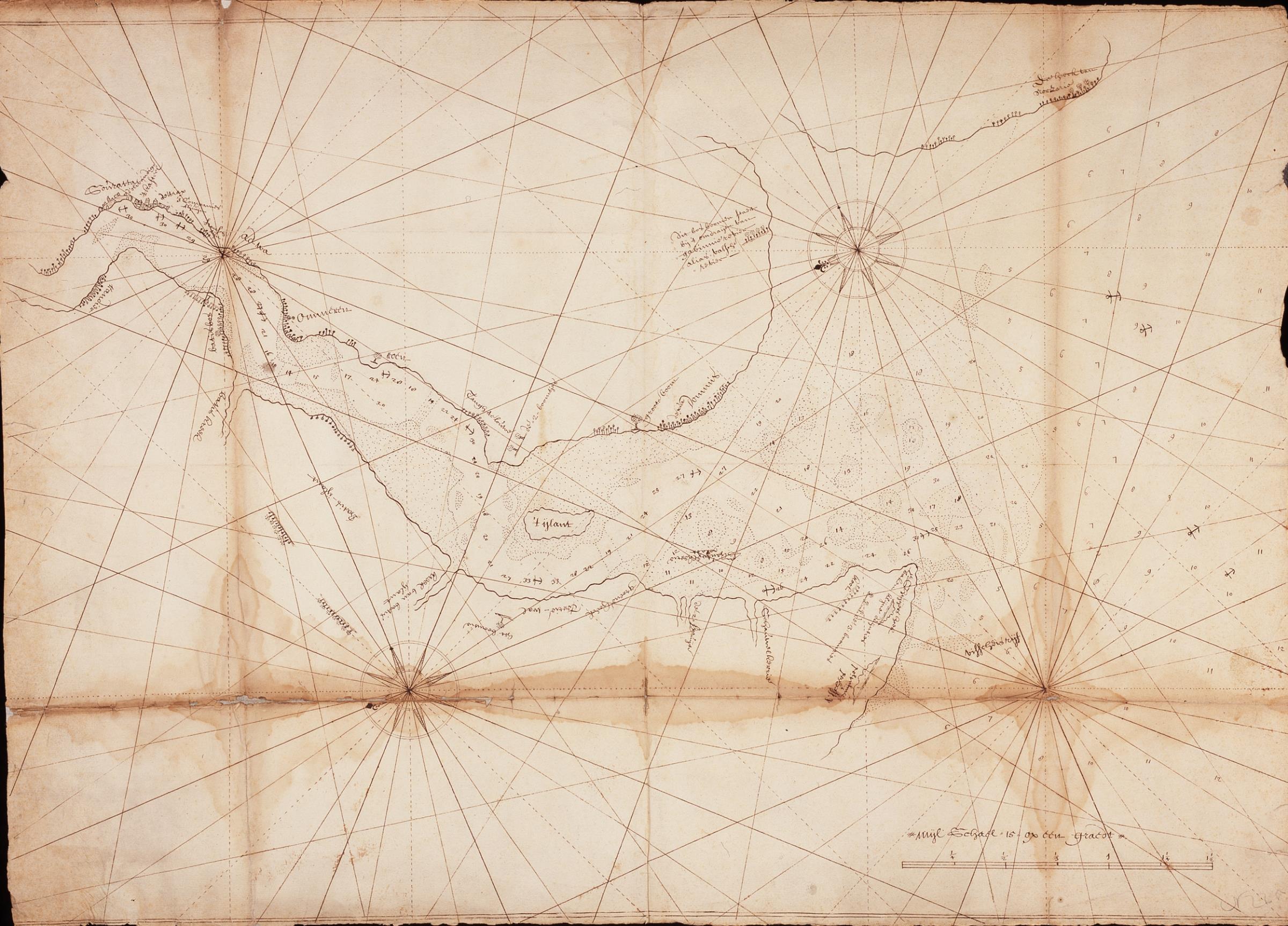
[edit]Nederlands: Kaart van de plaats en rivier Souratte
English: Map of Souratte and Souratte river( |
||||||||||||||||||||||||
|---|---|---|---|---|---|---|---|---|---|---|---|---|---|---|---|---|---|---|---|---|---|---|---|---|
| Author |
Nederlands: Anoniem / Anonymous (landmeter / kaartenmaker)
English: Anoniem / Anonymous (land surveyor / mapmaker) |
|||||||||||||||||||||||
| Title |
Nederlands: Kaart van de plaats en rivier Souratte
English: Map of Souratte and Souratte river |
|||||||||||||||||||||||
| Description |
Nederlands: Titel in catalogus Leupe (Nationaal Archief): Kaart van de Rivier Souratte.
Met bruine vochtplekken. Notities verso: N2 van Soeratte overgekomen 1699-1700 8e boek / 234 [folionummer in de band ?] / 225 [in rood potlood].English: Title in Leupe catalogue (National Archives): Kaart van de Rivier Souratte.
Marked by brown moisture stains. Notes on reverse: N2 van Soeratte overgekomen 1699-1700 8e boek / 234 [folio number in the file ?] / 225 [in red pencil]. |
|||||||||||||||||||||||
| Date | circa 1699 | |||||||||||||||||||||||
| Medium |
Nederlands: pen op papier
English: pen on paper |
|||||||||||||||||||||||
| Dimensions | height: 74 cm (29.1 in); width: 53 cm (20.8 in) | |||||||||||||||||||||||
| Collection |
|
|||||||||||||||||||||||
| Accession number |
NL-HaNA_4.VEL_225 (old number: VEL0225) |
|||||||||||||||||||||||
| Inscriptions |
-
|
|||||||||||||||||||||||
| Notes |
English: Subjects: building, compass / dial, chart / map / plan
Nederlands: Onderwerpen: gebouw, kompas / windroos, plattegrond / kaart
English: Post: this image is related to a VOC trading post called Surat |
|||||||||||||||||||||||
| Source/Photographer |
|
|||||||||||||||||||||||
| Permission (Reusing this file) |
|
|||||||||||||||||||||||

| Object location | | View this and other nearby images on: OpenStreetMap |
|---|
File history
Click on a date/time to view the file as it appeared at that time.
| Date/Time | Thumbnail | Dimensions | User | Comment | |
|---|---|---|---|---|---|
| current | 17:20, 10 June 2014 | | 2,400 × 1,726 (578 KB) | HuskyBot (talk | contribs) | == {{int:filedesc}} == {{Artwork |title = {{nl|1=Kaart van de plaats en rivier Souratte}} {{en|1=Map of Souratte and Souratte river}} |description = {{nl|1=Titel in catalogus Leupe (Nationaal Archief): ''Kaart... |
You cannot overwrite this file.
File usage on Commons
The following page uses this file: