File:AMH-4828-NA Map of Ceylon and the coast of Madure.jpg
Jump to navigation
Jump to search
Size of this preview: 780 × 600 pixels. Other resolutions: 312 × 240 pixels | 625 × 480 pixels | 999 × 768 pixels | 1,280 × 984 pixels | 2,400 × 1,845 pixels.
Original file (2,400 × 1,845 pixels, file size: 804 KB, MIME type: image/jpeg)
Captions
Captions
Add a one-line explanation of what this file represents
Summary
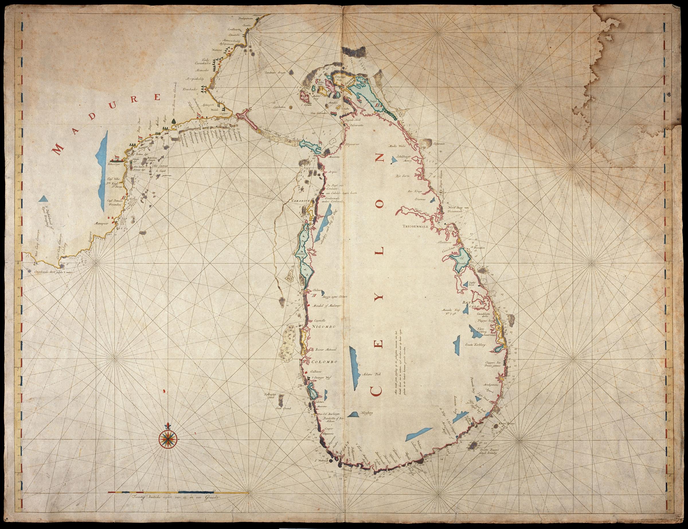
[edit]Nederlands: Kaart van Ceilon en de kust van Madure
English: Map of Ceylon and the coast of Madure( |
||||||||||||||||||||||||
|---|---|---|---|---|---|---|---|---|---|---|---|---|---|---|---|---|---|---|---|---|---|---|---|---|
| Author |
Nederlands: Anoniem / Anonymous (landmeter / kaartenmaker)
English: Anoniem / Anonymous (land surveyor / mapmaker) |
|||||||||||||||||||||||
| Title |
Nederlands: Kaart van Ceilon en de kust van Madure
English: Map of Ceylon and the coast of Madure |
|||||||||||||||||||||||
| Description |
Nederlands: Titel catalogus Leupe (NA): Kaart van het Eiland Ceylon en de Kust van Madure.
Bijzonderheden: de kaart is op blauw papier geplakt. Notities verso: XXXI.English: Title in the Leupe catalogue (NA): Kaart van het Eiland Ceylon en de Kust van Madure.
Pasted on blue paper. Notes on reverse: XXXI. |
|||||||||||||||||||||||
| Date | between 1656 and 1725 | |||||||||||||||||||||||
| Medium |
Nederlands: ingekleurde gravure op papier
English: coloured engraving on paper |
|||||||||||||||||||||||
| Dimensions | height: 105.5 cm (41.5 in); width: 80 cm (31.4 in) | |||||||||||||||||||||||
| Collection |
|
|||||||||||||||||||||||
| Accession number |
NL-HaNA_4.VEL_236 (old number: VEL0236) |
|||||||||||||||||||||||
| Source/Photographer |
|
|||||||||||||||||||||||
| Permission (Reusing this file) |
|
|||||||||||||||||||||||

| Object location | | View this and other nearby images on: OpenStreetMap |
|---|
File history
Click on a date/time to view the file as it appeared at that time.
| Date/Time | Thumbnail | Dimensions | User | Comment | |
|---|---|---|---|---|---|
| current | 17:13, 10 June 2014 | | 2,400 × 1,845 (804 KB) | HuskyBot (talk | contribs) | == {{int:filedesc}} == {{Artwork |title = {{nl|1=Kaart van Ceilon en de kust van Madure}} {{en|1=Map of Ceylon and the coast of Madure}} |description = {{nl|1=Titel catalogus Leupe (NA): ''Kaart van het Eiland... |
You cannot overwrite this file.
File usage on Commons
The following page uses this file: