File:AMH-2507-NA Map of the harbour of the city of Mocha.jpg
Original file (2,400 × 1,888 pixels, file size: 652 KB, MIME type: image/jpeg)
Captions
Captions
Summary
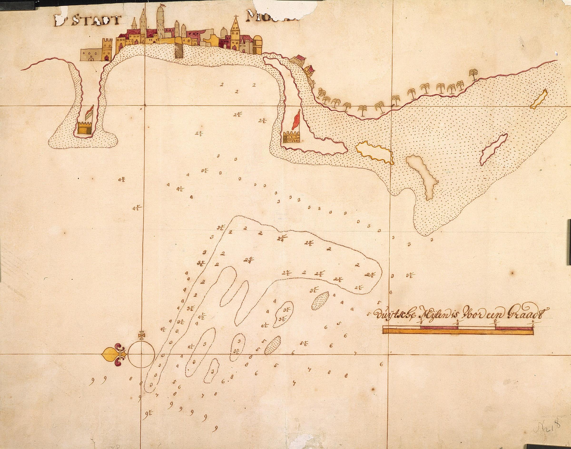
[edit]| Nederlands: Kaart van de rede voor de stad Mocha
English: Map of the harbour of the city of Mocha Bahasa Indonesia: Peta pelabuhan kota Mocha( |
||||||||||||||||||||||||
|---|---|---|---|---|---|---|---|---|---|---|---|---|---|---|---|---|---|---|---|---|---|---|---|---|
| Author |
Nederlands: Anoniem / Anonymous
English: Anoniem / Anonymous |
|||||||||||||||||||||||
| Title |
Nederlands: Kaart van de rede voor de stad Mocha
English: Map of the harbour of the city of Mocha
Bahasa Indonesia: Peta pelabuhan kota Mocha |
|||||||||||||||||||||||
| Description |
Nederlands: Titel catalogus Leupe (NA): Kaart van de Reede voor de Stad Mocha, met een gezigt op de Stad.
Geschenk van het gemeentebestuur Rotterdam, waarschijnlijk in 1866. Notitie op kaart: vgl. missieve minister BiZa d.d. 5-2-1866 nr. 277 3e afd. ingekomen nr. 28.English: According to the Leupe (NA) catalogue, the original title reads: Kaart van de Reede voor de Stad Mocha, met een gezigt op de Stad.
Gift of the Rotterdam municipal executive, probably in 1866. Note on map: vgl. missieve minister BiZa d.d. 5-2-1866 nr. 277 3e afd. ingekomen nr. 28.Bahasa Indonesia: Menurut katalog Leupe (AN), judul aslinya yaitu: Kaart van de Reede voor de Stad Mocha, met een gezigt op de Stad.
Hadiah dari eksekutif kota Rotterdam, mungkin pada tahun 1866. Catatan pada peta: vgl. missieve minister BiZa d.d. 5-2-1866 nr. 277 3e afd. ingekomen nr. 28. |
|||||||||||||||||||||||
| Date | between 1600 and 1700 | |||||||||||||||||||||||
| Medium |
Nederlands: ingekleurde tekening op papier
English: coloured drawing on paper
Bahasa Indonesia: gambar berwarna di atas kertas |
|||||||||||||||||||||||
| Dimensions | height: 530 mm (20.86 in); width: 420 mm (16.53 in) | |||||||||||||||||||||||
| Collection |
|
|||||||||||||||||||||||
| Accession number |
NL-HaNA_4.VEL_218 (old number: VEL0218) |
|||||||||||||||||||||||
| Inscriptions |
De stadt Mo[...]
|
|||||||||||||||||||||||
| Notes |
English: Subjects: survey / view, fortification, anchorage / pier / harbour, compass / dial, building
Nederlands: Onderwerpen: overzicht / aanzicht, vesting, rede / haven / pier, kompas / windroos, gebouw
English: Post: this image is related to a VOC trading post called Al Mukha |
|||||||||||||||||||||||
| Source/Photographer |
|
|||||||||||||||||||||||
| Permission (Reusing this file) |
|
|||||||||||||||||||||||

| Object location | | View this and other nearby images on: OpenStreetMap |
|---|
File history
Click on a date/time to view the file as it appeared at that time.
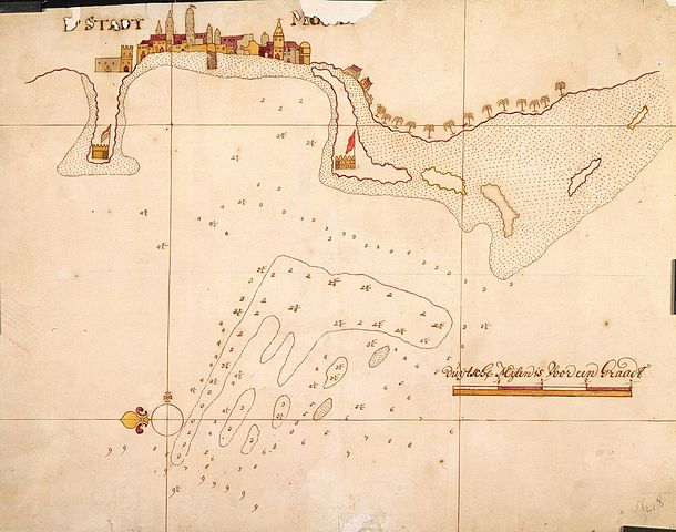
| Date/Time | Thumbnail | Dimensions | User | Comment | |
|---|---|---|---|---|---|
| current | 15:48, 10 June 2014 | | 2,400 × 1,888 (652 KB) | HuskyBot (talk | contribs) | == {{int:filedesc}} == {{Artwork |title = {{nl|1=Kaart van de rede voor de stad Mocha}} {{en|1=Map of the harbour of the city of Mocha}} |description = {{nl|1=Titel catalogus Leupe (NA): ''Kaart van de Reede vo... |
You cannot overwrite this file.
File usage on Commons
The following page uses this file:
File usage on other wikis
The following other wikis use this file:
- Usage on nl.wikipedia.org