File:ALMap-doton-BayouLaBatre.PNG
Jump to navigation
Jump to search
No higher resolution available.
ALMap-doton-BayouLaBatre.PNG (193 × 300 pixels, file size: 13 KB, MIME type: image/png)
Captions
Captions
Add a one-line explanation of what this file represents
Summary
[edit]

|
This locator map image could be re-created using vector graphics as an SVG file. This has several advantages; see Commons:Media for cleanup for more information. If an SVG form of this image is available, please upload it and afterwards replace this template with
{{vector version available|new image name}}.
It is recommended to name the SVG file “ALMap-doton-BayouLaBatre.svg”—then the template Vector version available (or Vva) does not need the new image name parameter. |
| Description |
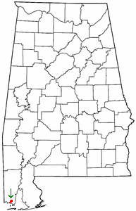
English: BayouLaBatre. |
| Date | 28 March 2004 (original upload date) |
| Source |
|
| Author |
The original uploader was Seth Ilys at English Wikipedia. Later versions were uploaded by Wikid77 at en.wikipedia. |
Licensing
[edit]
| This file is licensed under the Creative Commons Attribution-Share Alike 3.0 Unported license. Subject to disclaimers. | ||
| ||
| This licensing tag was added to this file as part of the GFDL licensing update. |

|
Permission is granted to copy, distribute and/or modify this document under the terms of the GNU Free Documentation License, Version 1.2 or any later version published by the Free Software Foundation; with no Invariant Sections, no Front-Cover Texts, and no Back-Cover Texts. A copy of the license is included in the section entitled GNU Free Documentation License. Subject to disclaimers. |
Original upload log
[edit]
(All user names refer to en.wikipedia)
- 2006-09-06 06:27 Wikid77 193×300×8 (13432 bytes) Location of Bayou La Batre (at arrow) "Seafood Capital of Alabama" on Gulf of Mexico. Edited to show city touches coastline (since bayou runs through town center and out into Gulf). Arrow added, independent of color.
- 2004-03-28 00:23 Seth Ilys 193×300×8 (13424 bytes) {{msg:GFDL}}<br>Adapted from Wikipedia's AL county maps by Seth Ilys.
File history
Click on a date/time to view the file as it appeared at that time.
| Date/Time | Thumbnail | Dimensions | User | Comment | |
|---|---|---|---|---|---|
| current | 15:26, 22 June 2007 | | 193 × 300 (13 KB) | SieBot (talk | contribs) | {{BotMoveToCommons|en.wikipedia}} {{Information |Description=<br>Adapted from Wikipedia's AL county maps by Seth Ilys. |Source=Originally from [http://en.wikipedia.org en.wikipedia]; description page is/was [http://en.wikipedia.org/w/index.php?title=Ima |
You cannot overwrite this file.
File usage on Commons
There are no pages that use this file.
File usage on other wikis
The following other wikis use this file:
- Usage on io.wikipedia.org