File:AB ND14 Quercus3.jpg
Original file (2,510 × 2,700 pixels, file size: 9.21 MB, MIME type: image/jpeg)
Captions
Summary
[edit]DescriptionAB ND14 Quercus3.jpg |
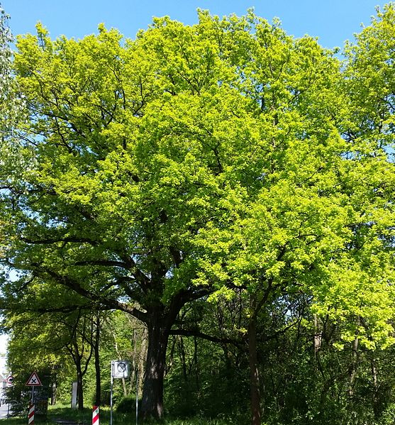
Deutsch: Naturdenkmal Aschaffenburg Nr. 14 (ND-06042), Baum 3 gemäß Verordnung der Stadt Aschaffenburg über den Schutz der "4 Stieleichen in der Deutschen Straße" in Aschaffenburg als Naturdenkmal vom 31.03.1992, 4 Stieleichen (Quercus robur)
English: Natural Monument Aschaffenburg No. 14 (ND-06042), tree 3 according to decree by the city of Aschaffenburg from 31.03.1992, 4 oaks (Quercus robur) |
Date | |
Source | Own work |
Author | KaiBorgeest |
Camera location | 49° 58′ 47.86″ N, 9° 09′ 40.53″ E | View this and other nearby images on: OpenStreetMap | 49.979961; 9.161258 |
---|
Licensing
[edit]- You are free:
- to share – to copy, distribute and transmit the work
- to remix – to adapt the work
- Under the following conditions:
- attribution – You must give appropriate credit, provide a link to the license, and indicate if changes were made. You may do so in any reasonable manner, but not in any way that suggests the licensor endorses you or your use.
- share alike – If you remix, transform, or build upon the material, you must distribute your contributions under the same or compatible license as the original.
This image was uploaded as part of Wiki Loves Earth 2016.
aragonés | العربية | asturianu | azərbaycanca | беларуская (тарашкевіца) | български | বাংলা | brezhoneg | català | čeština | Cymraeg | Deutsch | Ελληνικά | English | español | eesti | euskara | فارسی | français | galego | עברית | hrvatski | հայերեն | Bahasa Indonesia | italiano | 日本語 | ქართული | 한국어 | latviešu | македонски | മലയാളം | मराठी | Bahasa Melayu | norsk bokmål | नेपाली | Nederlands | norsk | polski | português | português do Brasil | русский | sicilianu | shqip | slovenščina | српски / srpski | svenska | ไทย | Türkçe | українська | اردو | 中文 | 中文(台灣) | +/− |
File history
Click on a date/time to view the file as it appeared at that time.
Date/Time | Thumbnail | Dimensions | User | Comment | |
---|---|---|---|---|---|
current | 20:31, 6 May 2016 | 2,510 × 2,700 (9.21 MB) | KaiBorgeest (talk | contribs) | VicuñaUploader 1.23 |
You cannot overwrite this file.
File usage on Commons
The following 2 pages use this file:
Metadata
This file contains additional information such as Exif metadata which may have been added by the digital camera, scanner, or software program used to create or digitize it. If the file has been modified from its original state, some details such as the timestamp may not fully reflect those of the original file. The timestamp is only as accurate as the clock in the camera, and it may be completely wrong.
Camera manufacturer | samsung |
---|---|
Camera model | SM-G900F |
Exposure time | 1/332 sec (0.0030120481927711) |
F-number | f/2.2 |
ISO speed rating | 40 |
Date and time of data generation | 14:56, 5 May 2016 |
Lens focal length | 4.8 mm |
User comments | JKJK'«\ˆ÷ùG?«ka˜ZŒ@£¤£œ‹„ÿÿ^ðÿÿ¾Âÿÿp5Ò¸ºAÿÿŽ·ˆˆ2w2w2w"w2w2w2w2w2w2w2w2w2wˆˆˆ"w2w2w2w2w2w2w2w2w2w2w2w2wˆˆˆˆ2w2w2w2w2w2w2w2w2w2w2w2wˆˆˆ2w2w2w2w2w2w2w2w2w2w2w2w2wˆˆˆ2w2w2w2w2w2w2w2w"w2w2w2w2wˆˆˆ2w2w2w2w2w2w2w2w2w2w2w2w2wˆˆˆ2w2w2w2w2w2w2w2w2w2w2w2w2wˆˆ2w2w2w2w2w2w2w2w2w2w2w2w2wˆˆˆ2w2w2w2w2w2w2w2w2w2w2w2w2wˆˆˆ2w2w2w2w2w2w2w"w2w2w2w2w2wˆˆˆ2w2w2w2w2w2w"w"w2w2w2w2w2wˆˆˆ2w2w2w2w2w2w2w"w2w2w1"2w1"ˆˆˆ2w2w2w"w2w2w2w2w2w2w2wBwBwˆˆˆ"w2w2w2w2w"w2w2w2w2w2w2w1"ˆˆˆ2w2w"w"w2w2w2w2w2w2w2w1"ˆˆˆ!"2w2w2w"w"w2wˆ"w"!"0h”õt2¦þÿ’‡>uAtp…溤 °AŒüÿ9£Œüÿ9£Œüÿ9£Œüÿ9£Œüÿ9£ö6Eø[FAFA‘´0wðFAFAeû.xfá#ÔW'6zÍl¼Sï¬*8SrÆIú.TiŸxMw»,×(~}Á¿/€†ÜwâR¿/€†ÜwâR¿/€†ÜwâR¿/€†ÜwâR¿/€†ÜwâR¿/€†ÜwâR¿/€†ÜwâR¿/€†ÜwâR¿/€†ÜwâR¿/€†ÜwâR¿/€†ÜwâR¿/€†ÜwâR¿/€†ÜFAFA§ rÝ”˜Ù~EˆFY w.a3ZPwsçwÿFAFA®®®®Fa§˜ »´ b &;L<˜0xæÏÿÿÿ(LaªP02011165F16QLGB00GB51FFEFDDFA4 |
Latitude | 49° 58′ 47.86″ N |
Longitude | 9° 9′ 40.53″ E |
Altitude | 196 meters above sea level |
Orientation | Normal |
Horizontal resolution | 72 dpi |
Vertical resolution | 72 dpi |
Software used | GIMP 2.8.16 |
File change date and time | 22:25, 6 May 2016 |
Y and C positioning | Centered |
Exposure Program | Normal program |
Exif version | 2.2 |
Date and time of digitizing | 14:56, 5 May 2016 |
Meaning of each component |
|
APEX shutter speed | 8.37 |
APEX aperture | 2.27 |
APEX brightness | 7.03 |
APEX exposure bias | 0 |
Maximum land aperture | 2.28 APEX (f/2.2) |
Metering mode | Center weighted average |
Light source | Unknown |
Flash | Flash did not fire |
DateTime subseconds | 842 |
DateTimeOriginal subseconds | 842 |
DateTimeDigitized subseconds | 842 |
Supported Flashpix version | 1 |
Color space | sRGB |
Sensing method | One-chip color area sensor |
Scene type | A directly photographed image |
Exposure mode | Auto exposure |
White balance | Auto white balance |
Focal length in 35 mm film | 31 mm |
Scene capture type | Standard |
Unique image ID | F16QLHF01GB |
GPS time (atomic clock) | 12:55 |
GPS date | 5 May 2016 |
GPS tag version | 0.0.2.2 |
Structured data
Items portrayed in this file
depicts
49°58'47.860"N, 9°9'40.529"E
5 May 2016
image/jpeg
08951fbb5e36a7e5d0f6f532eab9651b84e54b70
9,659,550 byte
2,700 pixel
2,510 pixel
- Files with coordinates missing SDC location of creation (49° N, 9° E)
- CC-BY-SA-4.0
- Self-published work
- Images from Wiki Loves Earth 2016
- Images from Wiki Loves Earth 2016 in Germany
- Images from Wiki Loves Earth missing SDC depicts
- Images from Wiki Loves Earth missing SDC location of creation
- Images from Wiki Loves Earth 2016, DE-BY
- Uploaded with VicuñaUploader
- Uploaded via Campaign:wle-de-by
- Germany photographs taken on 2016-05-05
- Pages with maps