File:A919-map.png
Jump to navigation
Jump to search

Size of this preview: 742 × 600 pixels. Other resolutions: 297 × 240 pixels | 594 × 480 pixels | 950 × 768 pixels | 1,267 × 1,024 pixels | 2,000 × 1,617 pixels.
Original file (2,000 × 1,617 pixels, file size: 841 KB, MIME type: image/png)
Captions
Captions
Add a one-line explanation of what this file represents
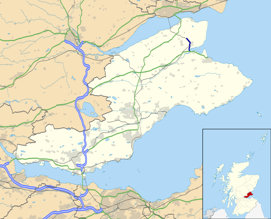
| Description | A919 road map |
| Date | 16.8.14 |
| Source |
|
| Author | Eschenmoser |
| Permission (Reusing this file) |
This file is licensed under the Creative Commons Attribution-Share Alike 3.0 Unported license. Attribution: Contains Ordnance Survey data © Crown copyright and database right
|
File history
Click on a date/time to view the file as it appeared at that time.
| Date/Time | Thumbnail | Dimensions | User | Comment | |
|---|---|---|---|---|---|
| current | 21:26, 16 August 2014 | | 2,000 × 1,617 (841 KB) | Eschenmoser (talk | contribs) | {{Information |Description=A919 road map |Source=* own work derived from File:Fife UK location map.svg originally uploaded by User:Nilfanion, created using Ordnance Survey data *Ordnance Survey [https://www.ordnancesurvey... |
You cannot overwrite this file.
File usage on Commons
The following page uses this file:
File usage on other wikis
The following other wikis use this file: