File:A4050 at Wenvoe.jpg
Jump to navigation
Jump to search
No higher resolution available.
A4050_at_Wenvoe.jpg (640 × 445 pixels, file size: 107 KB, MIME type: image/jpeg)
Captions
Captions
Add a one-line explanation of what this file represents
Summary
[edit]
| Description |
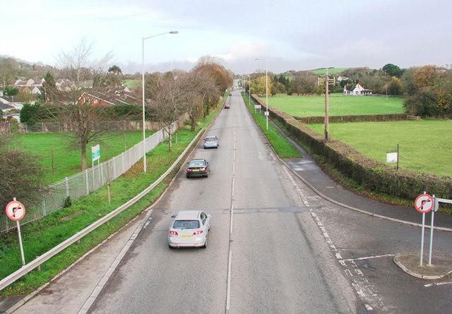
English: A4050 at Wenvoe Photo taken from the footbridge on a Sunday morning. On weekdays it's nose to tail in both directions |
| Date | |
| Source | From geograph.org.uk |
| Author | Tony Hodge |
| Camera location | | View this and other nearby images on: OpenStreetMap |
|---|
Licensing
[edit]

|
This image was taken from the Geograph project collection. See this photograph's page on the Geograph website for the photographer's contact details. The copyright on this image is owned by Tony Hodge and is licensed for reuse under the Creative Commons Attribution-ShareAlike 2.0 license.
|
This file is licensed under the Creative Commons Attribution-Share Alike 2.0 Generic license.
Attribution: Tony Hodge
- You are free:
- to share – to copy, distribute and transmit the work
- to remix – to adapt the work
- Under the following conditions:
- attribution – You must give appropriate credit, provide a link to the license, and indicate if changes were made. You may do so in any reasonable manner, but not in any way that suggests the licensor endorses you or your use.
- share alike – If you remix, transform, or build upon the material, you must distribute your contributions under the same or compatible license as the original.
File history
Click on a date/time to view the file as it appeared at that time.
| Date/Time | Thumbnail | Dimensions | User | Comment | |
|---|---|---|---|---|---|
| current | 13:04, 22 April 2008 | | 640 × 445 (107 KB) | Seth Whales (talk | contribs) | {{Information |Description= The A4050 road at Wenvoe, Vale of Glamorgan, Wales |Source= Geograph British Isles [http://www.geograph.org.uk/photo/288561 Original image] |Date= 2 December 2006 |Author= Tony Hodge (nickname: Zebraman) [http://www.geograph.o |
You cannot overwrite this file.
File usage on Commons
The following page uses this file:
File usage on other wikis
The following other wikis use this file:
- Usage on cy.wikipedia.org
- Usage on en.wikipedia.org
- Usage on www.wikidata.org