File:9395Poblacion, Lingayen, Pangasinan 16.jpg
Jump to navigation
Jump to search

Size of this preview: 800 × 600 pixels. Other resolutions: 320 × 240 pixels | 640 × 480 pixels | 1,024 × 768 pixels | 1,280 × 960 pixels | 2,560 × 1,920 pixels | 4,608 × 3,456 pixels.
Original file (4,608 × 3,456 pixels, file size: 6.43 MB, MIME type: image/jpeg)
Captions
Captions
Poblacion, Lingayen, Pangasinan
Summary
[edit]
| Description |
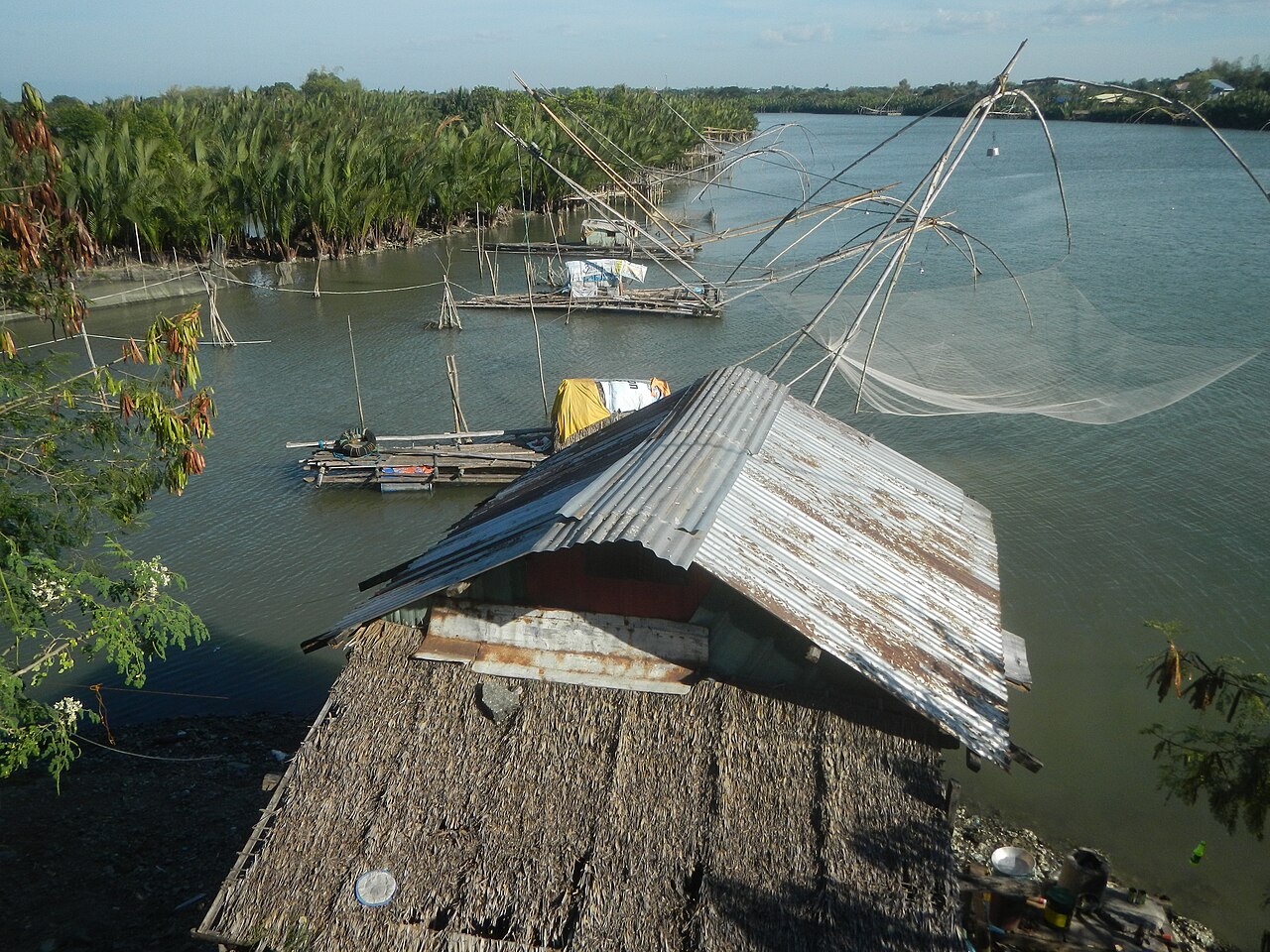
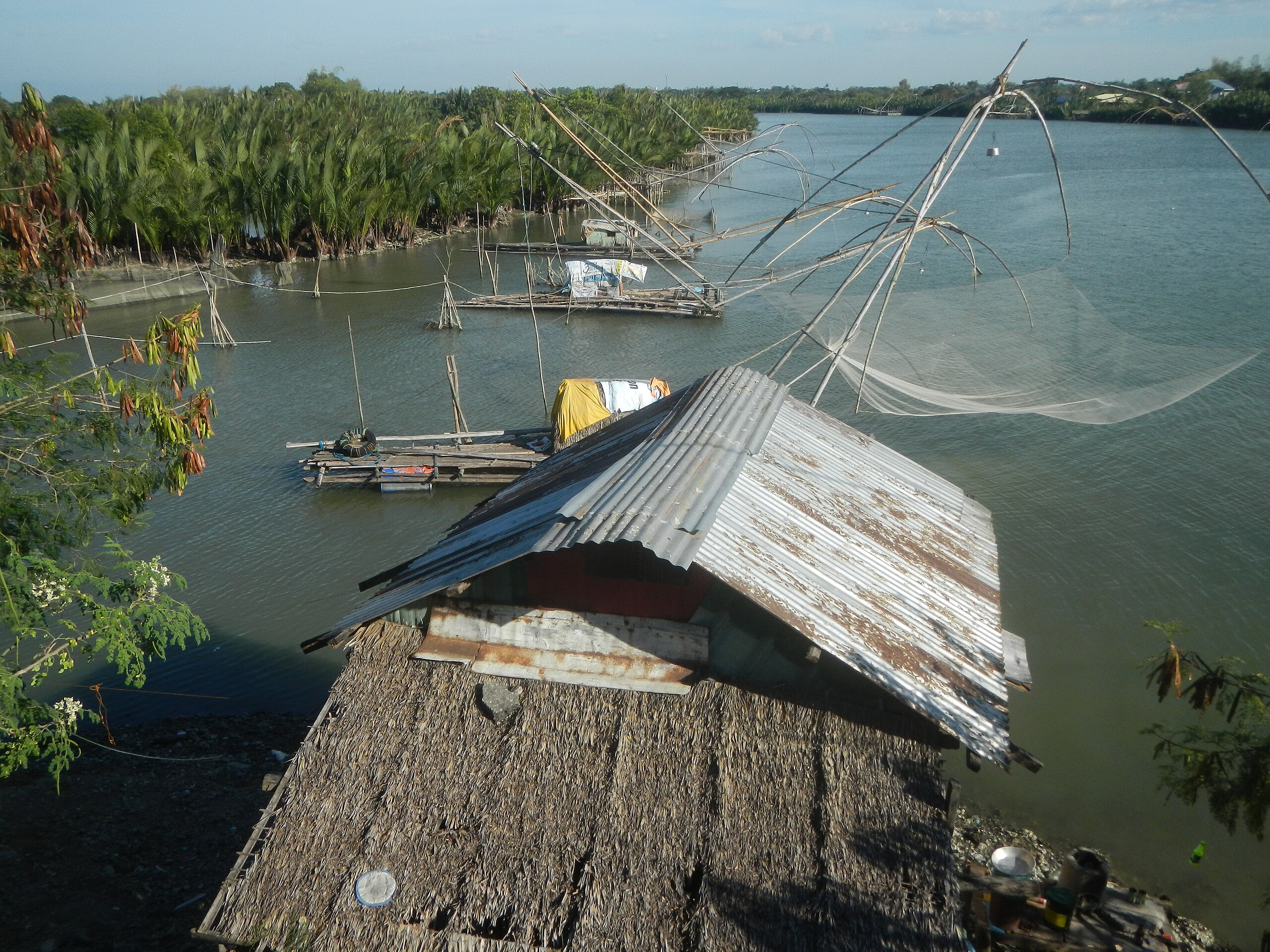
English: San Jose Bridge Lingayen Lingayen Gulf Binmaley-Lingayen Road (Lingayen) of Dagupan-Binmaley-Lingayen Highway of Pangasinan-Zambales Road to Nansangan-Matalava Lingayen Road San Jose Bridge Lingayen KM 362+317 20 tons load limit Salambao fishing boats Jesus Nazarene General Hospital Lingayen Town Proper Poblacion, Lingayen, Pangasinan CSI Lingayen Solis Street Municipal Social Welfare and Development Office Lingayen Lingayen Fire Station Lingayen District Hospital (Don Mariano C. Verzosa Memorial Hospital) The Lingayen Port Pala-Pala Seafoods Restaurant Lingayen Municipal Fish Port of the Ginintuang Masaganang Ani Project March 6, 2009 Binmaley-Lingayen Road (Lingayen) Quibaol, Lingayen, Pangasinan Fish ponds in Lingayen, Pangasinan Singit Bridge KM 363+337 15 tons load limit Lingayen Gulf Baay, Lingayen, Pangasinan Binmaley-Lingayen Road (Lingayen) of Dagupan-Binmaley-Lingayen Highway of Pangasinan-Zambales Road to Nansangaan-Matalava Lingayen Road Agno River Basin Category:Sitios and puroks of the Philippines Subdivisions of the Philippines List of barangays in Pangasinan, Barangays of Pangasinan, Barangays Baay, Lingayen, Pangasinan 16.0175, 120.2279 Poblacion, Lingayen, Pangasinan 16.0277, 120.2330 Lingayen Pangasinan Province bounded by Category:Sitios and puroks of the Philippines Subdivisions of the Philippines List of barangays in Pangasinan, Barangays of Pangasinan, Barangay Lomboy, Binmaley, Pangasinan 16.0146, 120.2664 to Biec, Binmaley, Pangasinan 16.0198, 120.2782 Binmaley, Pangasinan along Binmaley-Lingayen Road from Dagupan-Binmaley Road 16°1'15"N 120°19'22"E Pangasinan-Zambales road Daang Kalikasan (Nature's Highway) surrounded by the Agno Valley of Agno River along Lingayen Gulf from or along Urdaneta Junction-Dagupan-Lingayen Road MacArthur Highway or Manila North Road) surrounded by the Agno Valley of Agno River Philippine highway network (Note: Judge Florentino Floro, the owner, to repeat, Donor Florentino Floro of all these photos hereby donate gratuitously, freely and unconditionally Judge Floro all these photos to and for Wikimedia Commons, exclusively, for public use of the public domain, and again without any condition whatsoever). |
| Date | |
| Source | Own work |
| Author | Judgefloro |
| Camera location | | View this and other nearby images on: OpenStreetMap |
|---|
Poblacion, Lingayen, Pangasinan 16.0277, 120.2330
Licensing
[edit]
I, the copyright holder of this work, hereby publish it under the following license:
| This file is made available under the Creative Commons CC0 1.0 Universal Public Domain Dedication. | |
| The person who associated a work with this deed has dedicated the work to the public domain by waiving all of their rights to the work worldwide under copyright law, including all related and neighboring rights, to the extent allowed by law. You can copy, modify, distribute and perform the work, even for commercial purposes, all without asking permission.
|
File history
Click on a date/time to view the file as it appeared at that time.
| Date/Time | Thumbnail | Dimensions | User | Comment | |
|---|---|---|---|---|---|
| current | 10:47, 18 December 2019 | | 4,608 × 3,456 (6.43 MB) | Judgefloro (talk | contribs) | User created page with UploadWizard |
You cannot overwrite this file.
File usage on Commons
There are no pages that use this file.