File:7 - Watten — La Tour. vº.jpg
Jump to navigation
Jump to search
Size of this preview: 391 × 599 pixels. Other resolutions: 156 × 240 pixels | 313 × 480 pixels | 501 × 768 pixels | 668 × 1,024 pixels | 2,090 × 3,204 pixels.
Original file (2,090 × 3,204 pixels, file size: 4.03 MB, MIME type: image/jpeg)
Captions
Captions
Add a one-line explanation of what this file represents
Summary
[edit]
| Description |
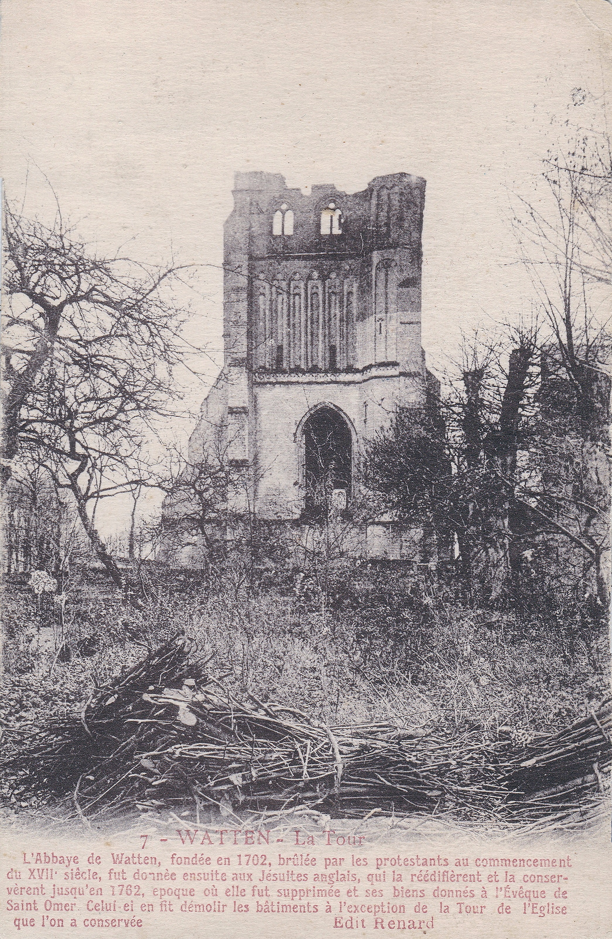
Français : Watten (France - département du Nord) - La tour de l'ancienne abbaye.
Texte côté illustration : L'abbaye de Watten fondée en 1702, brûlée par les protestants au commencement du XVIIe siècle, fut donnée ensuite aux jésuites anglais qui l'a réédifièrent et la conservèrent jusqu'en 1782, époque où elle fut supprimée* et ses biens donnés à l'évêque de Saint-Omer Celui-ci fit démolir les bâtiments à l'exception de la tour de l'église que l'on a conservée. * Expulsion des Jésuites et bannissement en 1763 Nederlands: Abdij van Waten (Watten) Frankrijk - Noorderdepartement De Abdij van Waten (Notre Dame du Mont of Onze-Lieve-Vrouw ten Berg) was een augustijner abdij in het Noord-Franse Waten (Watten). Zij werd op last van de bisschop van Sint-Omaars (Saint Omer) afgebroken in 1769 en verkocht tijdens de Franse Revolutie (1789). Enkel de toren bleef behouden als baken voor de zeevaarders. |
| Date | circa 1924 |
| Source | Collection personnelle |
| Author |
Lucien Pollet*, Éditeur à Lille - Réédition : Édition Renard.
|
|
This building is classé au titre des monuments historiques de la France. It is indexed in the base Mérimée, a database of architectural heritage maintained by the French Ministry of Culture, under the reference PA00107889
|
| Camera location | | View this and other nearby images on: OpenStreetMap |
|---|
Licensing
[edit]
|
This work is in the public domain in its country of origin and other countries and areas where the copyright term is the author's life plus 70 years or fewer. This work is in the public domain in the United States because it was published (or registered with the U.S. Copyright Office) before January 1, 1929. | |
| This file has been identified as being free of known restrictions under copyright law, including all related and neighboring rights. | |
File history
Click on a date/time to view the file as it appeared at that time.
| Date/Time | Thumbnail | Dimensions | User | Comment | |
|---|---|---|---|---|---|
| current | 20:54, 25 December 2021 | | 2,090 × 3,204 (4.03 MB) | Jpcuvelier (talk | contribs) | Uploaded a work by Lucien Pollet*, Éditeur à Lille - Réédition : Édition Renard. * indiqué côté correspondance / Indicated on the correspondence side from Collection personnelle with UploadWizard |
You cannot overwrite this file.
File usage on Commons
There are no pages that use this file.