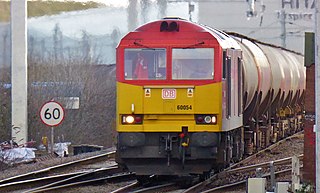
File:60054 Theale Murco to Robeston Sidings - 25417192297.jpg

Original file (4,848 × 2,928 pixels, file size: 6.56 MB, MIME type: image/jpeg)
Captions
Captions
Summary
[edit]
| Description |
English: According to Realtime Trains the route and timings were;
Theale Murco.........................1300............1300.........................RT Southcote Junction...............1344.............1343...........................1E Oxford Road Junction..........1346.............1345...........................1E Reading West Junction........1350............1348..........................2E Goring & Streatley ................1359 1/2......1357 1/2....................2E Moreton Cutting.....................1408............1407 3/4..................RT Didcot East Junction.............1410.............1411 3/4......................1L Didcot Parkway [DID]............1411...............1412 3/4.....................1L Foxhall Junction.....................1415..............1414..........................RT Milton Junction.......................1418/1428...NoRep/1429 1/2......1L Steventon................................1431..............1432...........................1L Wantage Road........................1438.............1436 1/4.....................1E Challow....................................1442/1448..NoRep/1449.............1L Uffington (Oxfordshire)..........1453.............1452...........................1E Swindon [SWI].........................1521.............1517...........................4E Wootton Bassett Jn...............1529............1530...........................1L Hullavington............................1540............1542..........................2L Westerleigh Junction............1556............1556.........................RT Bristol Parkway [BPW]..........1602/1615...1602/1615...............RT Patchway [PWY].....................1620............1619 3/4...................RT Pilning [PIL]..............................1626............1625.........................RT Severn Tunnel East...............1627.............1634..........................7L Severn Tunnel West.............1632.............1640 1/2...................8L Severn Tunnel Jn ..................1633.............1642 1/4....................9L Llanwern West Junction......1645............1653..........................8L Maindee West Junction.......1649............1657 1/4....................8L Newport [NWP].......................1651.............1658 3/4...................7L Marshfield................................1748.............1707........................41E Cardiff Central [CDF].............1756 1/2......1715 1/2...................41E Pontyclun [PYC].....................1810.............1729........................41E Bridgend [BGN]......................1820............1739........................41E Stormy......................................1825............1744........................41E Margam Moors Junction......1830............1755.......................35E Margam T.C.............................1835/1905..1803/1835.............30E Port Talbot Parkway .............1910.............1906 1/2...................3E Briton Ferry [BNF]..................1914..............1912 1/4......................1E Neath [NTH]............................1916.............1919 1/2....................3L Swansea Loop West.............1927.............1933..........................6L Llandeilo Junction.................1943.............1945..........................2L Llanelli [LLE]............................1945............1946 3/4....................1L Ferryside [FYS].......................2001............2001........................RT Carmarthen Junction[XCI]...2013............2010.........................3E Whitland [WTL].......................2031............2026........................5E |
| Date | |
| Source | https://www.flickr.com/photos/99279135@N05/25417192297/ |
| Author | train_photos |
| Camera location | | View this and other nearby images on: OpenStreetMap |
|---|
Licensing
[edit]
- You are free:
- to share – to copy, distribute and transmit the work
- to remix – to adapt the work
- Under the following conditions:
- attribution – You must give appropriate credit, provide a link to the license, and indicate if changes were made. You may do so in any reasonable manner, but not in any way that suggests the licensor endorses you or your use.
- share alike – If you remix, transform, or build upon the material, you must distribute your contributions under the same or compatible license as the original.
| This image was originally posted to Flickr by train_photos at https://flickr.com/photos/99279135@N05/25417192297. It was reviewed on 16 June 2021 by FlickreviewR 2 and was confirmed to be licensed under the terms of the cc-by-sa-2.0. |
File history
Click on a date/time to view the file as it appeared at that time.
| Date/Time | Thumbnail | Dimensions | User | Comment | |
|---|---|---|---|---|---|
| current | 17:39, 16 June 2021 | | 4,848 × 2,928 (6.56 MB) | Oxyman (talk | contribs) | Uploaded a work by train_photos from https://www.flickr.com/photos/99279135@N05/25417192297/ with UploadWizard |
You cannot overwrite this file.
File usage on Commons
The following page uses this file: