File:6-E 2010 track.jpg
Jump to navigation
Jump to search
Size of this preview: 800 × 498 pixels. Other resolutions: 320 × 199 pixels | 640 × 399 pixels | 1,024 × 638 pixels | 1,280 × 798 pixels | 2,600 × 1,620 pixels.
Original file (2,600 × 1,620 pixels, file size: 233 KB, MIME type: image/jpeg)
Captions
Captions
Add a one-line explanation of what this file represents
Summary
| Description |
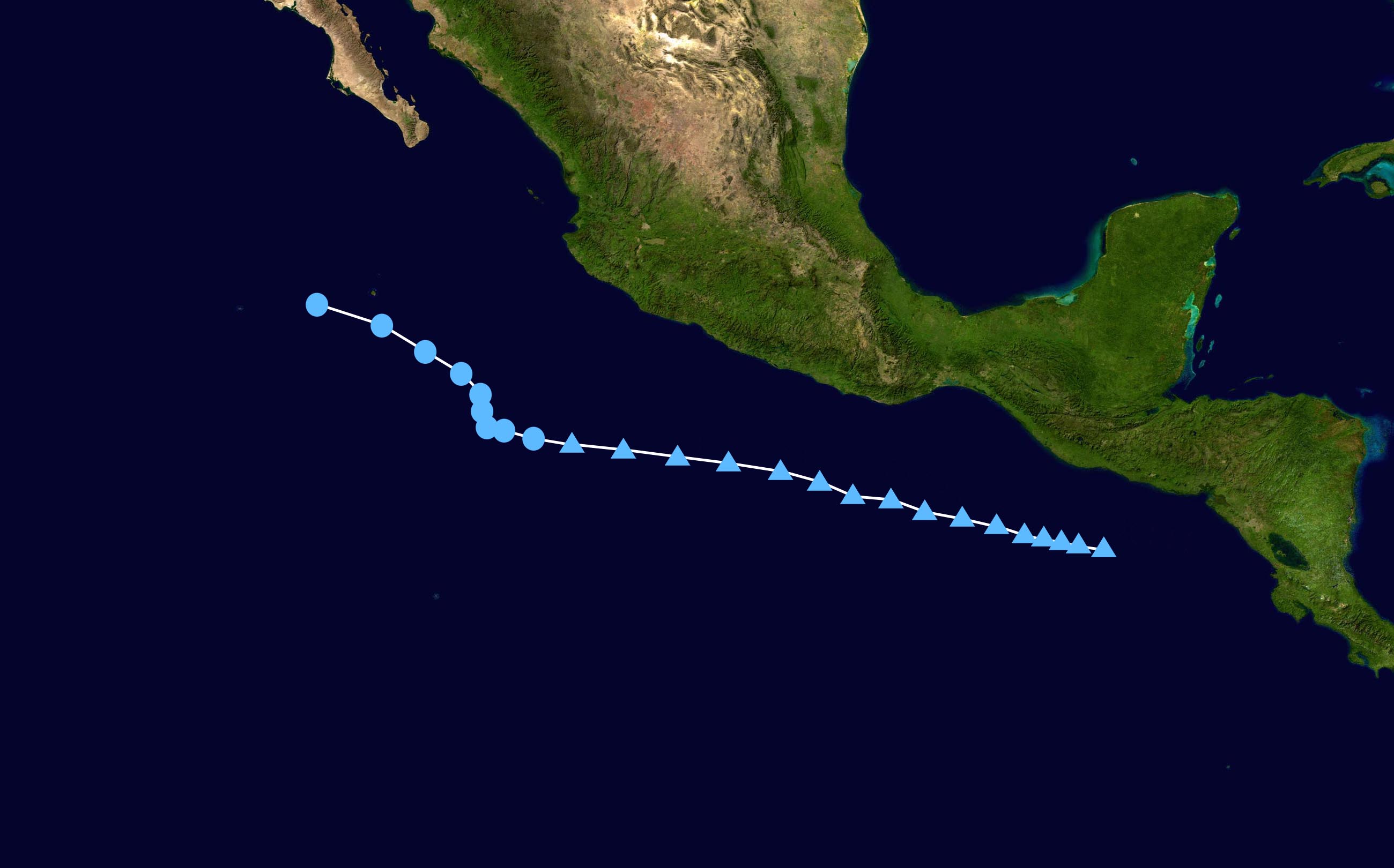
English: Track map of Tropical Depression Six-E (2010) of the 2010 Pacific hurricane season. The points show the location of the storm at 6-hour intervals. The colour represents the storm's maximum sustained wind speeds as classified in the (see below), and the shape of the data points represent the nature of the storm, according to the legend below. Tropical depression (≤38 mph, ≤62 km/h)
Tropical storm (39–73 mph, 63–118 km/h)
Category 1 (74–95 mph, 119–153 km/h)
Category 2 (96–110 mph, 154–177 km/h)
Category 3 (111–129 mph, 178–208 km/h)
Category 4 (130–156 mph, 209–251 km/h)
Category 5 (≥157 mph, ≥252 km/h)
Unknown
Storm type |
| Date | 2010-07-20–2010-07-20 |
| Source | Created by Supportstorm using Wikipedia:WikiProject Tropical cyclones/Tracks. The background image is from NASA. Tracking data is from from the National Hurricane Center's running best track.[1]. |
| Author | Supportstorm |
Licensing
[edit]| This work has been released into the public domain by its author, Supportstorm. This applies worldwide. In some countries this may not be legally possible; if so: Supportstorm grants anyone the right to use this work for any purpose, without any conditions, unless such conditions are required by law. |
File history
Click on a date/time to view the file as it appeared at that time.
| Date/Time | Thumbnail | Dimensions | User | Comment | |
|---|---|---|---|---|---|
| current | 04:18, 21 July 2010 | | 2,600 × 1,620 (233 KB) | Supportstorm (talk | contribs) | {{Information |Description={{en|1=Track map of Tropical Depression Six-E of the 2010 Pacific hurricane season. The points show the location of the storm at 6-hour intervals. The colour represents the storm's [[:w:maximu |
You cannot overwrite this file.
File usage on Commons
There are no pages that use this file.