File:52438cameramap.jpg
Jump to navigation
Jump to search

Size of this preview: 800 × 463 pixels. Other resolutions: 320 × 185 pixels | 640 × 370 pixels | 1,024 × 592 pixels | 1,548 × 895 pixels.
Original file (1,548 × 895 pixels, file size: 899 KB, MIME type: image/jpeg)
Captions
Captions
Add a one-line explanation of what this file represents


Summary
[edit]
| Description |
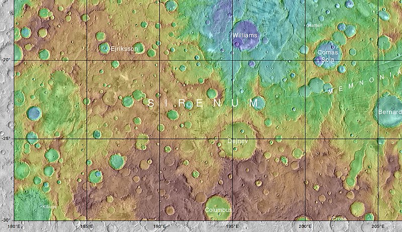
English: Map showing various craters in Memnonia quadrangle |
| Date | |
| Source | https://planetarynames.wr.usgs.gov/images/mc16_2014.pdf |
| Author | Jim Secosky modified NASA image NASA/USGS/Secosky |
Licensing
[edit]
| This file is in the public domain in the United States because it was solely created by NASA. NASA copyright policy states that "NASA material is not protected by copyright unless noted". (See Template:PD-USGov, NASA copyright policy page or JPL Image Use Policy.) | ||
 |
Warnings:
|
File history
Click on a date/time to view the file as it appeared at that time.
| Date/Time | Thumbnail | Dimensions | User | Comment | |
|---|---|---|---|---|---|
| current | 03:15, 4 May 2019 | | 1,548 × 895 (899 KB) | Huntster (talk | contribs) | Upload full resolution version, crop out all that whitespace. |
| 21:13, 28 November 2017 |  | 1,903 × 844 (309 KB) | Jimmarsmars (talk | contribs) | {{Information |Description ={{en|1=Map showing various craters in Memnonia quadrangle}} |Source =https://planetarynames.wr.usgs.gov/images/mc16_2014.pdf |Author =Jim Secosky modified NASA image NASA/USGS/Secosky |Date =201... |
You cannot overwrite this file.
File usage on Commons
There are no pages that use this file.
File usage on other wikis
The following other wikis use this file:
- Usage on en.wikipedia.org
- Usage on zh.wikipedia.org