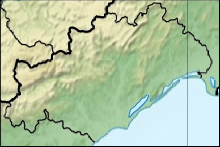
File:34-Hérault-carte-R1.jpg
From Wikimedia Commons, the free media repository
Jump to navigation
Jump to search
34-Hérault-carte-R1.jpg (716 × 479 pixels, file size: 170 KB, MIME type: image/jpeg)
File information
Structured data
Captions
Captions
Add a one-line explanation of what this file represents
- Carte 34 Hérault dfépartement fr Relief
- fr:Modèle:Géolocalisation/Hérault
- Source:Travail personnel
 This map was improved or created by the Wikigraphists of the Graphic Lab (fr). You can propose images to clean up, improve, create or translate as well.The map has been created with the Generic Mapping Tools: https://www.generic-mapping-tools.org/ using one or more of these public-domain datasets for the relief:
বাংলা ∙ English ∙ español ∙ français ∙ italiano ∙ 日本語 ∙ македонски ∙ sicilianu ∙ 中文(简体) ∙ 中文(繁體) ∙ +/−

Permission is granted to copy, distribute and/or modify this document under the terms of the GNU Free Documentation License, Version 1.2 or any later version published by the Free Software Foundation; with no Invariant Sections, no Front-Cover Texts, and no Back-Cover Texts. A copy of the license is included in the section entitled GNU Free Documentation License.http://www.gnu.org/copyleft/fdl.htmlGFDLGNU Free Documentation Licensetruetrue - Projection équirectangulaire
- top:44.00°
- bottom:43.1875°
- left:2.50°
- right:4.25°
File history
Click on a date/time to view the file as it appeared at that time.
| Date/Time | Thumbnail | Dimensions | User | Comment | |
|---|---|---|---|---|---|
| current | 09:38, 15 January 2013 |  | 716 × 479 (170 KB) | Wikisoft* (talk | contribs) | *Carte 34 Hérault département fr Relief *fr:Modèle:Géolocalisation/Hérault *Source:Travail personnel *{{Atelier graphique carte}} *Auteur:~~~~ *Licence:{{GFDL-GMT}} *Category:Maps of Hérault *Category:Hérault *Projection équire... |
You cannot overwrite this file.
File usage on Commons
There are no pages that use this file.
File usage on other wikis
The following other wikis use this file:
- Usage on ru.wikipedia.org
