File:22-08-007-pigeon.jpg

Original file (1,643 × 2,048 pixels, file size: 1.87 MB, MIME type: image/jpeg)
Captions
Captions
Summary
[edit]
| Description |
English:
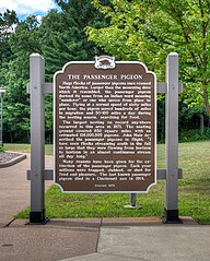
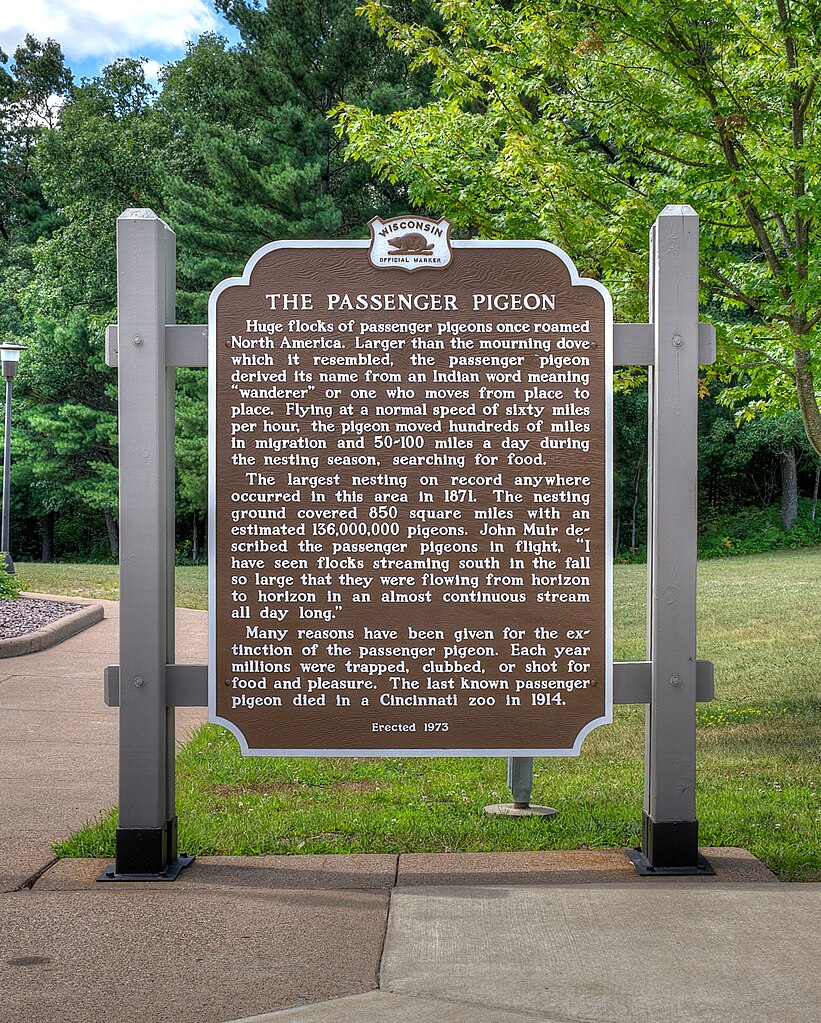
Huge flocks of passenger pigeons once roamed North America. Larger than the mourning dove which it resembled, the passenger pigeon derived its name from an Indian word meaning "wanderer" or one who moves from place to place. Flying at a normal speed of sixty miles per hour, the pigeon moved hundreds of miles in migration and 50-100 miles a day during the nesting season, searching for food. The largest nesting on record anywhere occurred in this area in 1871. The nesting ground covered 850 square miles with an estimated 136,000,000 pigeons. John Muir described the passenger pigeons in flight, "I have seen flocks streaming south in the fall so large that they were flowing from horizon to horizon in an almost continuous stream all day long." Many reasons have been given for the extinction of the passenger pigeon. Each year millions were trapped, clubbed, or shot for food and pleasure. The last known passenger pigeon died in a Cincinnati zoo in 1914. Erected 1973 by the Wisconsin Historical Society. (Marker Number 195.) |
| Date | |
| Source | Own work |
| Author | Dsdugan |
| Camera location | | View this and other nearby images on: OpenStreetMap |
|---|
Licensing
[edit]
| This file is made available under the Creative Commons CC0 1.0 Universal Public Domain Dedication. | |
| The person who associated a work with this deed has dedicated the work to the public domain by waiving all of their rights to the work worldwide under copyright law, including all related and neighboring rights, to the extent allowed by law. You can copy, modify, distribute and perform the work, even for commercial purposes, all without asking permission.
|
File history
Click on a date/time to view the file as it appeared at that time.
| Date/Time | Thumbnail | Dimensions | User | Comment | |
|---|---|---|---|---|---|
| current | 22:08, 24 August 2022 | | 1,643 × 2,048 (1.87 MB) | Dsdugan (talk | contribs) | Uploaded own work with UploadWizard |
You cannot overwrite this file.
File usage on Commons
There are no pages that use this file.