File:2020-07-28 Sand Point, Alaska M6.1 earthquake shakemap (USGS).jpg
Jump to navigation
Jump to search
Size of this preview: 481 × 599 pixels. Other resolutions: 193 × 240 pixels | 385 × 480 pixels | 804 × 1,001 pixels.
Original file (804 × 1,001 pixels, file size: 212 KB, MIME type: image/jpeg)
Captions
Captions
Add a one-line explanation of what this file represents
Summary
[edit].jpg&action=edit§ion=1)
| Description |
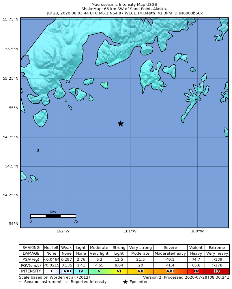
English: Shakemap from USGS for the magnitude 6.1, maximum intensity 4.384 earthquake with tsunami near en:Usgs Neic Shakemap (66 km SW of en:Sand Point, Alaska), 41.3 km depth. |
| Date | |
| Source | https://earthquake.usgs.gov/earthquakes/eventpage/us6000b56k |
| Author | United States Geological Survey |
Licensing
[edit].jpg&action=edit§ion=2)
This image is in the public domain in the United States because it only contains materials that originally came from the United States Geological Survey, an agency of the United States Department of the Interior. For more information, see the official USGS copyright policy.
|
File history
Click on a date/time to view the file as it appeared at that time.
| Date/Time | Thumbnail | Dimensions | User | Comment | |
|---|---|---|---|---|---|
| current | 10:04, 28 July 2020 | | 804 × 1,001 (212 KB) | Cewbot (talk | contribs) | Import USGS earthquake map, shakemap id: urn:usgs-product:us:shakemap:us6000b56k:1595925092585 (2020-07-28T08:31:32.585Z) |
You cannot overwrite this file.
File usage on Commons
The following page uses this file:
.jpg&oldid=813917869)