File:20190910-OPPE-LSC-0653.jpg

Original file (7,554 × 5,036 pixels, file size: 27.56 MB, MIME type: image/jpeg)
Captions
Captions
Summary
[edit]
| Description |
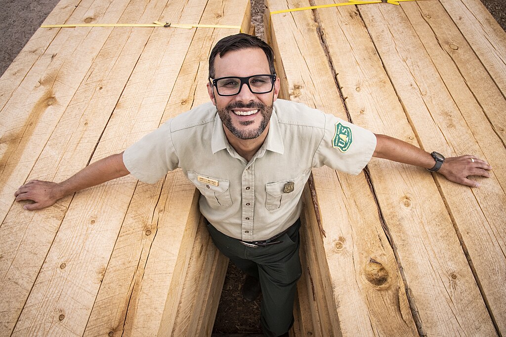
English: U.S. Department of Agriculture (USDA) Forest Service (FS) Santa Fe National Forest (SFNF) Forest Supervisor James Melonas has been working on government (Forest) to (Tribal) government relations to further restoration work such as the Southwest Jemez Restoration Project and the proposed Rio Chama Collaborative Forest Landscape Restoration Program (CFLRP) at the Walatowa Timber Industries (WTI) mill, in Jemez Pueblo, NM, Sept 10, 2019.
The program allows Walatowa Timber Industries (WTI) mill to process and sell the harvested timber. WTI produces wood pellets, poles for utilities, Ponderosa Pine, Douglas Fir, White Fir and Spruce beams and vigas for conventional and traditional home building, ties for railroads, posts for fences, milled lumber, mulch and firewood. The Southwest Jemez Collaborative Forest Landscape Restoration Project is a long-term forest and watershed restoration strategy to increase the landscape's resilience to severe wildfire and other large-scale disturbances. The landscape area is approximately 210,000 acres in the Southwest Jemez Mountains (SWJM) comprising the entire upper Jemez River watershed and including 110,000 acres on the Santa Fe National Forest, the 86,000-acre Valles Caldera National Preserve, the Pueblo of Jemez Pueblo, and additional parcels of state, private, and tribal lands. The project area includes ponderosa pine, mixed conifer, aspen and piñon-juniper forests as well as grasslands, meadows, riparian areas and aquatic habitats. The effect of human activities has significantly changed the ecological complexion of the landscape within the Jemez Mountains. Over time, the suppression of natural wildfires has dramatically altered the diversity, age, and productivity of native plant species. The forests have experienced dramatic increases in tree densities, thick understories, and ground litter. Decades of livestock grazing have left river and creek embankments without enough vegetation to hold the soil and shade the waterways to provide optimal temperatures for native trout and other aquatic species. Invasive plants and noxious weeds have encroached across the landscape, diminishing the quality, quantity and diversity of native forage for both wildlife and livestock. The overall goal is to restore the forest to conditions that were common to this geographical area prior to the first European contact. The SWJM project was designed to meet four primary purposes: Restore the forest's resilience to wildfire and other disturbances by using low-intensity fire to return fire to the landscape. Protect cultural resources. Improve wildlife habitat, watershed and riparian conditions, vegetation diversity and water quality. Create local economic development opportunities. The USDA FS Santa Fe National Forest (SFNF) have worked with the Pueblo of Jemez on the Collaborative Forest Landscape Restoration Program (CFLRP) that encourages the collaborative, science-based ecosystem restoration of priority forest landscapes. This helps to reduce the threat of wildland fire through hazardous fuels removal, promotes forest health through reducing insect infestation and disease, and the harvest of timber will go to the tribe’s nearby Walatowa Timber Industries mill. USDA Photo by Lance Cheung with permission of the Pueblo of Jemez. For more information please see: USDA.gov FS.usda.gov/detail/santafe/landmanagement/projects/?cid=stelprd3826396 FS.fed.us/restoration/CFLRP/ USDA |
| Date | |
| Source | https://www.flickr.com/photos/usdagov/49210267256/ |
| Author | U.S. Department of Agriculture |
| Camera location | | View this and other nearby images on: OpenStreetMap |
|---|
Licensing
[edit]
| This image was originally posted to Flickr by USDAgov at https://flickr.com/photos/41284017@N08/49210267256. It was reviewed on 10 August 2020 by FlickreviewR 2 and was confirmed to be licensed under the terms of the Public Domain Mark. |
This image is a work of the Forest Service of the United States Department of Agriculture. As a work of the U.S. federal government, the image is in the public domain.
|
File history
Click on a date/time to view the file as it appeared at that time.
| Date/Time | Thumbnail | Dimensions | User | Comment | |
|---|---|---|---|---|---|
| current | 03:48, 9 August 2020 | | 7,554 × 5,036 (27.56 MB) | Louisianajones1978 (talk | contribs) | Uploaded a work by U.S. Department of Agriculture from https://www.flickr.com/photos/usdagov/49210267256/ with UploadWizard |
You cannot overwrite this file.
File usage on Commons
There are no pages that use this file.