File:20190404-FS-Monongahela-JRF-320 (47743252361).jpg
Jump to navigation
Jump to search

Size of this preview: 800 × 600 pixels. Other resolutions: 320 × 240 pixels | 640 × 480 pixels | 1,024 × 768 pixels | 1,280 × 960 pixels | 2,560 × 1,920 pixels | 3,000 × 2,250 pixels.
Original file (3,000 × 2,250 pixels, file size: 3.98 MB, MIME type: image/jpeg)
Captions
Captions
Add a one-line explanation of what this file represents
Summary
[edit].jpg&action=edit§ion=1)
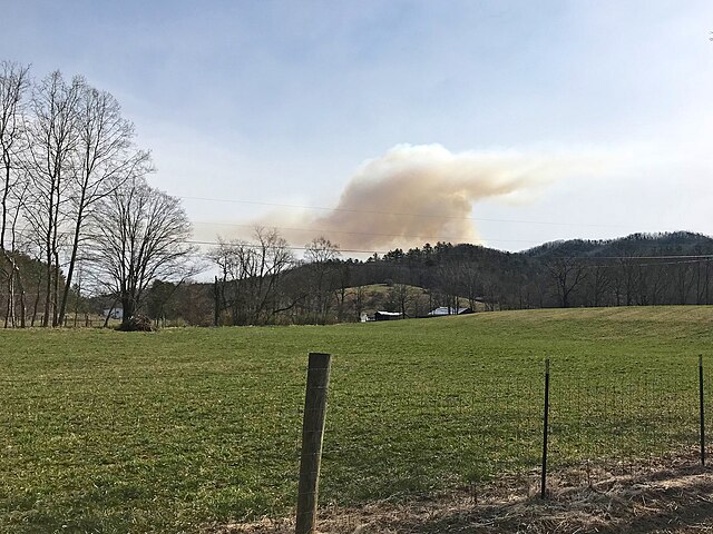
| Description | Smoke from the Brushy Mountain Grouse Management Area prescribed burn is visible from State Highway 92 on Monongahela National Forest near Mapledale, West Virginia, April 4, 2019. (Forest Service photo by John Fry) |
| Date | |
| Source | 20190404-FS-Monongahela-JRF-320 |
| Author | Monongahela National Forest from Elkins, WV, United States |
| Camera location | | View this and other nearby images on: OpenStreetMap |
|---|
.jpg¶ms=037.852831_N_-080.249376_E_globe:Earth_type:camera_source:Flickr_&language=en)
Licensing
[edit].jpg&action=edit§ion=2)
This image is a work of the Forest Service of the United States Department of Agriculture. As a work of the U.S. federal government, the image is in the public domain.
|
| This image was originally posted to Flickr by MonongahelaNF at https://flickr.com/photos/165530715@N03/47743252361 (archive). It was reviewed on 25 November 2019 by FlickreviewR 2 and was confirmed to be licensed under the terms of the Public Domain Mark. |
File history
Click on a date/time to view the file as it appeared at that time.
| Date/Time | Thumbnail | Dimensions | User | Comment | |
|---|---|---|---|---|---|
| current | 11:29, 24 November 2019 | | 3,000 × 2,250 (3.98 MB) | Ser Amantio di Nicolao (talk | contribs) | Transferred from Flickr via #flickr2commons |
You cannot overwrite this file.
File usage on Commons
There are no pages that use this file.
.jpg&oldid=758188495)