File:2019-12-16 Kangaroo Island Fire Terra MODIS-7-2-1-LABELS-EN.png
Jump to navigation
Jump to search
Size of this preview: 800 × 450 pixels. Other resolutions: 320 × 180 pixels | 640 × 360 pixels | 1,024 × 575 pixels | 1,280 × 719 pixels | 1,920 × 1,079 pixels.
Original file (1,920 × 1,079 pixels, file size: 2.67 MB, MIME type: image/png)
Captions
Captions
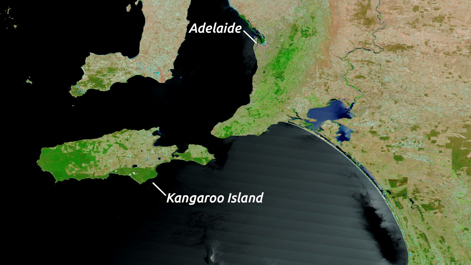
False color satellite imagery on 16th December 2019 showing areas before bushfires on Kangaroo Island, Australia
Summary
[edit]| Description |
English: False color imagery from NASA Terra Satellite showing MODIS bands 7-2-1 data of before Australian bushfires on Kangaroo Island. Notable landmarks labeled.
We acknowledge the use of imagery from the NASA Worldview application (https://worldview.earthdata.nasa.gov), part of the NASA Earth Observing System Data and Information System (EOSDIS). |
| Date | |
| Source | Data captured from https://worldview.earthdata.nasa.gov |
| Author | NASA Earth Observing System Data and Information System (EOSDIS) |
| Other versions |
|

Licensing
[edit]
| This file is in the public domain in the United States because it was solely created by NASA. NASA copyright policy states that "NASA material is not protected by copyright unless noted". (See Template:PD-USGov, NASA copyright policy page or JPL Image Use Policy.) | ||
 |
Warnings:
|
File history
Click on a date/time to view the file as it appeared at that time.
| Date/Time | Thumbnail | Dimensions | User | Comment | |
|---|---|---|---|---|---|
| current | 11:43, 8 January 2020 | | 1,920 × 1,079 (2.67 MB) | EnchanterTim (talk | contribs) | User created page with UploadWizard |
You cannot overwrite this file.
File usage on Commons
The following 2 pages use this file: