File:2019-09-25 Kairatu, Indonesia M6.5 earthquake shakemap (USGS).jpg
Jump to navigation
Jump to search
Size of this preview: 463 × 600 pixels. Other resolutions: 185 × 240 pixels | 370 × 480 pixels | 822 × 1,065 pixels.
Original file (822 × 1,065 pixels, file size: 206 KB, MIME type: image/jpeg)
Captions
Captions
සිංහල
Summary
[edit].jpg&action=edit§ion=1)
| Description |
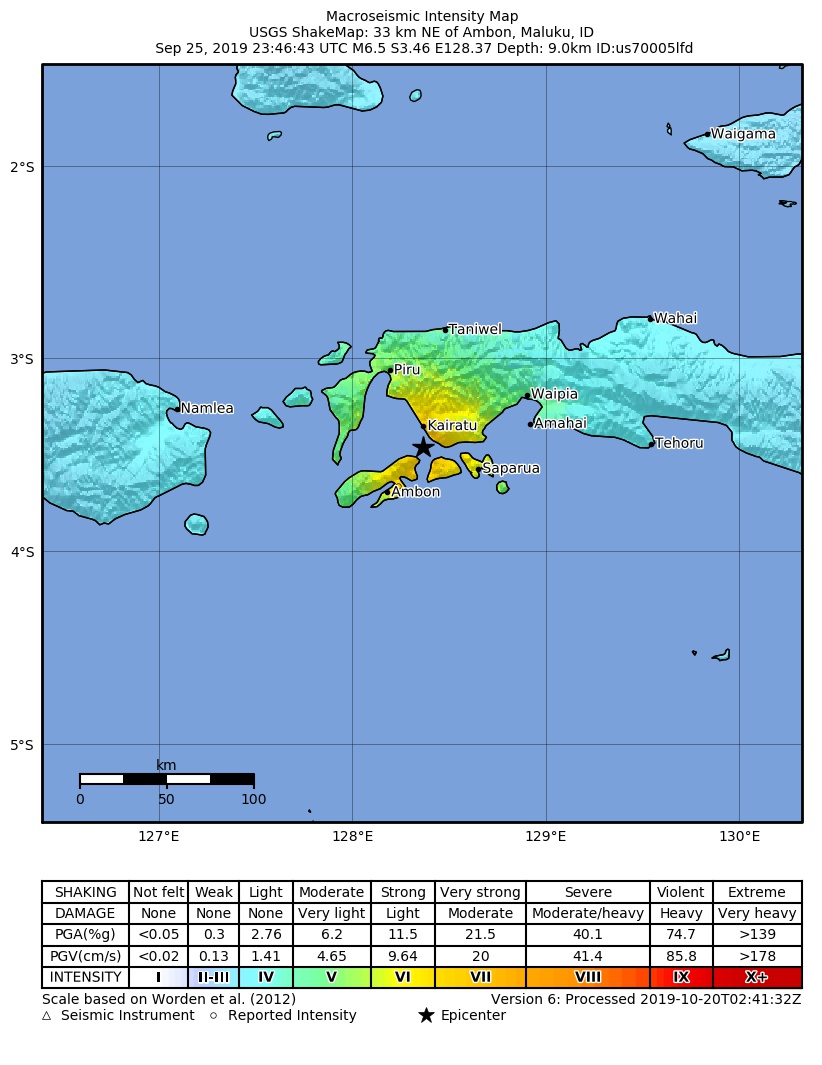
English: Shakemap from USGS for the magnitude 6.5, maximum intensity 7.166 earthquake with tsunami near en:Usgs Neic Shakemap (10km S of en:Kairatu, Indonesia), 18.2 km depth. |
| Date | |
| Source | https://earthquake.usgs.gov/earthquakes/eventpage/us70005lfd |
| Author | United States Geological Survey |
Licensing
[edit].jpg&action=edit§ion=2)
This image is in the public domain in the United States because it only contains materials that originally came from the United States Geological Survey, an agency of the United States Department of the Interior. For more information, see the official USGS copyright policy.
|
File history
Click on a date/time to view the file as it appeared at that time.
| Date/Time | Thumbnail | Dimensions | User | Comment | |
|---|---|---|---|---|---|
| current | 04:03, 20 October 2019 | | 822 × 1,065 (206 KB) | Cewbot (talk | contribs) | Import USGS updated earthquake map, shakemap id: urn:usgs-product:us:shakemap:us70005lfd:1571539345527 (2019-10-20T02:42:25.527Z) |
| 02:04, 29 September 2019 |  | 822 × 1,062 (209 KB) | Cewbot (talk | contribs) | Import USGS updated earthquake map, shakemap id: urn:usgs-product:us:shakemap:us70005lfd:1569541734683 (2019-09-26T23:48:54.683Z) | |
| 02:03, 26 September 2019 |  | 822 × 1,062 (208 KB) | Cewbot (talk | contribs) | Import USGS earthquake map, shakemap id: urn:usgs-product:us:shakemap:us70005lfd:1569462525513 (2019-09-26T01:48:45.513Z) |
You cannot overwrite this file.
File usage on Commons
There are no pages that use this file.
File usage on other wikis
The following other wikis use this file:
- Usage on de.wikipedia.org
- Usage on en.wikipedia.org
- Usage on fa.wikipedia.org
- Usage on id.wikipedia.org
- Usage on nl.wikipedia.org
- Usage on pl.wikipedia.org
- Usage on ru.wikipedia.org
- Usage on zh.wikipedia.org
.jpg&oldid=757923247)