File:20171015170DR Dresden-Plauen Blick vom Hohen Stein.jpg
Jump to navigation
Jump to search

Size of this preview: 800 × 599 pixels. Other resolutions: 320 × 239 pixels | 640 × 479 pixels | 1,024 × 766 pixels | 1,280 × 958 pixels | 2,560 × 1,916 pixels | 3,648 × 2,730 pixels.
Original file (3,648 × 2,730 pixels, file size: 7.46 MB, MIME type: image/jpeg)
Captions
Captions
Add a one-line explanation of what this file represents
Summary
[edit]| Description |
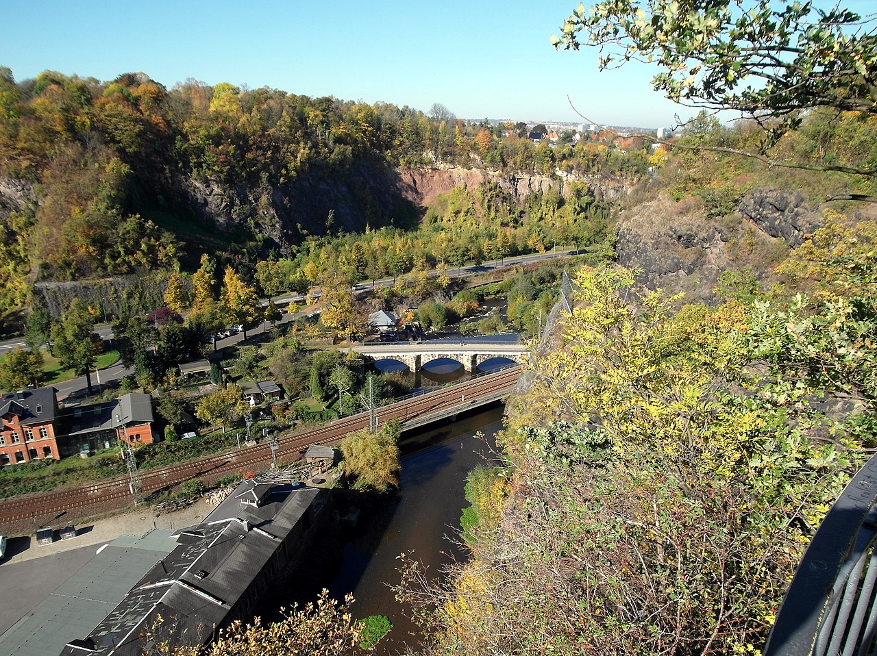
Deutsch: 15.10.2017 01187 Dresden-Dölzschen: Blick vom Aussichtspunkt in Dresden-Hohenplauen beim Hohen Stein (GMP: 51.023987,13.703025) nach Nordwesten über die heutige Brücke der Albertbahn (heute die Sachsen-Franken-Magistrale), danach die Hegereiterbücke (GMP: 51.025034,13.701097) über die Weißeritz. Die Hegereiterbrücke der alten Poststraße über die Vereinigte Weißeritz von 1782 ist die älteste Natursteinbogenbrücke Dresdens. Eine Querung der Weißeritz an dieser Stelle existierte vermutlich bereits seit dem 14. Jahrhundert. Die damalige Holzbrücke diente der Erschließung des Plauenschen Grundes und dem Zugang zur Villa Grassi und zur Buschmühle. Ihr Name leitet sich von einem Forsthaus ab, das 1722 unmittelbar vor der Brücke für einen berittenen Förster, den Hegereiter, errichtet wurde. 1965 wurde es abgebrochen. Am Hang gegenüber der Ratssteinbruch Dölzschen. [SAM2341.JPG]20171015170DR.JPG(c)Blobelt |
||||||||||||||
| Date | |||||||||||||||
| Source | Own work | ||||||||||||||
| Author |
|
||||||||||||||

| Object location | | View this and other nearby images on: OpenStreetMap |
|---|
Licensing
[edit]
This file is licensed under the Creative Commons Attribution-Share Alike 4.0 International license.
- You are free:
- to share – to copy, distribute and transmit the work
- to remix – to adapt the work
- Under the following conditions:
- attribution – You must give appropriate credit, provide a link to the license, and indicate if changes were made. You may do so in any reasonable manner, but not in any way that suggests the licensor endorses you or your use.
- share alike – If you remix, transform, or build upon the material, you must distribute your contributions under the same or compatible license as the original.
File history
Click on a date/time to view the file as it appeared at that time.
| Date/Time | Thumbnail | Dimensions | User | Comment | |
|---|---|---|---|---|---|
| current | 19:59, 30 May 2020 | | 3,648 × 2,730 (7.46 MB) | Jörg Blobelt (talk | contribs) | Uploaded a work by {{Creator:Jörg Blobelt}} from {{own}} with UploadWizard |
You cannot overwrite this file.
File usage on Commons
The following 3 pages use this file: