File:20160828 Weißbachlscharte im Steinernen Meer, Saalfelden, Österreich (06534).jpg
Original file (4,912 × 2,730 pixels, file size: 17.45 MB, MIME type: image/jpeg)
Captions
Captions
Summary
[edit]| Description |
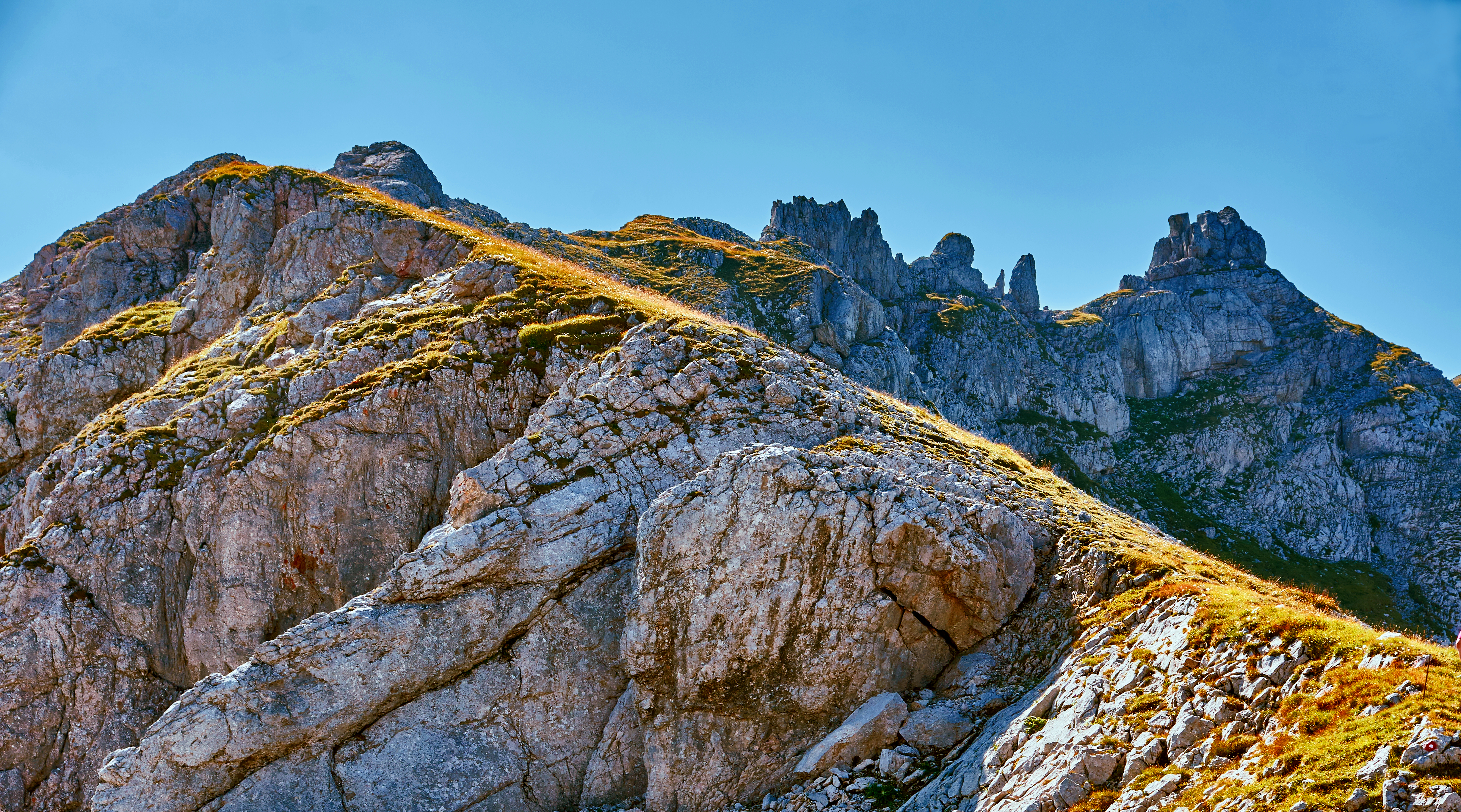
Deutsch: Die 2259 m hohe Weißbachlscharte ist ein Gebirgspass im Steinernen Meer. Sie verbindet Saalfelden im Süden mit der Hochfläche des Gebirgsstocks im Norden und dient als Übergang von der Peter-Wiechenthaler-Hütte zum Ingolstädter, Kärlinger oder Riemannhaus. Von der Weißbachlscharte kann man auch den Gebirgskamm nach Südosten entlang der Gipfel von Alhorn, Mitterhorn und Breithorn zur Ramseider Scharte überschreiten. Das Foto zeigt den Beginn dieses hochalpinen Wegs. Das Bild entstand im Natur- und Europaschutzgebiet Kalkhochalpen auf dem Gebiet der Gemeinde Saalfelden.
English: View from Weißbachlscharte, a 2259 m high mountain pass located in the mountain range of Steinernes Meer, towards Alhorn, Saalfelden, Austria.
|
||||
| Date | |||||
| Source | Photo taken by Watzmann | ||||
| Author | Günter Seggebäing, Coesfeld |

.jpg&action=edit§ion=1)
| Camera location | | View this and other nearby images on: OpenStreetMap |
|---|
.jpg¶ms=047.478366_N_0012.897745_E_globe:Earth_type:camera__&language=en)
- You are free:
- to share – to copy, distribute and transmit the work
- to remix – to adapt the work
- Under the following conditions:
- attribution – You must give appropriate credit, provide a link to the license, and indicate if changes were made. You may do so in any reasonable manner, but not in any way that suggests the licensor endorses you or your use.
- share alike – If you remix, transform, or build upon the material, you must distribute your contributions under the same or compatible license as the original.
I have published this image (this file) as author under the Creative-Commons-License CC BY-SA 3.0 (“Attribution-ShareAlike 3.0”). Legally binding is only the full legalcode.
This means that free usage outside of Wikimedia projects is possible under the following terms of license:
- The image is credited with “© Günter Seggebäing, CC BY-SA 3.0” as part of the caption, of the image credits or of the edition notice. Provide a copy of, or the URI for, the applicable license (https://creativecommons.org/licenses/by-sa/3.0/legalcode).
- If this is not possible (due to shortage of space), contact me first.
- In online presences the author is mentioned, and weblinks to the original image and to the licence model are set: “© Günter Seggebäing, Wikimedia Commons, CC BY-SA 3.0”
.jpg)
Any of the above conditions can be waived if you get permission from the copyright holder.
This license and the rights granted hereunder will terminate automatically upon any breach by you of the terms of this license. In this case the author reserves to demand declaration to cease and desist, and compensation (according to the MFM fee references currently in force).
I would be happy to receive a specimen copy or the URL of the website where the image is used.
Please contact me (eMail via Wikipedia), if you
- need my postal address for sending a specimen copy or
- have further questions to the terms of license or
- like to have the picture in higher resolution or
- need another license model for usage.
⇒ More informations about reusing content from Wikimedia Commons.
|
The license of this work is not consistent with the licensing terms of Facebook. Therfore it is not permitted to use this work on Facebook |

|
Diese Datei wurde im Rahmen von WikiDaheim 2017 in Österreich erstellt und hochgeladen. Sie wurde dem Themenbereich Naturschutz zugeordnet. |
File history
Click on a date/time to view the file as it appeared at that time.
| Date/Time | Thumbnail | Dimensions | User | Comment | |
|---|---|---|---|---|---|
| current | 09:50, 30 September 2017 | | 4,912 × 2,730 (17.45 MB) | Watzmann (talk | contribs) | == {{int:filedesc}} == {{Information |Description={{de|Die 2259 m hohe Weißbachlscharte ist ein Gebirgspass im Steinernen Meer. Sie verbindet Saalfelden im Süden mit der Hochfläche des Ge... |
You cannot overwrite this file.
File usage on Commons
The following 2 pages use this file:
File usage on other wikis
The following other wikis use this file:
- Usage on de.wikipedia.org
- Usage on sv.wikipedia.org
.jpg&oldid=898896583)