File:20150705 - 10 - The Blue Mountains, Ont. - Namesake Landform Seen from Highway 26.jpg
Jump to navigation
Jump to search

Size of this preview: 800 × 480 pixels. Other resolutions: 320 × 192 pixels | 1,024 × 615 pixels | 1,280 × 768 pixels | 2,048 × 1,229 pixels.
Original file (2,048 × 1,229 pixels, file size: 490 KB, MIME type: image/jpeg)
Captions
Captions
Add a one-line explanation of what this file represents
Summary
[edit]
| Description |
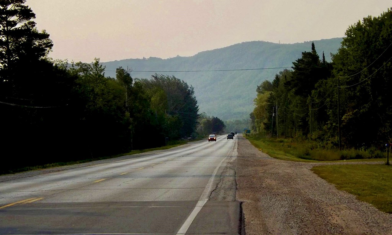
English: The especially imposing stretch of the Niagara Escarpment known as the Blue Mountains towers in the distance in this morning view eastward along Highway 26 in the municipality of Blue Mountains, Ontario as seen in July 2015. The area is one of Canada's most important destinations for downhill skiing, with the Blue Mountain ski resort and the private Georgian Peaks, Osler, Craigleith and Alpine Ski Clubs all situated within a few miles. |
| Date | |
| Source | Own work |
| Author | Andre Carrotflower |
Licensing
[edit]
I, the copyright holder of this work, hereby publish it under the following license:
This file is licensed under the Creative Commons Attribution-Share Alike 4.0 International license.
- You are free:
- to share – to copy, distribute and transmit the work
- to remix – to adapt the work
- Under the following conditions:
- attribution – You must give appropriate credit, provide a link to the license, and indicate if changes were made. You may do so in any reasonable manner, but not in any way that suggests the licensor endorses you or your use.
- share alike – If you remix, transform, or build upon the material, you must distribute your contributions under the same or compatible license as the original.
File history
Click on a date/time to view the file as it appeared at that time.
| Date/Time | Thumbnail | Dimensions | User | Comment | |
|---|---|---|---|---|---|
| current | 05:14, 2 June 2022 | | 2,048 × 1,229 (490 KB) | Andre Carrotflower (talk | contribs) | Uploaded own work with UploadWizard |
You cannot overwrite this file.
File usage on Commons
There are no pages that use this file.