File:20150602080DR Olbernhau Pech und Kunte Dörfelstraße 7-11.jpg
Jump to navigation
Jump to search
Size of this preview: 800 × 503 pixels. Other resolutions: 320 × 201 pixels | 640 × 403 pixels | 1,024 × 644 pixels | 1,280 × 805 pixels | 3,107 × 1,955 pixels.
Original file (3,107 × 1,955 pixels, file size: 2.77 MB, MIME type: image/jpeg)
Captions
Captions
Add a one-line explanation of what this file represents
Summary
[edit]| Description |
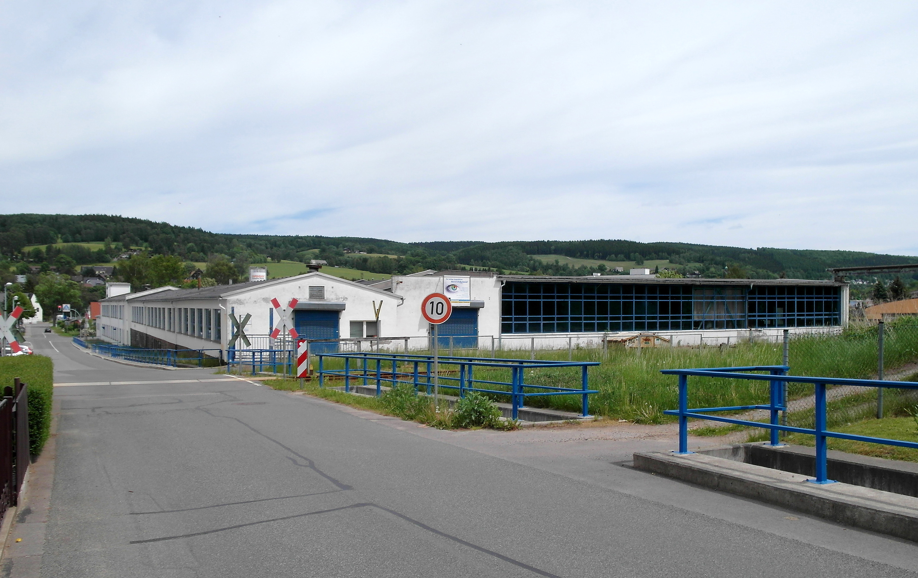
Deutsch: 02.06.2015 09526 Olbernhau, Dörfelstraße 7-11. Glaswerk Pech & Kunte (GMP: 50.650018,13.350893), heute (2015) Olbernhauer Glashandelsgesellschaft mbH. Nach dem II. Weltkrieg hat nach Flucht und Vertreibung aus dem Sudetenland Herr Edmund Pech aus aus dem böhmischen Haida (Novy Bor) in Olbernhau ein Unternehmen mit Weltruf erschaffen. Pech & Kunte Olbernhau, mit seinen Niederlassungen in Satzung und Carlsfeld, war der beste Glasveredlungsbetrieb der ehemaligen DDR. Bleikristall aus Olbernhau wurde in die ganze Welt exportiert. Bis heute hat Bleikristall aus der Firma Pech & Kunte einen hervorragenden Ruf in der Welt. Großabnehmer waren Japan, Italien und zunehmend die USA. In den 70er Jahren vergrößerte sich der Export in über 20 Länder, was der DDR ein hohes Maß an Devisen einbrachte. Da Edmund Pech immer neue Ideen hatte, ließ er 1964/65 ein neues Produktionsgebäude an der Dörfelstraße errichten und nahm die Produktion von Wirtschaftsglas auf. Dabei wurden Flachglasscheiben zu Lampenschirmen und verschiedenen gebogenen Gegenständen mit farbigen Siebdruck produziert. Später kam noch die Produktion von Einscheiben-Sicherheitsglas für Eisenbahn-, Straßenbahn- und Schiffsbau dazu. 1972 wurde der Betrieb von Privat- in Volkseigentum umgewandelt, Edmund Pech blieb aber weiterhin Betriebsdirektor. Nach der Wende 1989 begann der Niedergang. [Quelle: Rolf Christian Hofmann, Satzung (Marienberg)] [SAM0596.JPG]20150602080DR.JPG(c)Blobelt |
||||||||||||||
| Date | |||||||||||||||
| Source | Own work | ||||||||||||||
| Author |
|
||||||||||||||

| Object location | | View this and other nearby images on: OpenStreetMap |
|---|
Licensing
[edit]
This file is licensed under the Creative Commons Attribution-Share Alike 4.0 International license.
- You are free:
- to share – to copy, distribute and transmit the work
- to remix – to adapt the work
- Under the following conditions:
- attribution – You must give appropriate credit, provide a link to the license, and indicate if changes were made. You may do so in any reasonable manner, but not in any way that suggests the licensor endorses you or your use.
- share alike – If you remix, transform, or build upon the material, you must distribute your contributions under the same or compatible license as the original.
File history
Click on a date/time to view the file as it appeared at that time.
| Date/Time | Thumbnail | Dimensions | User | Comment | |
|---|---|---|---|---|---|
| current | 19:45, 22 September 2023 | | 3,107 × 1,955 (2.77 MB) | Jörg Blobelt (talk | contribs) | Uploaded a work by {{Creator:Jörg Blobelt}} from {{own}} with UploadWizard |
You cannot overwrite this file.
File usage on Commons
There are no pages that use this file.