File:20150125105606 Caletones smokestacks.jpg
Jump to navigation
Jump to search

Size of this preview: 800 × 600 pixels. Other resolutions: 320 × 240 pixels | 640 × 480 pixels | 1,024 × 768 pixels | 1,280 × 960 pixels | 2,592 × 1,944 pixels.
Original file (2,592 × 1,944 pixels, file size: 903 KB, MIME type: image/jpeg)
Captions
Captions
Add a one-line explanation of what this file represents
Summary
[edit]
| Description |
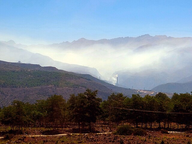
Deutsch: Bergbaubezirk El Teniente: 15 km nach der Einfahrt aufs Werksgelände, 1540 m ü.M. Die Schlote vom Schmelzwerk Caletones werden sichtbar.
English: El Teniente Mining District: 15 km after entering the works area, 1540 m a.s.l. The smokestacks of the Caletones smelter come in sight.
Español: Distrito Minero El Teniente: 15 km después de ingresar al recinto, 1540 m s.n.m. Las chimeneas de la fundición Caletones vienen a la vista. |
| Date | Taken on 25 January 2015, 10:56:06 (according to Exif data) |
| Source | Own work |
| Author | WeHaKa |
| Permission (Reusing this file) |
I, the copyright holder of this work, hereby publish it under the following license: This file is licensed under the Creative Commons Attribution-Share Alike 4.0 International license.
|
| Camera location | | View this and other nearby images on: OpenStreetMap |
|---|
| Object location | | View this and other nearby images on: OpenStreetMap |
|---|
File history
Click on a date/time to view the file as it appeared at that time.
| Date/Time | Thumbnail | Dimensions | User | Comment | |
|---|---|---|---|---|---|
| current | 23:56, 11 October 2020 | | 2,592 × 1,944 (903 KB) | WeHaKa (talk | contribs) | {{Information |description = {{de|Bergbaubezirk El Teniente: 15 km nach der Einfahrt aufs Werksgelände, 1540 m ü.M. Die Schlote vom Schmelzwerk Caletones werden sichtbar. }} {{en|El Teniente Mining District: 15 km after entering the works area, 1540 m a.s.l. The smokestacks of the Caletones smelter come in sight. }} {{es|Distrito Minero El Teniente: 15 km después de ingresar al recinto, 1540 m s.n.m. Las chimeneas de la fundición Caletones vienen a la vista. }} |date = {{Taken... |
You cannot overwrite this file.
File usage on Commons
There are no pages that use this file.
File usage on other wikis
The following other wikis use this file:
- Usage on es.wikipedia.org