File:2015-03-01-Cap Engela-Northernmost tip of Africa-panorama.JPG
Jump to navigation
Jump to search

Size of this preview: 799 × 172 pixels. Other resolutions: 320 × 69 pixels | 640 × 138 pixels | 1,024 × 221 pixels | 1,280 × 276 pixels | 2,560 × 551 pixels | 13,632 × 2,936 pixels.
Original file (13,632 × 2,936 pixels, file size: 13.38 MB, MIME type: image/jpeg)
Captions
Captions
Add a one-line explanation of what this file represents
Summary
[edit]
| Description |
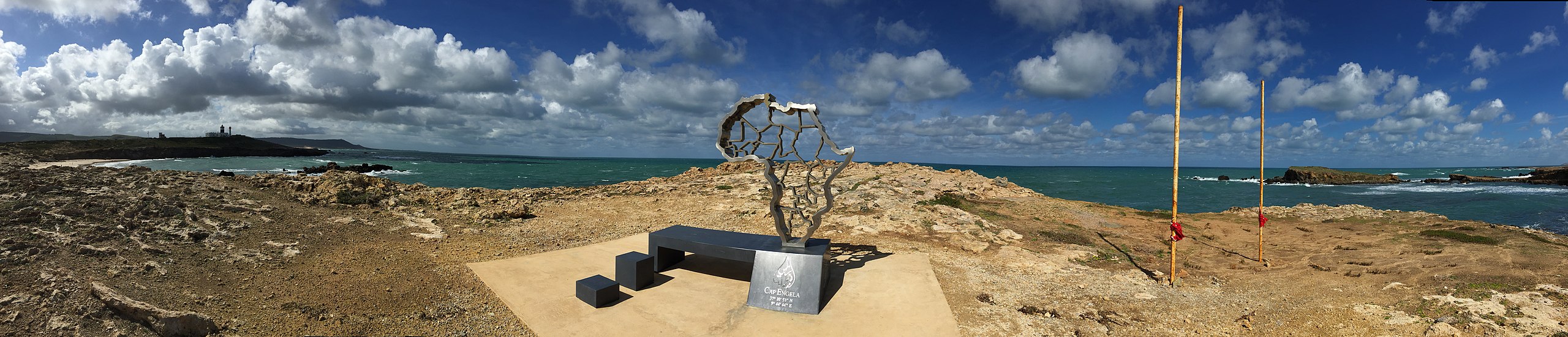
English: Panoramic view of Cap Engela, the northernmost tip of the African continent. The center of the picture points towards North.
Deutsch: Panorama von Cap Engela, dem nördlichsten Punkt des afrikanischen Festlandes. Die Bildmitte zeigt Richtung Norden. |
| Date | |
| Source | Own work |
| Author | Aleister2 |
| Permission (Reusing this file) |
This file is licensed under the Creative Commons Attribution-Share Alike 3.0 Germany license.
 |
| Other versions |
This file is licensed under the Creative Commons Attribution-Share Alike 3.0 Germany license.
|
| Camera location | | View this and other nearby images on: OpenStreetMap |
|---|
File history
Click on a date/time to view the file as it appeared at that time.
| Date/Time | Thumbnail | Dimensions | User | Comment | |
|---|---|---|---|---|---|
| current | 18:55, 11 March 2015 | 13,632 × 2,936 (13.38 MB) | Aleister2 (talk | contribs) | {{Information |Description ={{en|1=Panoramic view of Cap Engela, the northernmost tip of the African continent. The center of the picture points towards North.}} {{de|1=Panorama von Cap Engela, dem nördlichsten Punkt des afrikanischen Festlandes. D... |
You cannot overwrite this file.
File usage on Commons
There are no pages that use this file.
File usage on other wikis
The following other wikis use this file:
- Usage on ca.wikipedia.org
- Usage on de.wikipedia.org
- Usage on lv.wikipedia.org