File:20120402430DR Kühnitzsch (Lossatal) Schloß.jpg
Jump to navigation
Jump to search
Size of this preview: 761 × 600 pixels. Other resolutions: 305 × 240 pixels | 609 × 480 pixels | 975 × 768 pixels | 1,280 × 1,008 pixels | 2,342 × 1,845 pixels.
Original file (2,342 × 1,845 pixels, file size: 3.58 MB, MIME type: image/jpeg)
Captions
Captions
Add a one-line explanation of what this file represents
Summary
[edit]| Description |
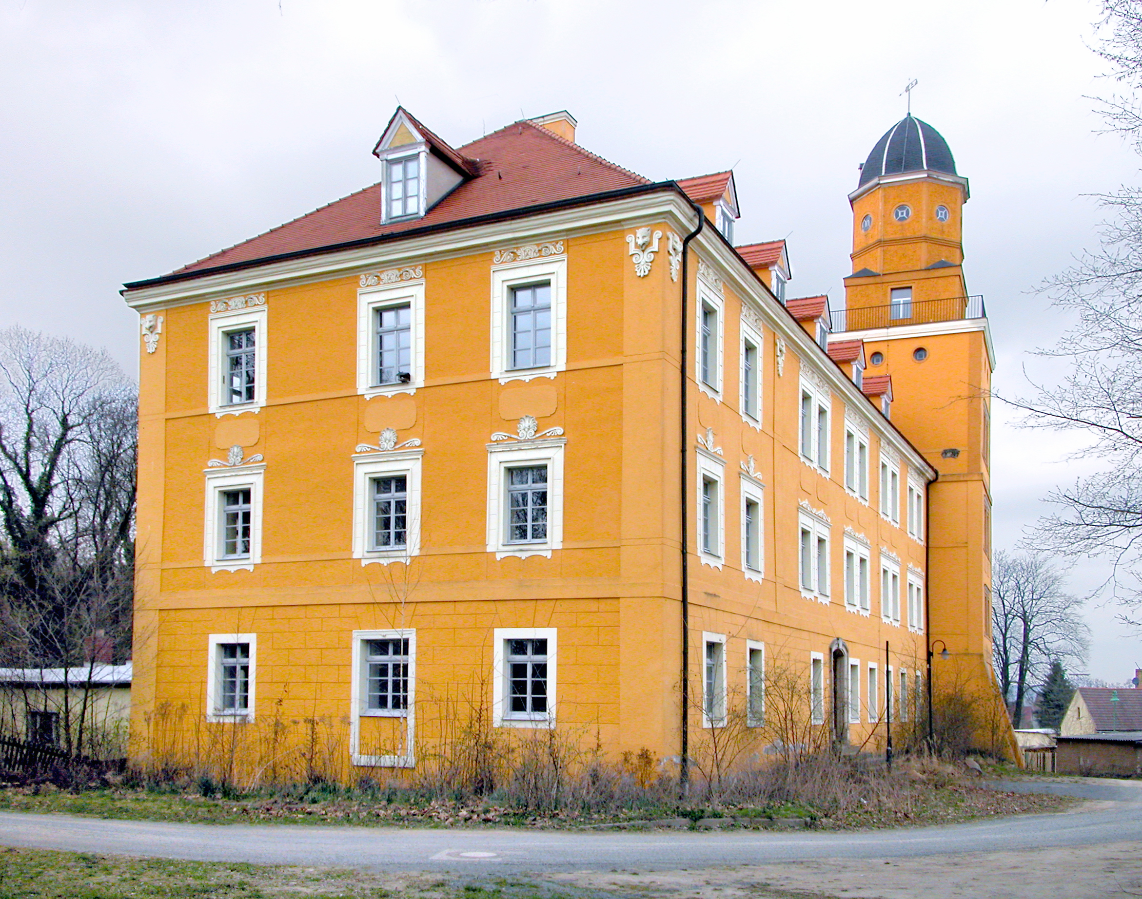
Deutsch: 02.04.2012 04808 Kühnitzsch (Falkenhain -> Lossatal), Schloßhof 1: Schloß Kühnitzsch (GMP: 51.376378,12.831741) von Nordosten. Bereits im 13. Jahrhundert bezeugter Adelssitz. Das Schloß stammt im Kern wohl aus dem 17. Jahrhundert. 1842 wurde es modernisiert und spätklassizistisch überformt. Das Rittergut war bis 1945 durchgehend in adligem Besitz. In der DDR befanden sich hier Wohnungen, ein Kindergarten und eine Grundschule. Anfang der 1990er Jahre wurde das Schloß saniert und durch eine Förderschule genutzt. Nachdem diese 2006 ausgezogen war, verkaufte die Gemeinde das Anwesen an den in Niederbayern lebenden Bauunternehmer Rudi Schartel.
[DSCBn3656.TIF]20120402430DR.JPG(c)Blobelt |
||||||||||||||
| Date | |||||||||||||||
| Source | Own work | ||||||||||||||
| Author |
|
||||||||||||||

_Schlo%C3%9F.jpg&action=edit§ion=1)
| Object location | | View this and other nearby images on: OpenStreetMap |
|---|
_Schlo%C3%9F.jpg¶ms=051.376378_N_0012.831741_E_globe:Earth_class:object_type:object__&language=en)
Licensing
[edit]_Schlo%C3%9F.jpg&action=edit§ion=2)
This file is licensed under the Creative Commons Attribution-Share Alike 4.0 International license.
- You are free:
- to share – to copy, distribute and transmit the work
- to remix – to adapt the work
- Under the following conditions:
- attribution – You must give appropriate credit, provide a link to the license, and indicate if changes were made. You may do so in any reasonable manner, but not in any way that suggests the licensor endorses you or your use.
- share alike – If you remix, transform, or build upon the material, you must distribute your contributions under the same or compatible license as the original.

|
This image was uploaded as part of Wiki Loves Monuments 2021.
|
File history
Click on a date/time to view the file as it appeared at that time.
| Date/Time | Thumbnail | Dimensions | User | Comment | |
|---|---|---|---|---|---|
| current | 18:45, 14 September 2021 | | 2,342 × 1,845 (3.58 MB) | Jörg Blobelt (talk | contribs) | Uploaded a work by {{Creator:Jörg Blobelt}} from {{own}} with UploadWizard |
You cannot overwrite this file.
File usage on Commons
There are no pages that use this file.
_Schloß.jpg&oldid=751090756)