File:2012-09-09T13-55-53 panorama v1.jpg
Jump to navigation
Jump to search

Size of this preview: 800 × 145 pixels. Other resolutions: 320 × 58 pixels | 640 × 116 pixels | 1,024 × 186 pixels | 1,280 × 232 pixels | 9,271 × 1,680 pixels.
Original file (9,271 × 1,680 pixels, file size: 4.17 MB, MIME type: image/jpeg)
Captions
Captions
Add a one-line explanation of what this file represents
Summary
[edit]| Description |
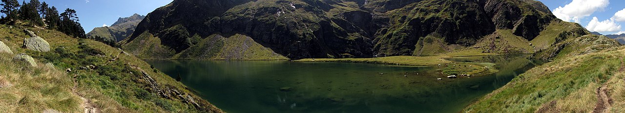
English: Panorama of the Green Lake, in the Lily Valley, at Castillon-de-Larboust, near Bagnères-de-Luchon.
Français : Panorama du Lac Vert, dans la vallée du Lys, à Castillon-de-Larboust, près de Bagnères-de-Luchon. |
||
| Date | |||
| Source | Self-photographed | ||
| Author |
MathieuMD (If you can improve this photo development, ask me the RAW.) | ||
| Attribution (required by the license) | © MathieuMD / Wikimedia Commons / | ||
| Permission (Reusing this file) |
|

| Camera location | | View this and other nearby images on: OpenStreetMap |
|---|
Licensing
[edit]
I, the copyright holder of this work, hereby publish it under the following licenses:
This file is licensed under the Creative Commons Attribution-Share Alike 3.0 Unported license.
- You are free:
- to share – to copy, distribute and transmit the work
- to remix – to adapt the work
- Under the following conditions:
- attribution – You must give appropriate credit, provide a link to the license, and indicate if changes were made. You may do so in any reasonable manner, but not in any way that suggests the licensor endorses you or your use.
- share alike – If you remix, transform, or build upon the material, you must distribute your contributions under the same or compatible license as the original.

|
Permission is granted to copy, distribute and/or modify this document under the terms of the GNU Free Documentation License, Version 1.2 or any later version published by the Free Software Foundation; with no Invariant Sections, no Front-Cover Texts, and no Back-Cover Texts. A copy of the license is included in the section entitled GNU Free Documentation License. |
You may select the license of your choice.
File history
Click on a date/time to view the file as it appeared at that time.
| Date/Time | Thumbnail | Dimensions | User | Comment | |
|---|---|---|---|---|---|
| current | 11:14, 15 September 2012 | 9,271 × 1,680 (4.17 MB) | MathieuMD (talk | contribs) | Upload via KIPI uploader |
You cannot overwrite this file.
File usage on Commons
The following 2 pages use this file:
File usage on other wikis
The following other wikis use this file:
- Usage on arz.wikipedia.org
- Usage on fr.wikipedia.org
- Usage on www.wikidata.org