File:20110313-TokyoTower.jpg
From Wikimedia Commons, the free media repository
Jump to navigation
Jump to search
![File:20110313-TokyoTower.jpg](https://upload.wikimedia.org/wikipedia/commons/thumb/f/f5/20110313-TokyoTower.jpg/396px-20110313-TokyoTower.jpg?20111208061650)
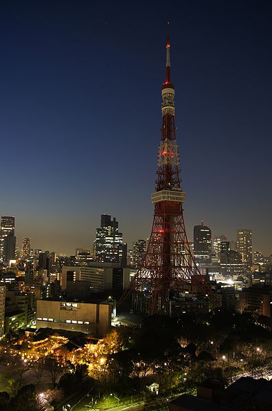
Size of this preview: 396 × 599 pixels. Other resolutions: 158 × 240 pixels | 317 × 480 pixels | 507 × 768 pixels | 676 × 1,024 pixels | 1,353 × 2,048 pixels.
Original file (1,353 × 2,048 pixels, file size: 1,004 KB, MIME type: image/jpeg)
File information
Structured data
Captions
Captions
Add a one-line explanation of what this file represents
Summary
[edit]Description20110313-TokyoTower.jpg |
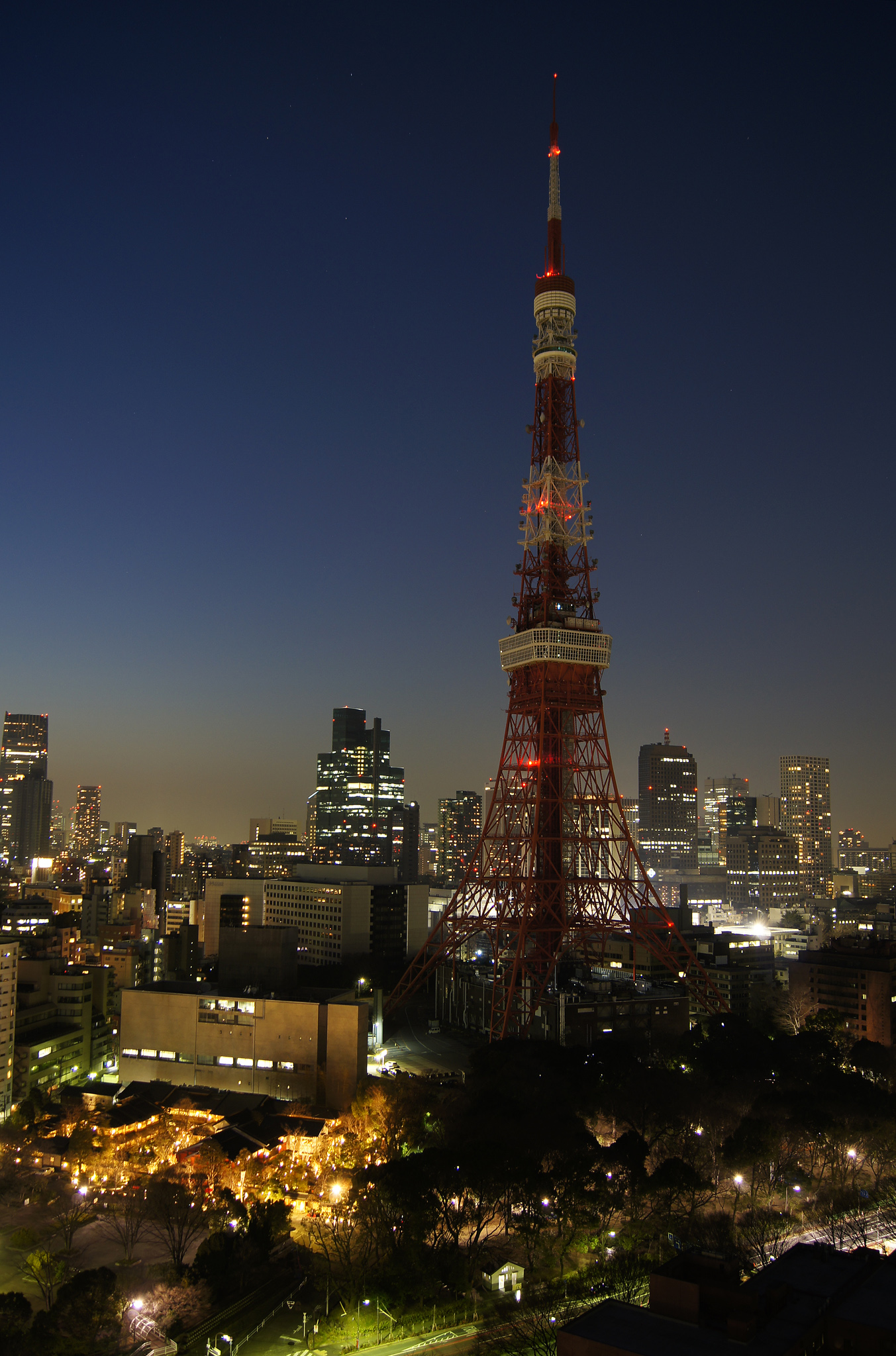
日本語: 2011.3.11(金)の東北地方太平洋沖地震にて電力不足となったため、ライトアップを中止し節電に協力する東京タワー。ザ・プリンスパークタワー東京より撮影。 |
Date | Taken on 13 March 2011 |
Source | Self-photographed |
Author | 東京太郎 |
Camera location | 35° 39′ 09.6″ N, 139° 44′ 47.94″ E ![]() | View this and other nearby images on: OpenStreetMap | ![]() |
---|
Licensing
[edit]東京太郎, the copyright holder of this work, hereby publishes it under the following licenses:
![]() |
Permission is granted to copy, distribute and/or modify this document under the terms of the GNU Free Documentation License, Version 1.2 or any later version published by the Free Software Foundation; with no Invariant Sections, no Front-Cover Texts, and no Back-Cover Texts. A copy of the license is included in the section entitled GNU Free Documentation License.http://www.gnu.org/copyleft/fdl.htmlGFDLGNU Free Documentation Licensetruetrue |
![w:en:Creative Commons](https://upload.wikimedia.org/wikipedia/commons/thumb/7/79/CC_some_rights_reserved.svg/90px-CC_some_rights_reserved.svg.png)
![attribution](https://upload.wikimedia.org/wikipedia/commons/thumb/1/11/Cc-by_new_white.svg/24px-Cc-by_new_white.svg.png)
![share alike](https://upload.wikimedia.org/wikipedia/commons/thumb/d/df/Cc-sa_white.svg/24px-Cc-sa_white.svg.png)
This file is licensed under the Creative Commons Attribution-Share Alike 3.0 Unported, 2.5 Generic, 2.0 Generic and 1.0 Generic license.
Attribution: 東京太郎
- You are free:
- to share – to copy, distribute and transmit the work
- to remix – to adapt the work
- Under the following conditions:
- attribution – You must give appropriate credit, provide a link to the license, and indicate if changes were made. You may do so in any reasonable manner, but not in any way that suggests the licensor endorses you or your use.
- share alike – If you remix, transform, or build upon the material, you must distribute your contributions under the same or compatible license as the original.
You may select the license of your choice.
File history
Click on a date/time to view the file as it appeared at that time.
Date/Time | Thumbnail | Dimensions | User | Comment | |
---|---|---|---|---|---|
current | 06:16, 8 December 2011 | ![]() | 1,353 × 2,048 (1,004 KB) | 東京太郎 (talk | contribs) | 画像を回転 |
14:39, 15 March 2011 | ![]() | 2,048 × 1,361 (992 KB) | 東京太郎 (talk | contribs) | {{Information |Description ={{ja|1=2011.3.11(金)の東北地方太平洋沖地震にて電力不足となったため、ライトアップを中止し節電に協力する東京タワー。ザ・プリンスパークタワー東京より撮影。}} |S |
You cannot overwrite this file.
File usage on Commons
There are no pages that use this file.
File usage on other wikis
The following other wikis use this file:
- Usage on en.wikipedia.org
- Usage on es.wikipedia.org
- Usage on ja.wikipedia.org
- Usage on simple.wikipedia.org
Metadata
This file contains additional information such as Exif metadata which may have been added by the digital camera, scanner, or software program used to create or digitize it. If the file has been modified from its original state, some details such as the timestamp may not fully reflect those of the original file. The timestamp is only as accurate as the clock in the camera, and it may be completely wrong.
Image title |
|
---|---|
Camera manufacturer | SONY |
Camera model | SLT-A55V |
Exposure time | 10/1 sec (10) |
F-number | f/4 |
ISO speed rating | 100 |
Date and time of data generation | 18:25, 13 March 2011 |
Lens focal length | 18 mm |
Latitude | 35° 39′ 9.6″ N |
Longitude | 139° 44′ 47.94″ E |
Altitude | 81.8 meters above sea level |
Orientation | Normal |
Horizontal resolution | 350 dpi |
Vertical resolution | 350 dpi |
Software used | Adobe Photoshop Elements 9.0 Windows |
File change date and time | 15:13, 8 December 2011 |
White point chromaticity |
|
Chromaticities of primarities |
|
Color space transformation matrix coefficients |
|
Y and C positioning | Co-sited |
Exposure Program | Shutter priority |
Exif version | 2.3 |
Date and time of digitizing | 18:25, 13 March 2011 |
Meaning of each component |
|
Image compression mode | 2 |
APEX brightness | −5.38 |
APEX exposure bias | 0 |
Maximum land aperture | 3.61 APEX (f/3.49) |
Metering mode | Pattern |
Light source | Unknown |
Flash | Flash did not fire, compulsory flash suppression |
Supported Flashpix version | 1 |
Color space | Uncalibrated |
File source | Digital still camera |
Scene type | A directly photographed image |
Custom image processing | Normal process |
Exposure mode | Auto exposure |
White balance | Auto white balance |
Focal length in 35 mm film | 27 mm |
Scene capture type | Standard |
Contrast | Hard |
Saturation | High saturation |
Sharpness | Hard |
GPS time (atomic clock) | 09:14:54.78 |
Receiver status | Measurement interoperability |
Measurement mode | 3-dimensional measurement |
Speed unit | Kilometers per hour |
Speed of GPS receiver | 4 |
Reference for direction of movement | True direction |
Direction of movement | 356.2 |
Geodetic survey data used | WGS-84 |
GPS date | 13 March 2011 |
GPS differential correction | 0 |
GPS tag version | 0.0.3.2 |
Supported Flashpix version | 1 |
Image width | 1,353 px |
Image height | 2,048 px |
Date metadata was last modified | 00:13, 9 December 2011 |
Unique ID of original document | xmp.did:7213A0C56321E111BCFDBD0359D62642 |