File:2011-10 Schlosslinde Augustusburg (Sachsen).jpg
Jump to navigation
Jump to search

Size of this preview: 800 × 532 pixels. Other resolutions: 320 × 213 pixels | 640 × 426 pixels | 1,024 × 681 pixels | 1,280 × 852 pixels | 2,254 × 1,500 pixels.
Original file (2,254 × 1,500 pixels, file size: 5.77 MB, MIME type: image/jpeg)
Captions
Captions
Add a one-line explanation of what this file represents
Summary
[edit].jpg&action=edit§ion=1)
| Description |
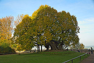
Deutsch: Naturdenkmal Schlosslinde des Schlosses Augustusburg, Sachsen > in den nordöstlichen Außenanlagen (auf dem Gelände der Falknerei) > angeblich verkehrtherum gepflanzt worden, 1421 unter Friedrich dem Streitbaren |
| Date | |
| Source | Own work |
| Author | Yvonne Bentele |
| Camera location | | View this and other nearby images on: OpenStreetMap |
|---|
.jpg¶ms=050.813613_N_0013.099618_E_globe:Earth_type:camera__&language=en)
Licensing
[edit].jpg&action=edit§ion=2)
I, the copyright holder of this work, hereby publish it under the following license:
This file is licensed under the Creative Commons Attribution-Share Alike 3.0 Unported license.
- You are free:
- to share – to copy, distribute and transmit the work
- to remix – to adapt the work
- Under the following conditions:
- attribution – You must give appropriate credit, provide a link to the license, and indicate if changes were made. You may do so in any reasonable manner, but not in any way that suggests the licensor endorses you or your use.
- share alike – If you remix, transform, or build upon the material, you must distribute your contributions under the same or compatible license as the original.
This image was uploaded as part of Wiki Loves Earth 2014.
|
File history
Click on a date/time to view the file as it appeared at that time.
| Date/Time | Thumbnail | Dimensions | User | Comment | |
|---|---|---|---|---|---|
| current | 17:11, 11 May 2014 | | 2,254 × 1,500 (5.77 MB) | YvoBentele (talk | contribs) | User created page with UploadWizard |
You cannot overwrite this file.
File usage on Commons
The following 2 pages use this file:
File usage on other wikis
The following other wikis use this file:
- Usage on de.wikipedia.org
- Usage on www.wikidata.org
.jpg&oldid=750780884)