File:2011-08-17 14-14-55 Austria Unterberg.jpg
From Wikimedia Commons, the free media repository
Jump to navigation
Jump to search
Size of this preview: 800 × 531 pixels. Other resolutions: 320 × 213 pixels | 640 × 425 pixels | 1,024 × 680 pixels | 1,280 × 850 pixels | 2,560 × 1,700 pixels | 3,974 × 2,639 pixels.
Original file (3,974 × 2,639 pixels, file size: 5.55 MB, MIME type: image/jpeg)
File information
Structured data
Captions
Summary
[edit]Description2011-08-17 14-14-55 Austria Unterberg.jpg |
Austria 
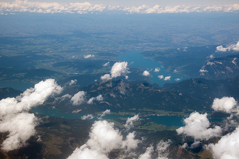
Deutsch: Salzkammergut mit Attersee, Wolfgangsee und Mondsee. Der Berg in der Mitte ist der Schafberg.
English: Aerial impressions between Belgrade and Munich |
Date | |
Source | Own work: Hansueli Krapf (User Simisa (talk · contribs)) |
Author |
Hansueli Krapf This file was uploaded with Commonist. |
Camera location | 47° 34′ 34.14″ N, 13° 18′ 17.76″ E | View this and other nearby images on: OpenStreetMap | 47.576150; 13.304934 |
---|
Licensing
[edit]I, the copyright holder of this work, hereby publish it under the following license:
This file is licensed under the Creative Commons Attribution-Share Alike 3.0 Unported license.
- You are free:
- to share – to copy, distribute and transmit the work
- to remix – to adapt the work
- Under the following conditions:
- attribution – You must give appropriate credit, provide a link to the license, and indicate if changes were made. You may do so in any reasonable manner, but not in any way that suggests the licensor endorses you or your use.
- share alike – If you remix, transform, or build upon the material, you must distribute your contributions under the same or compatible license as the original.
Annotations InfoField | This image is annotated: View the annotations at Commons |
1073
1894
238
55
3974
2639
Wolfgangsee
154
1406
248
40
3974
2639
Mondsee
File history
Click on a date/time to view the file as it appeared at that time.
Date/Time | Thumbnail | Dimensions | User | Comment | |
---|---|---|---|---|---|
current | 17:34, 8 January 2015 | 3,974 × 2,639 (5.55 MB) | Simisa (talk | contribs) |
You cannot overwrite this file.
File usage on Commons
The following page uses this file:
File usage on other wikis
The following other wikis use this file:
- Usage on de.wikipedia.org
Metadata
This file contains additional information such as Exif metadata which may have been added by the digital camera, scanner, or software program used to create or digitize it. If the file has been modified from its original state, some details such as the timestamp may not fully reflect those of the original file. The timestamp is only as accurate as the clock in the camera, and it may be completely wrong.
Camera manufacturer | NIKON CORPORATION |
---|---|
Camera model | NIKON D90 |
Author | Hansueli Krapf |
Copyright holder |
|
Exposure time | 1/320 sec (0.003125) |
F-number | f/10 |
ISO speed rating | 200 |
Date and time of data generation | 14:14, 17 August 2011 |
Lens focal length | 38 mm |
Latitude | 47° 34′ 34.14″ N |
Longitude | 13° 18′ 17.76″ E |
Altitude | 6,754 meters above sea level |
Source | Hansueli Krapf |
City shown | Abtenau |
Orientation | Normal |
Horizontal resolution | 300 dpi |
Vertical resolution | 300 dpi |
Software used | Adobe Photoshop CC (Windows) |
File change date and time | 21:45, 7 January 2015 |
Exposure Program | Not defined |
Exif version | 2.21 |
Date and time of digitizing | 14:14, 17 August 2011 |
APEX shutter speed | 8.321928 |
APEX aperture | 6.643856 |
APEX exposure bias | 0 |
Maximum land aperture | 4.3 APEX (f/4.44) |
Metering mode | Pattern |
Light source | Unknown |
Flash | Flash did not fire, auto mode |
DateTime subseconds | 00 |
DateTimeDigitized subseconds | 00 |
Color space | sRGB |
Sensing method | One-chip color area sensor |
File source | Digital still camera |
Scene type | A directly photographed image |
Custom image processing | Normal process |
Exposure mode | Auto exposure |
White balance | Auto white balance |
Digital zoom ratio | 1 |
Focal length in 35 mm film | 57 mm |
Scene capture type | Landscape |
Scene control | None |
Contrast | Normal |
Saturation | Normal |
Sharpness | Normal |
Subject distance range | Unknown |
GPS time (atomic clock) | 14:14 |
Geodetic survey data used | WGS-84 |
GPS date | 17 August 2011 |
GPS tag version | 0.0.2.2 |
Serial number of camera | 6207876 |
Lens used | 18.0-105.0 mm f/3.5-5.6 |
Rating (out of 5) | 0 |
Date metadata was last modified | 22:45, 7 January 2015 |
Unique ID of original document | A67C5963514E70793C7474301FC45575 |
Contact information |
Hinterdorf 24 Dörflingen, , CH-8239 |
Keywords |
|
Code for country shown | AUT |
Sublocation of city shown | Unterberg |
Country shown | Austria |
Province or state shown | Salzburg |
Structured data
Items portrayed in this file
depicts
47°34'34.140"N, 13°18'17.762"E
17 August 2011
0.003125 second
10
38 millimetre
200
image/jpeg
e52a89e71de797f24aa5021bb02652d986699082
5,819,957 byte
2,639 pixel
3,974 pixel
Categories:
- Aerial photographs of the Alps in Austria
- Views of Sankt Wolfgang im Salzkammergut
- Remote views of Wolfgangsee
- Attersee
- Schafberg
- Aerial photographs of lakes of Austria
- Mondsee
- August 2011 in Salzburg (state)
- August 2011 in Upper Austria
- Nature of Bezirk Salzburg-Umgebung in August
- Gschwand
- Ried (Sankt Gilgen)
- 2011 in Sankt Gilgen