File:20100812 Hoge der A 37 Groningen NL.jpg
Jump to navigation
Jump to search

Size of this preview: 600 × 600 pixels. Other resolutions: 240 × 240 pixels | 480 × 480 pixels | 768 × 768 pixels | 1,024 × 1,024 pixels | 2,500 × 2,500 pixels.
Original file (2,500 × 2,500 pixels, file size: 1.54 MB, MIME type: image/jpeg)
Captions
Captions
Add a one-line explanation of what this file represents
| Description |
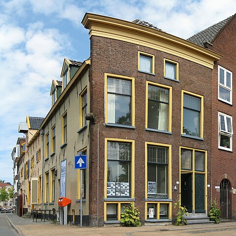
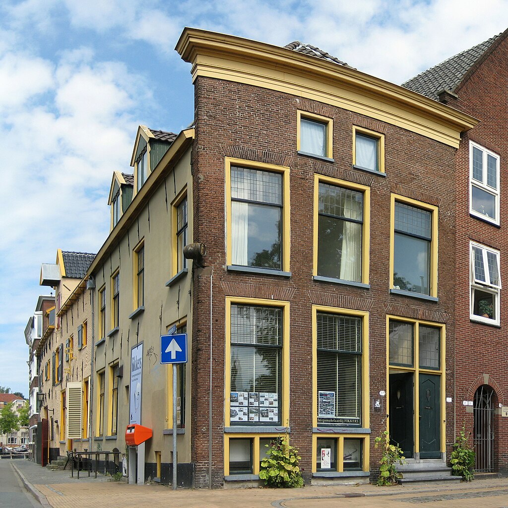
Deutsch: Ehemalige Brauerei in der niederländischen Stadt Groningen. English: A former brewery in the Dutch city of Groningen. Frysk: Eardere brouwerij op de hoeke fan de Hoge der A en de Visserstraat yn Grins. It pân, it meast súdlike op de Hoek van Ameland, is setten yn de lette 15e of iere 16e ieu. De foargevel datearret út it midden fan de 18e ieu. Links De Sleutel (rm 18599). Nederlands: Voormalige brouwerij op de hoek van de Hoge der A en de Visserstraat in de stad Groningen. Het pand, het meest zuidelijke op de Hoek van Ameland, werd gebouwd in de late 15e of vroege 16e eeuw. De voorgevel stamt uit het midden van de 18e eeuw. Links De Sleutel (rm 18599).
|
||||
| Date | |||||
| Source | Own work | ||||
| Author | Wutsje | ||||
| Permission (Reusing this file) |
This file is licensed under the Creative Commons Attribution-Share Alike 3.0 Unported license.
|
||||
| Attribution (required by the license) | Wutsje / Wikimedia Commons / | ||||
| Camera location | | View this and other nearby images on: OpenStreetMap |
|---|
File history
Click on a date/time to view the file as it appeared at that time.
| Date/Time | Thumbnail | Dimensions | User | Comment | |
|---|---|---|---|---|---|
| current | 19:42, 6 September 2010 | | 2,500 × 2,500 (1.54 MB) | Wutsje (talk | contribs) | {{Information |Description={{en|1=A former brewery in the Dutch city of Groningen.}} {{fy|1=In eardere brouwerij oan de Hoge der A yn Grins. It pân, dat in ryksmonumin |
You cannot overwrite this file.
File usage on Commons
The following 2 pages use this file:
File usage on other wikis
The following other wikis use this file:
- Usage on de.wikipedia.org
- Usage on nl.wikipedia.org
- Usage on www.wikidata.org