File:2010.08.22.123059 Burg Sulzbach-Rosenberg.jpg
Jump to navigation
Jump to search

Size of this preview: 800 × 533 pixels. Other resolutions: 320 × 213 pixels | 640 × 427 pixels | 1,024 × 683 pixels | 1,280 × 853 pixels | 1,920 × 1,280 pixels.
Original file (1,920 × 1,280 pixels, file size: 654 KB, MIME type: image/jpeg)
Captions
Captions
Add a one-line explanation of what this file represents
Summary
[edit]
| Description |
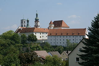
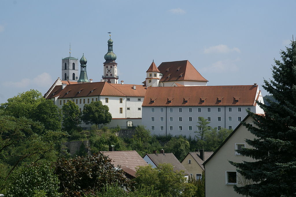
English: Burg in Sulzbach-Rosenberg (Germany) |
| Date | |
| Source | Own work |
| Author | Hermann Luyken |
| Camera location | | View this and other nearby images on: OpenStreetMap |
|---|
Licensing
[edit]
| I, the copyright holder of this work, release this work into the public domain. This applies worldwide. In some countries this may not be legally possible; if so: I grant anyone the right to use this work for any purpose, without any conditions, unless such conditions are required by law. |
File history
Click on a date/time to view the file as it appeared at that time.
| Date/Time | Thumbnail | Dimensions | User | Comment | |
|---|---|---|---|---|---|
| current | 19:31, 25 December 2010 | | 1,920 × 1,280 (654 KB) | Hermann Luyken (talk | contribs) | {{Information |Description={{en|1=Burg in Sulzbach-Rosenberg (Germany)}} |Source={{own}} |Author=Hermann Luyken |Date=2010-08-22 |Permission= |other_versions= }} Category:Burg Sulzbach-Rosenberg |
You cannot overwrite this file.
File usage on Commons
The following page uses this file:
File usage on other wikis
The following other wikis use this file:
- Usage on bg.wikipedia.org
- Usage on de.wikipedia.org
- Wittelsbach
- Landkreis Amberg-Sulzbach
- Burgruine Lichtenegg (Birgland)
- Pfalz-Sulzbach
- Sulzbach (Adelsgeschlecht)
- Liste von Burgen und Schlössern in Bayern
- Portal:Bayern/Burgen in Bayern
- Schloss Neidstein
- Schweppermannsburg
- Burg Sulzbach
- Burg Dagestein
- Burg Heimhof
- Burgstall Scharfenberg
- Burg Breitenstein (Bayern)
- Burgruine Poppberg
- Burgruine Roßstein
- Burgruine Hauseck
- Burgruine Steinamwasser
- Burgstall Alte Bürg (Eschenfelden)
- Hammerschloss Theuern
- Burgstall Gernotenstein
- Burgstall Im alten Haus
- Burgruine Eberburg
- Burgstall Werdenstein
- Liste von Burgen und Schlössern in der Oberpfalz
- Burgstall Hartenfels
- Burgstall Hagfelsen
- Liste der Baudenkmäler in Sulzbach-Rosenberg
- Pflegschloss Hirschau
- Vorlage:Navigationsleiste Burgen und Schlösser im Landkreis Amberg-Sulzbach
- Unteres Schloss (Lintach)
- Oberes Schloss (Lintach)
- Unteres Schloss Schmidmühlen
- Burgstall Altes Haus (Hirschbach)
- Burgstall Haldenrode
- Abschnittsbefestigung Kalmusfels
- Abschnittsbefestigung Kuhfels
- Burg Allersburg (Hohenburg)
- Burg Ammerthal
- Ringwall Archenleiten
- Burgruine Aschach
- Burgstall Breitenthal
- Abschnittsbefestigung Bürg
- Ringwall Etsdorf
- Burg Freudenberg (Oberpfalz)
View more global usage of this file.